Being an Historian
Geography
The 4 Regions
The 4 Cultures
Tools Historians Use
100
People who study history are also participants in history.
What is true about history?
100
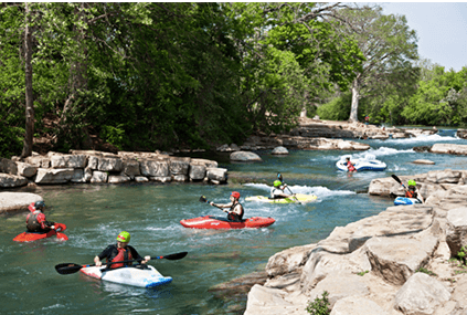 human-environment interaction
What is them of geography this photo represents ?
100
The Mountains and Basins region contains more dessert lands than the North Central Plains.
How do the Mountains and Basins region or Texas contrast with the Central Plains?
100
The Tiguas did not take part in the Pueblo revolt against the Spanish.
Why did many Pueblo peoples turn against the Tiguas in New Mexico?
100
This shows the order in which important historical events occurred in Texas.
What is a timeline?
200
Large collections of information which make it easy to check facts and understand information.
What are databases and how can they help the understanding of history?
200
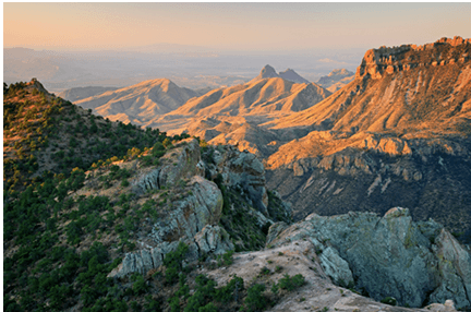 erosion
What is responsible for the effects seen on these mountains?
200
The Piney Woods and the city of Corpus Christi are contained in this region.
What is the Coastal Plains region?
200
It was portable and would not spoil.
What made pemmican an ideal food for many American Indian groups?
200
A comparison of different American Indian cultures.
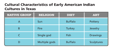 This chart makes what possible?
300
The result of open debate of multiple opinions.
What is, in order to be considered valid, and understanding of history must...
300
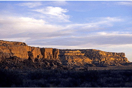 mesa
mesa
What is the term for the type of landform shown here?
300
We live in this region.
What is the Central Plains?
300
People must adapt their lives to their surroundings in order to survive.
How do the cultures of Texas reflect the state's physical geography?
300
A line graph.
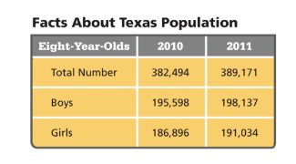 If you wanted to highlight the information from 2011, which would be the best way of resenting it?
400
Austin is located at 30 degrees north latitude and 97 degrees west longitude.
Which statement describes absolute location?
400
Beringia
What is the name of the land bridge that connected Asia to North America?
400
The tallest point in Texas is located here.
What is the Mountains and Basins regoin?
400
Sometimes, American Indians who shared the same culture belonged to different tribes.
What explains the statement: it is best to think of Indians as "peoples" or "cultures" rather than "tribes."
400
Climate in Texas varies more from east to west than from north to south.
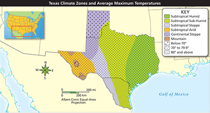 What statement is supported by the map?
500
BONUS!!! History
What is the study of past events?
500
prime meridian
What is the line that divides the Earth into eastern and western hemispheres?
500
This is where the Llano Estacado is located.
What are the Great Plains?
500
BONUS!!! The Spanish explorer who decided it was better to think of Indians as "peoples" or "cultures" rather than "tribes" is who?
Who is Alvar Núñez Cabeza de Vaca?
500
These maps show man made features such as borders and cities.
What is a political map?