Basics
Maps
Down or Across
Pic
Brain
100
What is a map? Why is it important?
A map is a drawing of a place from above. It shows what an area looks like, where things are, and how they are connected.
Maps show locations, so we can understand where things are in the world.
100
What are the 3 types of maps? What does each one show us?
1. Physical Map
2. Political Map
3. Thematic Map
100
Which one is which? Down or across?
Latitude -- across
Longitude -- down
100
What is this? Why do we use it?
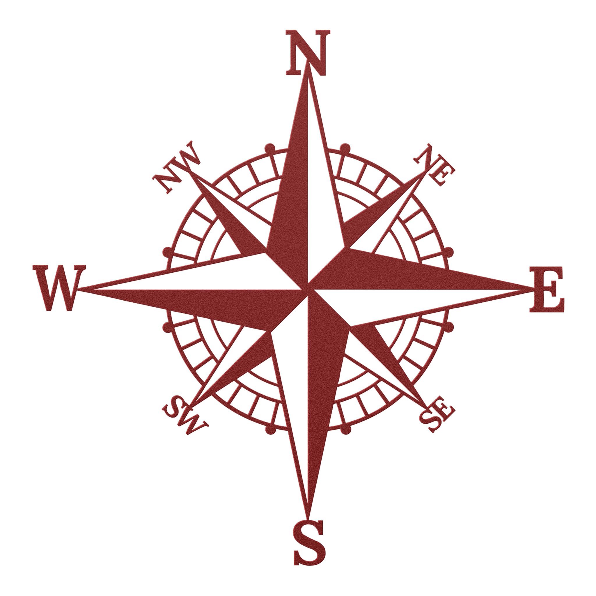
Compass Rose is the symbol on a map that shows directions. It helps us understand which way is which.
200
Which ones are cardinal and which ones are intermediate directions?
Cardinal Directions:
- North (N)
- South (S)
- East (E)
- West (W)
Intermediate Directions:
- North‑East (NE)
- South‑East (SE)
- South‑West (SW)
- North‑West (NW)
200
Give me 3 examples of thematic map:
Climate map, population map, transport map, trails, etc.
200
What do latitude and longitude lines create?
They create a map grid.
200
What do we see next to the map? What do we use it for?

A map key - we use it to understand the symbols on the map.
300
What is a scale? What are the 3 types?
Scale shows the relationship between a distance on a map and the real distance on the ground.
1. Word Scale
2. Ratio Scale
3. Line Scale
300
Is this a large-scale or small-scale map? Explain why:

This is a large-scale map because it shows us a small area in detail.
300
What is another name for both longitude and latitude lines? Each one has a special one as well - what is the special one?
Longitude lines - Meridians - Prime Meridian
Latitude lines - Parallels - Equator
300
What type of map is this?

Topological Map
400
In which hemisphere/hemispheres would you find United States?

Northern and Western Hemisphere
400
What type of map is this?
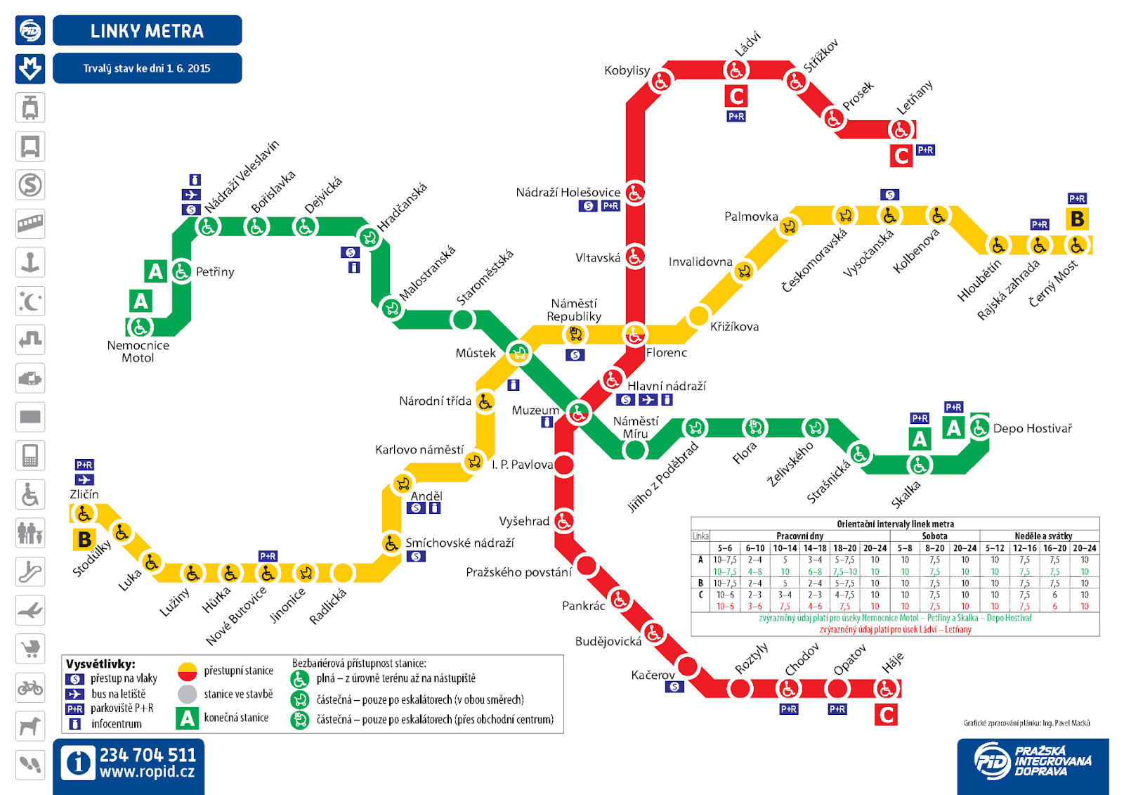
Thematic map - Specifically, transportation
500
If we look at a physical map, describe the change between colors. How do the colors change?
Physical maps use different colors to show changes in height and landscape.
- Green = low land
- Yellow/Orange = higher land and hills
- Brown/Red = mountains
- White = highest, snow‑covered peaks
- Blue = water (light = shallow, dark = deep)
500
A map has a scale of 1:500 km.
The distance between two town is 7cm. What is the actual distance between the cities?
1cm=500km
7cm=?
7x500=3500km
500
What does the star shows us?

A capital city of France - Paris