King? I didn't vote for you.
Really?
This Again?
This Again?
New Phone.
Who dis?
Who dis?
Where in the world is...?
Wait. Wait!
I know this! (HARD)
I know this! (HARD)
100
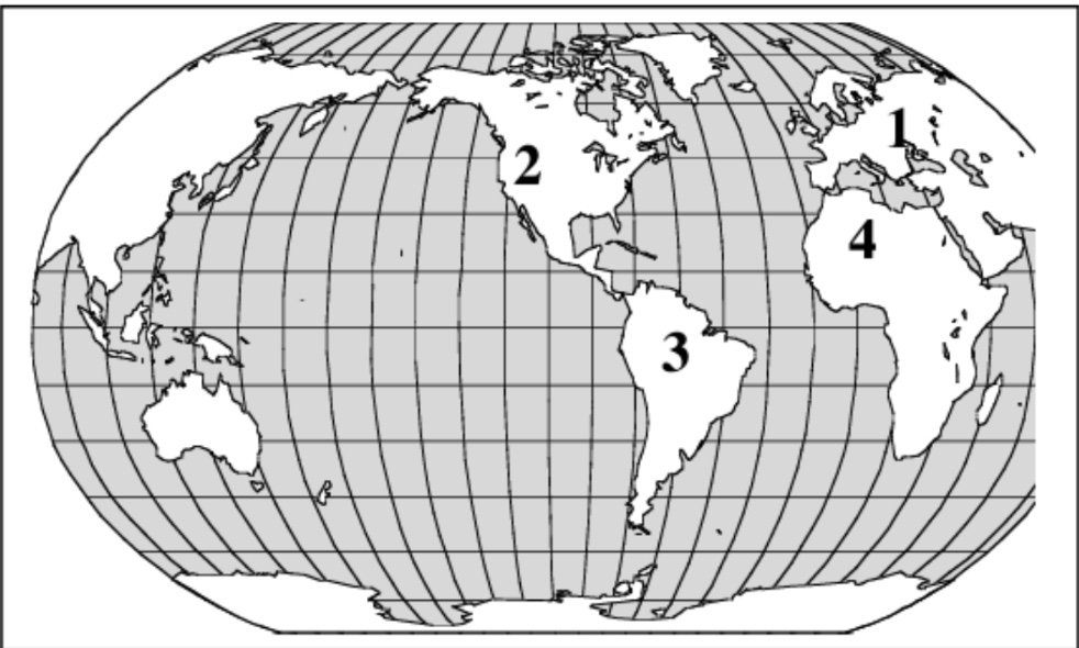
The kingdoms of Ghana, Mali, and Songhai were located in the western region of the continent number—
4
100
What is the best title for the chart below?
A. Reasons for Explorations
B. Obstacles to the Explorations
C. Motivations for the Explorations
D. Accomplishments of the Explorations
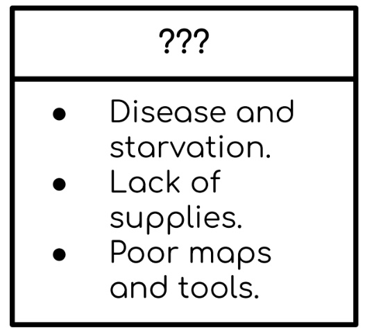
Obstacles to the Explorations
100
Which country sent explorers along the routes on the map below? France, England, Spain, Portugal
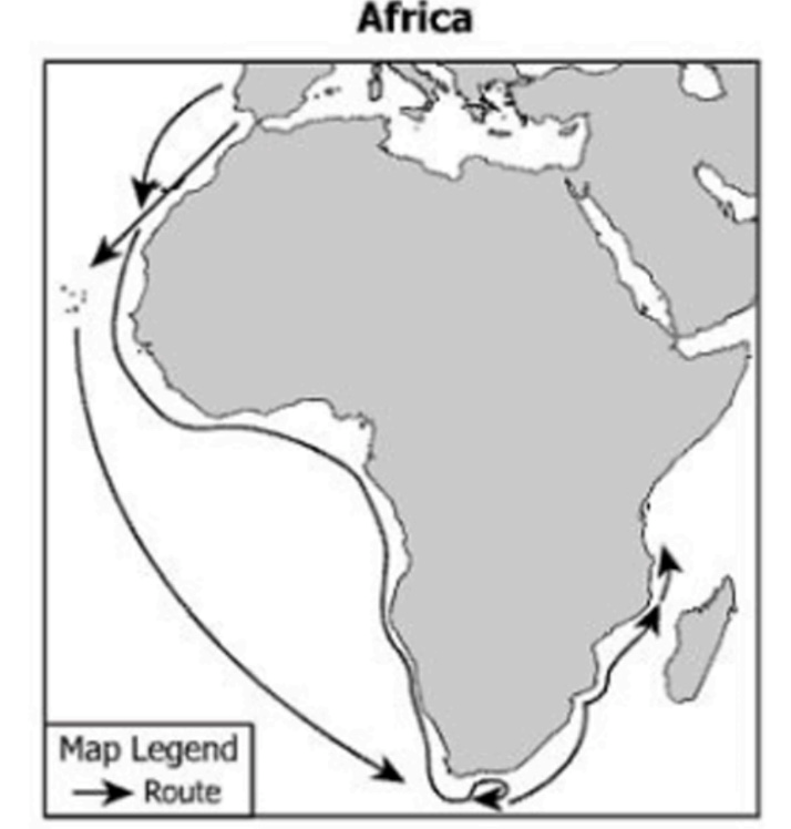
Portugal
100
Which letter on the map represents the Niger River?
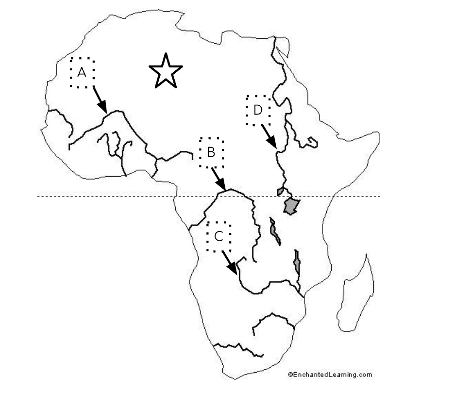
A
100
What is the name of the voyage that the enslaved people took across the Atlantic?
The Middle Passage
200
What kingdoms controlled West Africa one after another from 300-1600 A.D.?
-Portugal and Spain
-France and England
-Ghana, Mali, and Songhai
-England and the United States
Ghana, Mali, and Songhai
200
Which of the following was a reason for European exploration?
A. Spread Christianity
B. Reduce the need for trade
C. Create new maps of the world
D. Mend relationships with other nations
Spread Christianity
200
The cultural interactions described took place between Indigenous societies and—
England, France, Spain, Portugal
Spain
200
Which body of water served as a gateway for early exploration, settlement, and trade between North America and Europe?
Atlantic Ocean
200
How many total enslaved people were taken to the new world?
10 million
300
The kingdoms that controlled West Africa were powerful because—
-They controlled trade in West Africa.
-They spread Christianity to other nations.
-They refused to participate in the slave trade.
-They lacked access to major sources of water.
They controlled trade in West Africa.
300
One important accomplishment of European exploration was—
A. Lack of supplies
B. Poor maps were still in use
C. Goods and ideas were exchanged
D. Disease increased among Native Americans
Goods and ideas were exchanged
300
What are artifacts?
-Fossils of ancient animals
-Natural materials such as rocks and minerals
-Objects made or used by humans in the past
-Tools used by archaeologists to excavate sites
Objects made or used by humans in the past
300
Which geographic region of North America is described as wrapping around the Hudson Bay in a horseshoe shape and containing hills worn by erosion and hundreds of lakes carved by glaciers?
-Great Plains
-Coastal Plain
-Canadian Shield
-Rocky Mountain
Canadian Shield
300
Where were the first enslaved people taken to in North America?
Ft. Monroe, VA
400
Ghana, Mali, and Songhai became powerful primarily because they—
Controlled trade routes across the Sahara Desert
400
Which explorer claimed the Mississippi River Valley for France?
-John Cabot
-Robert La Salle
-Francisco Coronado
-Samuel de Champlain
Robert LaSalle
400
What is the best title for the diagram below?
French, Spanish, English, Indigenous People
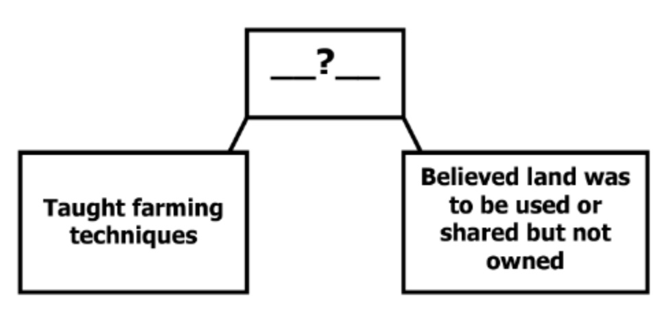
Indigenous People
400
Which two oceans border the continent of North America?
The Atlantic and the Pacific
400
Which country PRIMARILY traded with West Africa for gold and other good?
Portugal
500
Between 300 and 1600 A.D., which characteristic was shared by the empires of Ghana, Mali, and Songhai?
-Established colonies in Europe
-Built wealth through trade in gold and salt
-They avoided contact with other regional groups
-They relied entirely on manufacturing goods and supplies
Built wealth through trade in gold and salt
500
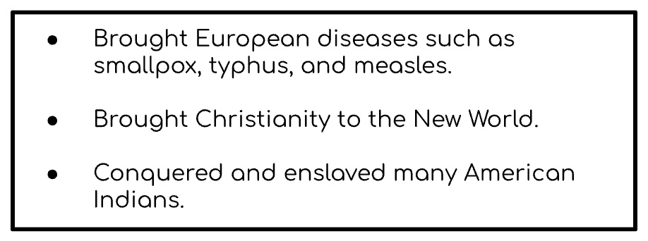
What is the best title for the graphic representing the interaction between Europeans and Indigenous peoples?
Areas of Conflict, Education Levels, Areas of Cooperation, Economic Obstacles
Areas of cooperation
500
Why did European ships carry manufactured goods to Africa during the Triangular Trade?
-To avoid interaction with African societies entirely
-To establish permanent European settlements in Africa immediately
-To introduce European culture without exchanging goods or people
-To trade them for enslaved Africans who would be transported to the Americas
To trade them for enslaved African Americans
500
Why did many West African communities shift from traditional farming and craftwork to participating in the slave trade?
-The climate no longer supported farming
-European goods replaced all African products
-Capturing and selling people became more profitable
-Farming and crafts were outlawed by European powers
Capturing and selling people became more profitable
500
Name the two important land features we learned about in this unit
The Niger River and the Sahara Desert