Maps and Mapping
Demographics
Physical features
Climate and Regions
Population and immigration
100
What is the coordinate that is Horizontal? and what compass direction are there?
Latitude, East and West
100
Between Canada, the United States and Mexico who has the most RAPID POPULATION GROWTH and why
Mexico it has more of a younger population
100
What is a physical feature
Natural things about an area that are visible like mountains, lakes, rivers, oceans ETC
Like their NAMES!!!!
100
Canada VS US Climate what is the difference between them?
Canada is overall colder, while the US has more climate diversity
100
Why does Canada have lower population?
Harsher Climate and less Farmland
200
What is the coordinate that is Vertical? and what compass direction are there?
Longitude, North and south
200
What is the difference between Mexico's population from 2019 to 2024
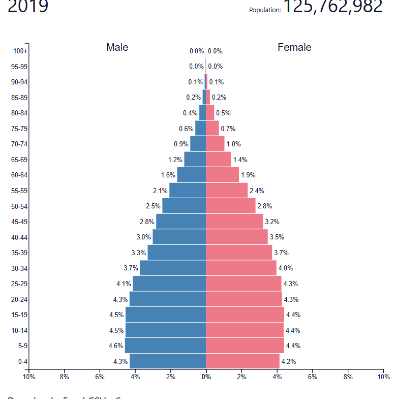
Mexico's growing population is beginning to stablize
200
What countries are in north America
Canada and United States
200
Name some of the climates in the United States
Deserts, plains, tropics, tundra
200
Why does the US have more of a population Growth? According to the information we have talked about in class?
Economic opportunities and better quality of life for the pull factor for immigrants
300
What Map shows Mountains, Rivers, Elevation and lakes
Physical Map
300
List the biggest land area from bigger to least big between
Mexico, Canada and US
Canada, US, Mexico
300
Are the pacific and Atlantic ocean considered physical features.
YES
300
What type of climate does SOUTHEAST US have and name a type of job it is perfect for
Warm and humid perfect for commercial farming
300
How does immigration impact the US?
IT adds cultural Diversity to the country
400
What map shows where the boarders of cities/counties/states/highways/ and roads?
Political Map
400
What is a demographic transition model.
it shoes/describes population changes over times, there are 5 stages from birth and death rates they are linked to economics and social development , THEY ARE COMPARED TO POPULATION PYRAMIDS!!
400
Who came to North America first and how?
Native Americans, Bering Bridge
400
What type of climate does the WESTCOAST have? and why would people want to live in these areas?
favorable climate, like marine they have more access to waterways. and job opportunities.
400
List some reasons that are a PUSH FACTORS
POLITCAL ISSUES
LACK OF JOBS
CLIMATE
etc
500
What map goes over population, income levels, Data?
Thematic Map
500
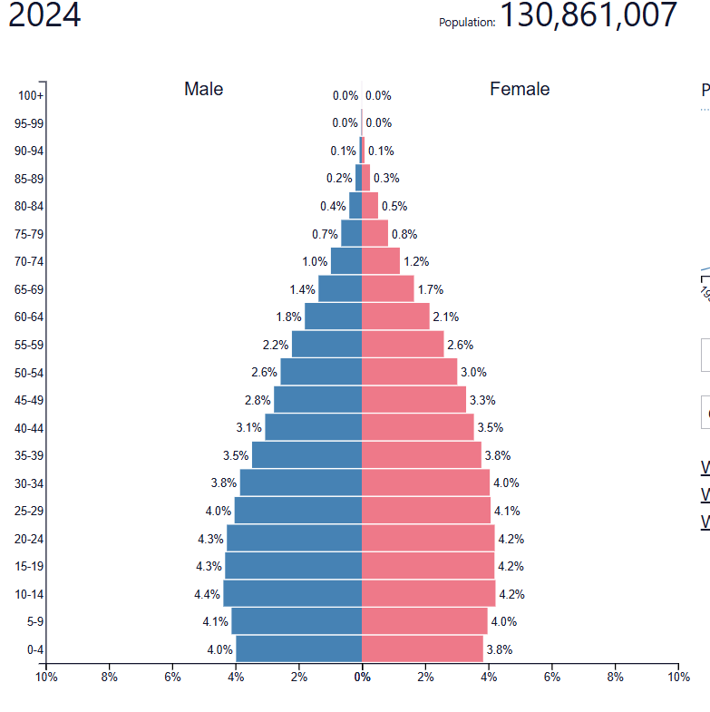
When you look at a population Pyramid how would you know about any information about the younger population use the population map below to tell me.
(I used a random country)
you would look at the bottom of the pyramid
500
What are the main climates of United States and Canada?
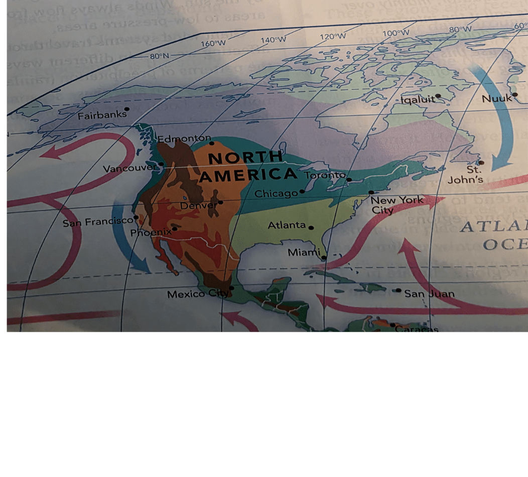
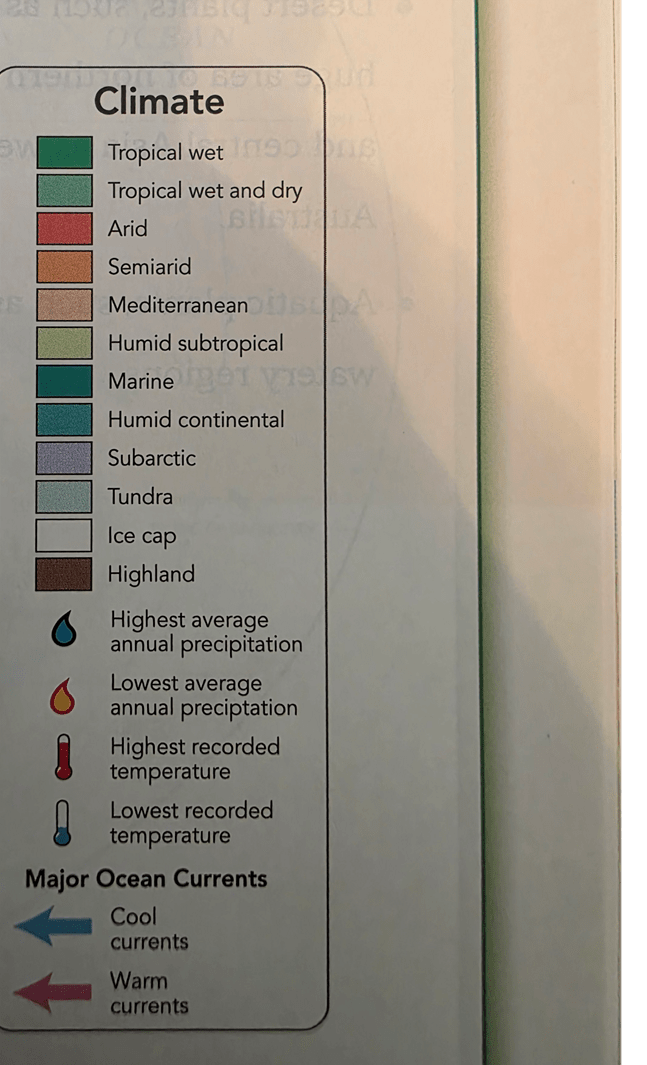
Canada Tundra
United State humid subtropical
500
What is the most populated region?
The Northeast, it has big cities like NYC, jobs and trade
500
List some PULL FACTORS
BETTER JOBS
RELIGIOUS FREEDOM
POLITICS
WEATHER
ETC
600
What type of map displays information about a particular place, like climate zones, population density historical trade
Special Purpose maps
600
Difference indicated by bottom of pyramid.
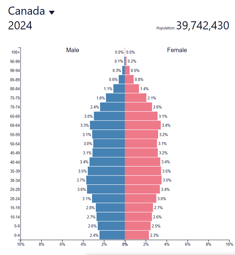
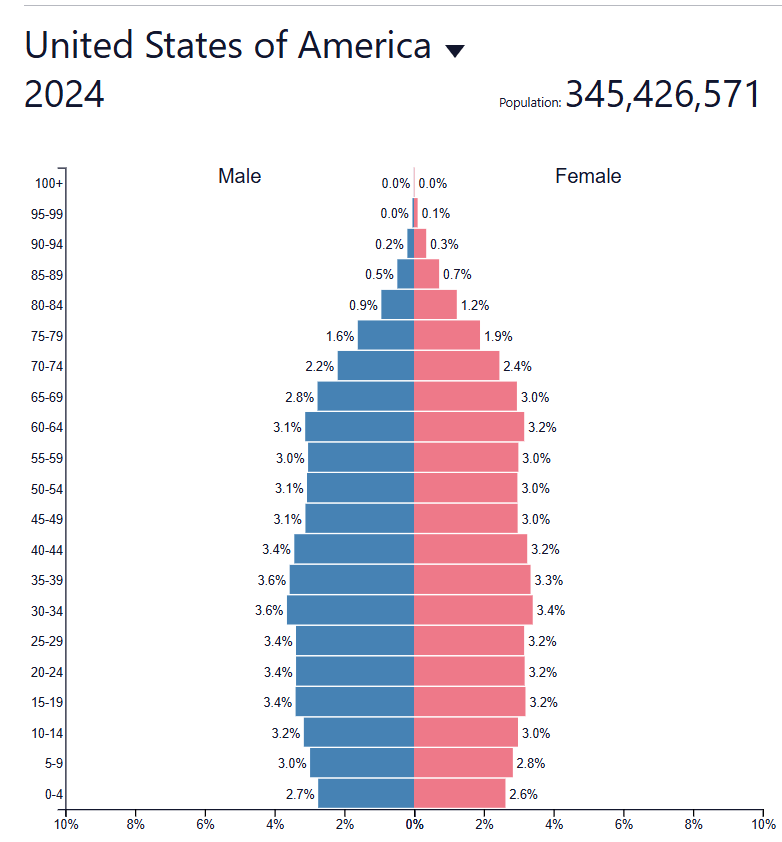
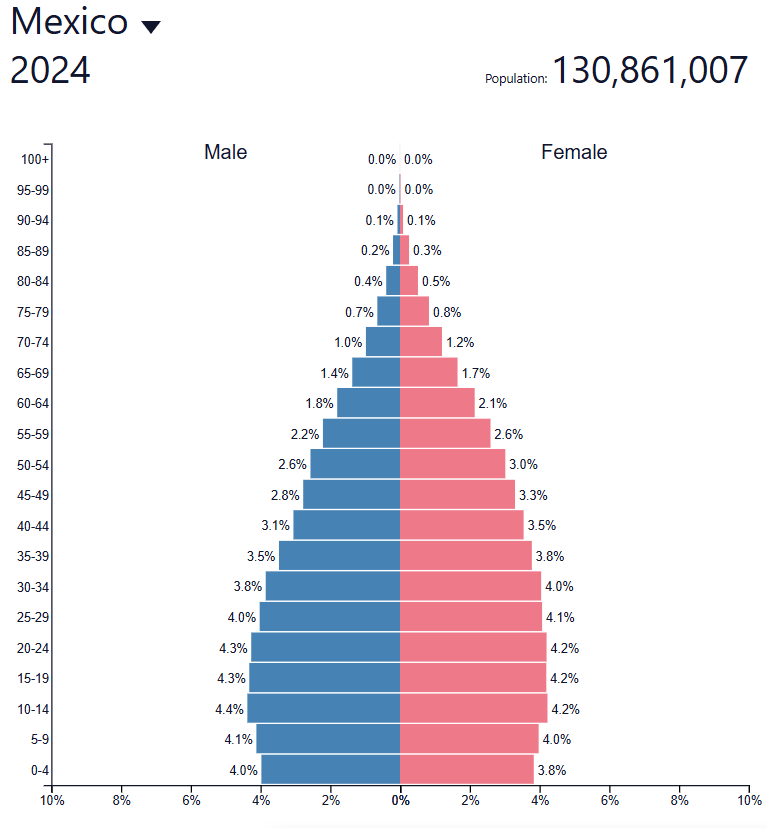
What is Mexico's birth rate is increasing, the others are decreasing?
600
What does the MISSISSIPPI RIVER do for people?
Provides water for farming, helps move good/people
MAINLY FOR TRADE!
600
What main climate is in Canada?
Tundra
600
Why would people want to move from CUBA to the US?
CUBAS GOVERMENT IS LIMITING MIGRATION ADN IT IS SLOW IN MODERNIZATIONS... MEANS IT LOOKS LIKE IT IS IN THE 1950S INSTEAD OF 2025
700
What are the directions of a compass rose?
North
Northeast
East
South East
South
South west
West
North West
700
FREE QUESTION MRS Yahnes Random Question for 1000 points!
the question is: who is Mrs. Yahne's Son CASSIUS names after
Muhamad ALI
700
What does the East of the MISSISSIPPE RIVER have that the WEST does not?
How does the Mississippi River affect the US economy?
Teh east has more resources, better farmland and more jobs, it is more populated.
With the fact the Mississippi River is so long it helps the economy with trade and easier access to it
700
Teh closer you get to the south is it hotter because of its location to the equator, TRUE OR FALSE?
TRUE
700
WHY WOULD PEOPLE FROM HAITI WANT TO MOVE?
Because of its location it has BAD natural disasters, its has a lack of clean water, food, and resources