Name the State - East
Border Changes
Name the State - West
Border Changes
Maps
100
This state is to the north of North Carolina, east of Kentucky, and has the Atlantic Ocean as a border.
What is Virginia?
100
This is why the first colonies were formed.
What is freedom of religion/independence from England?
100
This state has Canada as one border and the Pacific Ocean as another border.
What is Washington?
100
This is the country the United States bought Alaska from.
What is Russia?
100
The dark orange section of the map below portrays this treaty.
What is the Florida Purchase Treaty?
200
This state is to the north of Pennsylvania, the west of Massachusetts, and has one of the Great Lakes as part of its border.
What is New York?
200
This is the country the United States bought the Oregon land from.
What is Spain?
200
This state has the Pacific Ocean as one border and Mexico as another border.
What is California?
200
Florida officially became a state in this year.
What is 1845?
200
The yellow part of the map below portrays this example of westward expansion.

What is the Louisiana Purchase of 1803?
300
This state is to the east of Ohio and the west of Maryland.
What is West Virginia?
300
This is where the unofficial territory in addition to the thirteen colonies in the United States ended.
What is the Mississippi River?
300
This state is to the north of Texas and west of Kansas.
What is Colorado?
300
This is why Americans overthrew Hawaii's queen.
What is to stop high sugar tariffs/economic reasons/land use?
300
The United States acquired the land in red in the map below during this year. 
What is 1821?
400
This state is to the south of New York and has the Atlantic Ocean as one of its borders.
What is New Jersey?
400
Name the three main states the United States acquired from the Oregon Country.
What is Washington, Oregon, Idaho?
400
This western state has other states as its borders on three sides and another country as its northern border.
What is Idaho?
400
List the current United States territories that we discussed.
What is Guam, Puerto Rico, Samoa, and the U.S. Virgin Islands?
400
Name two states located in the light orange part of the map below other than Texas and California.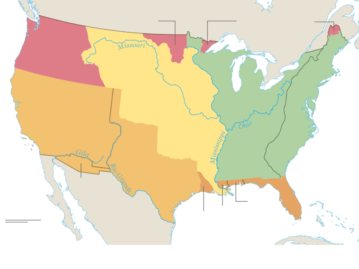
What is Arizona, Utah, Nevada, and/or parts of New Mexico and Colorado?
500
This state is to the east of Connecticut and the Atlantic Ocean serves as its southern border.
What is Rhode Island?
500
This is why the United States bought Samoa and the U.S. Virgin Islands (two separate answers).
What is to use as a naval base and to protect the Panama Canal?
500
This state is the furthest western state where all four borders are other states.
What is Nevada?
500
This is how many years it took between the overthrow of Hawaii to when it was officially a state.
What is 66 years? (1893-1959)
500
Name five of the original colonies located in the green area of the map below. 
What is Massachusetts, New Hampshire, New York, Rhode Island, Connecticut, New Jersey, Pennsylvania, Delaware, Maryland, Virginia, North Carolina, South Carolina, Georgia?