What does this map tell me?
Physical Geography
Political Geography
Maps, Maps, Maps
Random
100
What information can you learn with a climate map?
What climate a place has. Such as temperature and precipitation.
100
What Physical Feature is # 11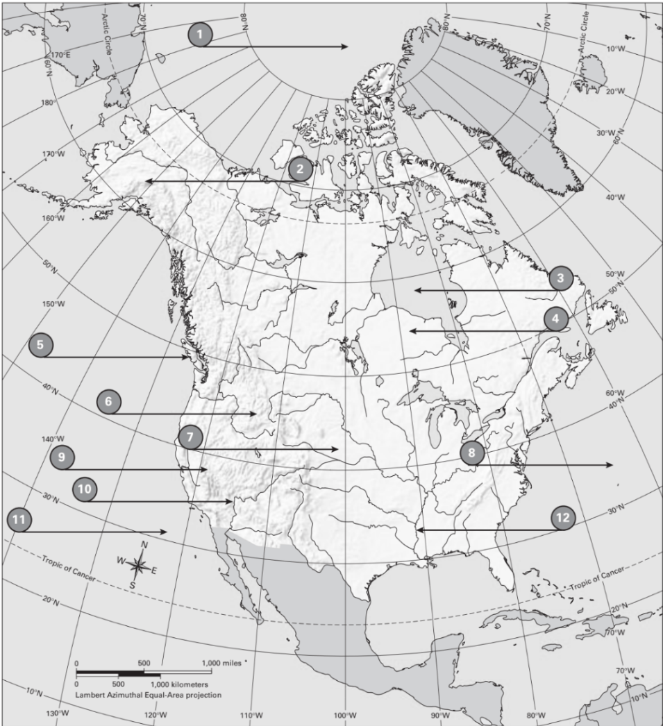
Pacific Ocean
100
What is # 13

Alaska
100
What is the most common vegetation in the SW United States. 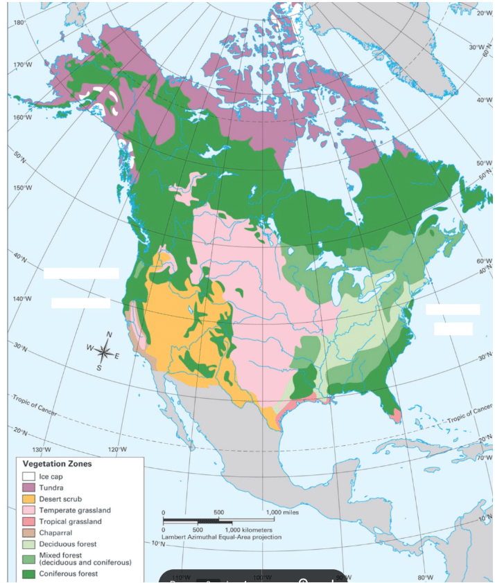
Desert Scrub
100
How does climate vary in the US & Canada?
The northern regions are colder, while the southern regions are warmer. The western US has dry desert climates, while the eastern and southeastern areas are more humid
200
What information can you learn with a population density map?
How many people live in an area. Ex 250 per square mile.
200
What is #5
Vancouver Island
200
What is #16
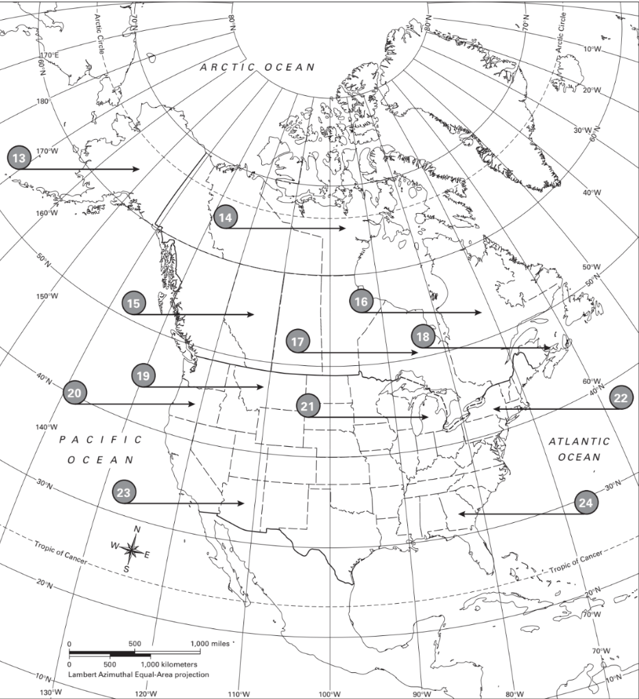
Quebec
200
What is the most common land use in Michigan? Why does that make sense?
Trade and Manufacturing. We have a lot of car factories in Michigan.
200
What state has the most variation of climate zones?
California
300
What information can you learn with a vegetation map?
What types of plants grow in an area.
300
What is #4

Canadian Sheild
300
What is # 24

Georgia
300
What states/ Provinces have a tundra climate?
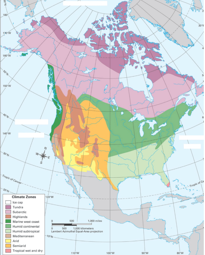
Alaska, Nunavet, Yukon, Northwest Territory and Quebec
300
In the US & Canada, what places have high population density? Why?
Major cities have higher population densities. The cities tend to be by water and offer lots of economic opportunities.
400
What information can you learn with an economic activity map?
How people use the land. What resources are available. Such as oil, natural gas, etc.
400
What is #10

Colorado River
400
What is #23

Arizona
400
What Canadian Provinces are entirely covered in forest?
New Brunswick, Prince Edward Island, Nova Scotia
400
What is the most common vegetation zone in the central US & Canada?
Temperate Grassland.
500
What information can you learn from a political map?
You can see the political boundaries of countries. A political map can also show state boundaries.
500
What is #9
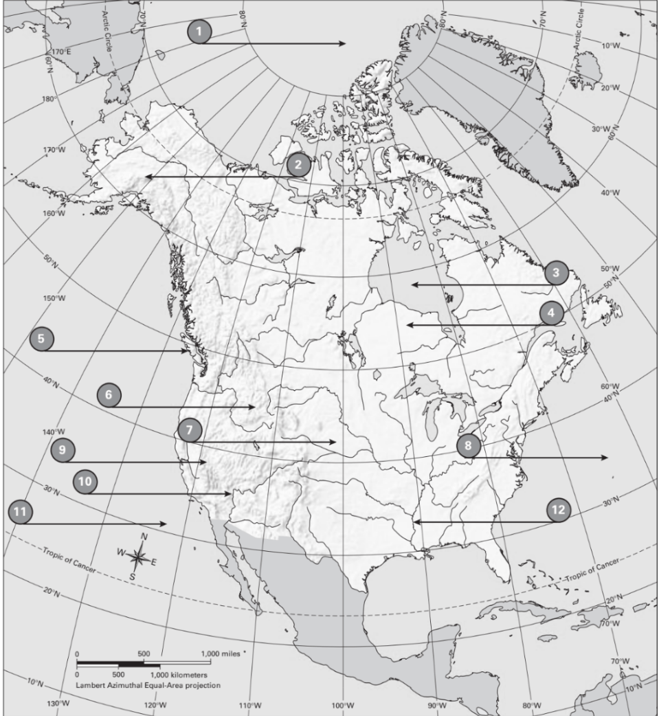
Sierra Nevada Mountain Range
500
What is #18
Prince Edward Island
500
In the eastern U.S, we see coal mining. Coal mining happens in this physical feature. What is the name of that physical feature?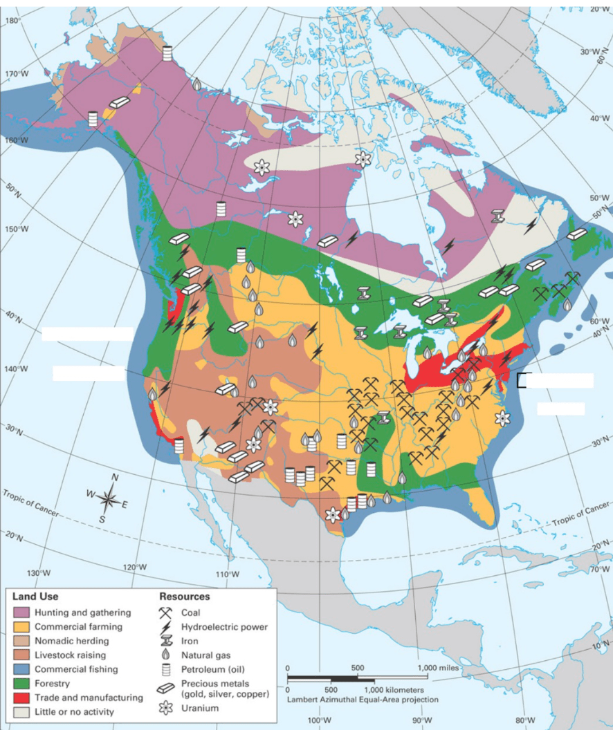
Appalachian Mountains.
500
How does economic activity relate to a regions physical features?
Different types of jobs can be created depending on the physical features of an area. For example, a place that is close to the ocean will be a good place for trade and fishing.