Buoys
Headlands & Landmarks
Hazards
Roads & Evacs
Potluck!
100
This port lateral mark can be found outside the entrance of Whitstable Harbour
What is the Oyster buoy?
100
This nearby collection of turbines produce renewable energy
What is Kentish Flats Offshore Wind Farm?

100
These cages appear at LW
What are the Oyster Racks?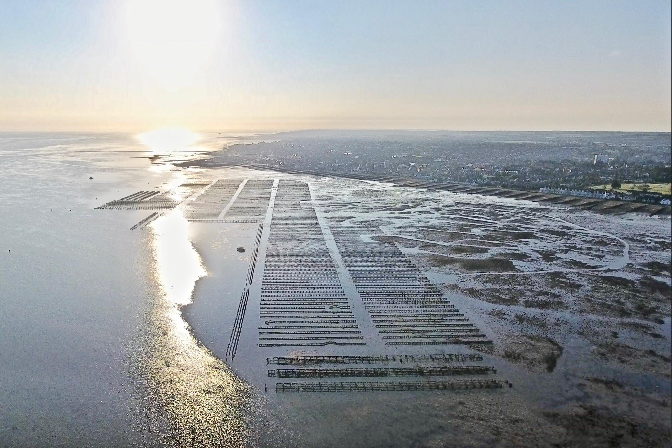
100
This road runs along the top of Tankerton Slopes
What is Marine Parade?
100
This Thames barge often calls Whitstable Harbour its home
What is GRETA?
200
This starboard lateral mark is good friends with Pollard Spit
What is Ham Gat?
200
This is the southeastern tip of the Isle of Sheppey
What is Shellness?
200
A road you don't want to hit at sea
What is Whitstable Street?
200
This evac comes with free parking, and sometimes a hot shower
What is Whitstable Lifeboat Station?
200
This comedian is often likened to one of Whitstable's crew
Who is Joe Wilkinson?
300
This unlit special mark sits 1NM offshore from Long Rock
What is the sewer outfall buoy?
300
This landing stage is also a north cardinal
What is the old Herne Bay Pier Head?
300
This sandbank starts at Shellness
What is Columbine Spit?
300
This evac haven has two slipways
What is Herne Bay Harbour?
300
This is the distance from the Mean High Water Springs (MHWS) to the 8kt buoys
What is 300m?
400
On the River Swale, this cardinal is where the direction of buoyage changes
What is Lilies?
400
These two tall towers are spitting distance from The Shipwright's Arms
What are the Faversham Creek Pylons?

400
This well-connected hazard has four buoyfriends
What is the Kentish Flats cable crossover?
400
This evac has two options, north and south
What is Harty Ferry?
400
Mike Judge has long been rumoured to have towed this unusual kind of craft
What is a Seaplane?
500
This is the closest buoy to station featuring a bell
What is North Red Sand?
500
These towers lie north of the Princes Channel
What are the Shivering Sand Towers?
500
This is the noteably rocky area at the Eastern edge of our patch
What is Black Rock?
500
This road is where "Jimmy G" calls home
What is The Promenade?

500
This is the "B" number for Oxford Town & Gown
What is B-764?