Longitude and latitude
Maps
More maps
Random geography
100
What time zone are we in?
central
100
What is one type of map?
political etc
100
What is cartography?
the study and making of maps
100
Which continent includes the United States?
North America
200
Is the equator a longitude or latitude line?
latitude remember latitude gets fat at the equator
200
What is one thing you can use a map for?
getting places, etc
200
Which continent includes Brazil?
South America
200
Which continent includes Spain?
Europe
300
How many longitude lines are there?
180
300
What is something a map can show you?
countries, roads, etc
300
A map that shows boundaries of nations, other political areas, capitals and cities is called
a political map
300
Which continent includes China?
Asia
400
how many latitude lines are there?
90 in each hemisphere so 180
400
Besides getting places what is one thing you can use a map for?
seeing populations, natural features, etc
400
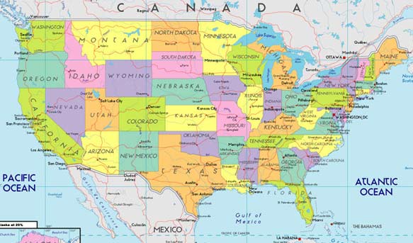
The U.S. map pictured above is a
political
400
Which continent includes Egypt?
africa
500
What do coordinates tell you?
where you are on the earth
500
A map that shows the natural features of the Earth's surface such as landforms, bodies of water and land elevation is called
A topographical map or physical map
500
A map that shows natural features is called a what map?
physical
500
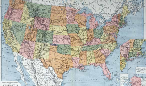
The U.S. map pictured above is a
physical map