Cultural Diffusion
Wild Card Vocab
Earth Structure
MAPS!
Earth's Landforms
100
The rapid and widespread diffusion of a cultural trait throughout a population.
Contagious Diffusion
100
The origin of a culture is called a _____________.
Cultural hearth
100
Measures North and South of the Equator, with a minimum of 0 degrees and a maximum of 180 degrees.
Latitude
100
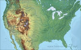 These maps focus on the geography of an area. They will often show the mountains and valleys using different shades of browns and greens.
Physical Maps
100
A freshwater source which lies beneath the earth's surface in wells and springs.
Groundwater
200
The spread of cultural traits from one influential person or group to another less influential person or group.
Hierarchical Diffusion
200
The fact that people who live in the United States largely speak English and people who live in Quebec, Canada largely speak French is due to THIS TYPE of diffusion.
Relocation Diffusion
200
Measures East and West of the Prime Meridian, with a minimum of 0 degrees and a maximum of 180 degrees.
Longitude
200
These colorful maps show the boundaries of countries, states, and counties by using different colors. It also shows the locations of major cities and significant bodies of water.
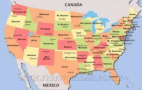
Political Maps
200
The names of the five oceans
Atlantic, Pacific, Indian, Artic, Southern
300
Occurs when a cultural trait is adopted or modified by a different group, resulting in a changed form of the original trait.
Stimulus Diffusion
300
A form of expansion diffusion, THIS TYPE of diffusion is the process of an idea being spread rapidly throughout the population; all places and individuals in the region are affected.
Contagious Diffusion
300
Northernmost point on earth that receives direct rays of the sun, located at 23.5 degrees north.
Tropic of Cancer
300
These maps show different physical landscapes by using contour lines instead of colors to show changes in the landscape.
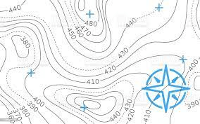
Topographic Maps
300
The condition of the atmosphere in one place during a short period of time.
Weather
400
Occurs when individuals or groups move from one place to another, bringing their cultural traits with them.
Relocation Diffusion
400
Broken into physical characteristics and human characteristics, this theme of geography describes the location.
Place
400
Southernmost point on earth that receives direct rays of the sun, located at 23.5 degrees south.
Tropic of Capricorn
400
These maps are also known as data maps. They emphasize a certain theme in an area like birth rate, population, language, and even happiness.
Thematic Maps
400
Weather patterns that an area typically experiences during a long period of time.
Climate
500
Globalization is an example of THIS TYPE of diffusion as it involves the interconnectedness and integration of economics, cultures, and societies worldwide.
Spatial Diffusion
500
Variations of English spoken by different cultures are called THIS.
Dialects
500
Location on the earth affects the temperature of a place. When THIS is farther away from the equator it receives colder weather.
Latitude
500
These maps show information about the climate of an area – like rain and snow. They normally use colors to show differences between temperatures.
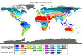
Climate Maps
500
A long hollow in the earth's surface
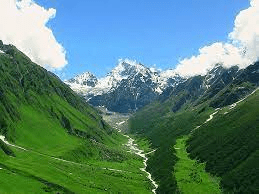
Valley