This map element shows what the different symbols and colors on the map represent.
Legend/Key
Identify two natural site factors in the image.
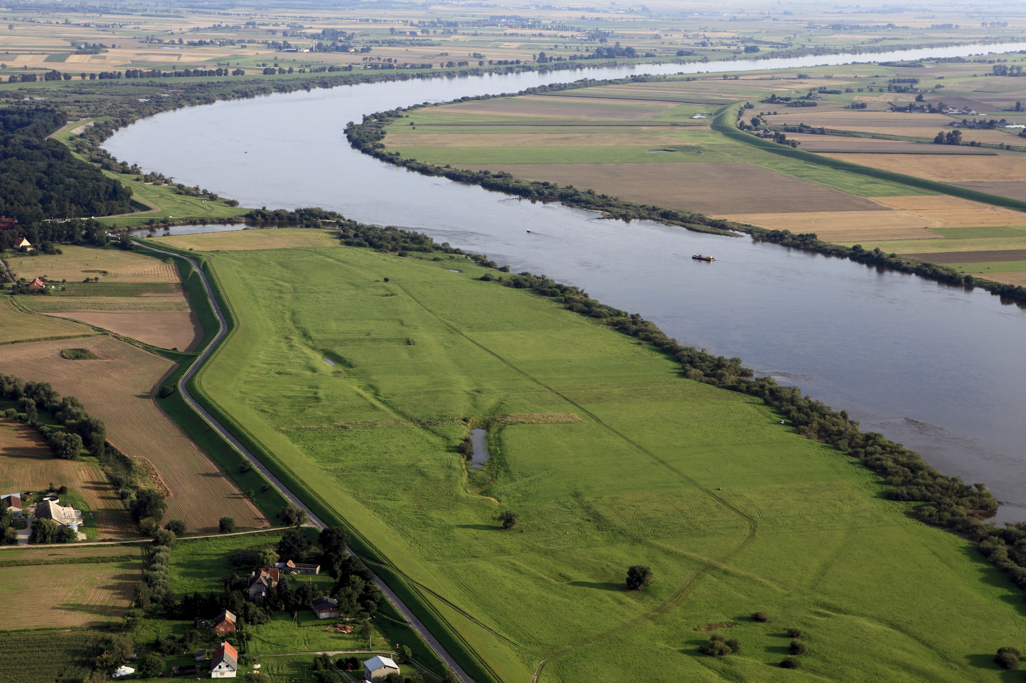
Flat land and water
Give 2 examples of greenhouse gases.
Carbon dioxide, methane, CFC
Give 2 characteristics of the tropical rainforest.
What are the three types of Geography?
What is this type of map called?
Political
Define these types of settlement functions:
1. Market town
2. Industrial town
1. Market town - where people buy and sell things
2. Industrial town - where goods are made in factories
Give 3 human activities that emit carbon dioxide.
Burning fossil fuels
Using vehicles
Factories
What is the name of this vegetation adaptation?
Buttress roots
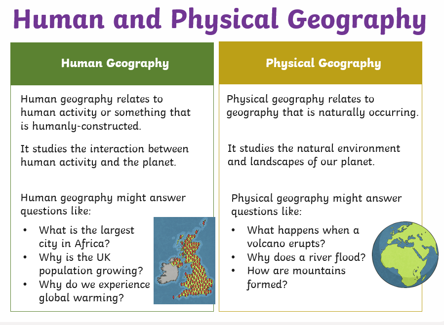
What is the difference between Physical and Human Geography?
What are the 4-figure grid references of the church and Grove Farm?

Church: 6901
Grove Farm: 7099
Name these two settlement patterns:
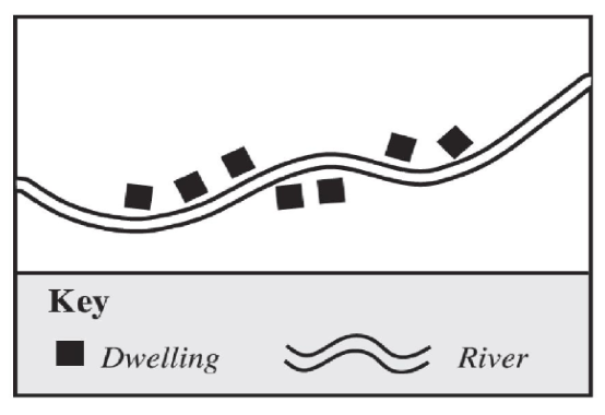
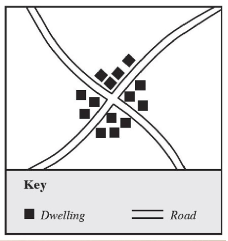
Top: linear
Bottom: nucleated
What is the difference between climate change mitigation and adaptation?
Mitigation = stopping or solving the problem
Adaptation = learning to live or cope with the problem
Camouflage to blend in their surroundings
Mimicry to look like something itended to be seen
Limited diet to only consume fruits that other animals cannot access
Bright colors to warn predators that they are poisonous
Reduction of size to be fast to acquire food
Nocturnality so there is less competition for food at night
Good climbers to swing on the trees
What is the name of the longest river in Asia?
Yangtze River
Convert the statement scale 1cm to 50m to a representative fraction.
1:5000
Name all the zones in the Burgess Land Use Model.
From the inside going out:
CBD, Industrial Areas, Inner City, Inner Suburbs, Outer Suburbs
Give 3 examples each of climate change mitigation and adaptation.
Mitigation: reducing carbon emissions, afforestation, carbon capturing, recycling
Adaptation: building sea walls, planting genetically modified crops, damming glacial lakes, cloud seeding
Identify all layers of the rainforest.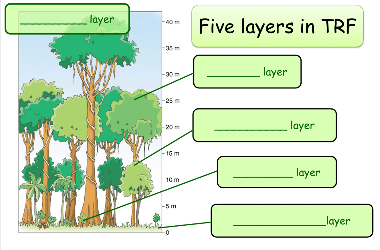
From top to bottom:
- emergent
- canopy
- young tree
- shrub
- undergrowth and ground
What is the tallest mountain in the world from base to peak?
Mauna Kea (Hawaii)
What is this symbol called and where are they usually found?
Triangulation/Trigonometrical Station - they are often found on hilltops.
Give 5 characteristics of the Hong Kong CBD.
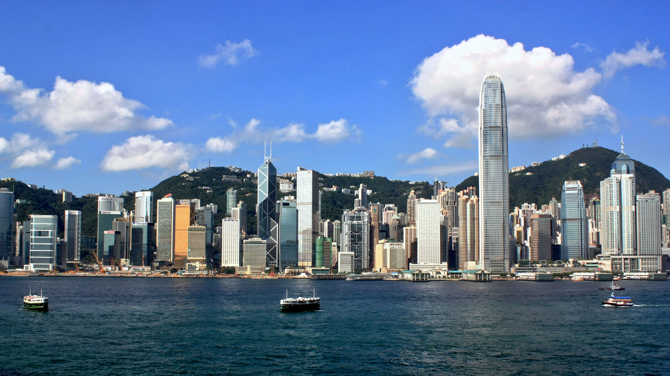
2. Expensive rent
3. High building density
4. Mostly used for offices, banks, shops, etc.
5. Lots of transport infrastructure, e.g. MTR, tram, ferry
Any valid ideas
Name 3 types of fossil fuels and 5 types of renewable energy
Fossil fuels: coal, petroleum, natural gas
Renewable: wind, solar, wave, hydroelectric, geothermal, biofuel
Explain 2 reasons why people would like to exploit the rainforest and 3 strategies to save the rainforest.
Exploitation -- to earn more profits from logging, mining, etc.; to have more space for settlements and farms; to earn income from working in the rainforest; etc.
Strategies: buying sustainable products; selective logging; creating protected areas; satellite monitoring, industry cooperation; etc.
Mrs. Amy Callaghan
Mr. Eric Wong
Mr. Herald Pedregosa
(Other possible answers: Ms. Leah Eun, Ms. Jacqueline Le)