Vocabulary
Erosion
Deposition
Topography
Remote Sensing
100
The process in which sediment is dropped or deposited in a new location
Deposition
100
What are the 4 agents of erosion?
Wind, Water, Ice, and Gravity
100
Which geologic process forms beaches on the shore of a bay?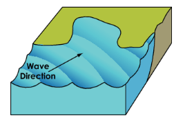
Depositon
100
What type of map is this?
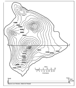
Topographic Map
100
What does GPS stand for
Global Positioning System
200
A large mass of moving ice on land
Glacier
200
What is one geologic process that is responsible for forming Hoodoos?
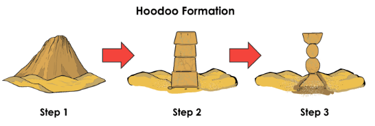
Erosion and Weathering
200
When a river is carrying eroded sediment, what causes the sediment to finally begin to drop and be deposited?
When the speed of the water decreases
200
How are hills and mountains represented on a topographic map?
Concentric circles that get smaller and smaller
200
Where are satellite images taken from
Space
300
The process in which sediment is moved from one place to another
Erosion
300
Explain the erosion rate between these two stones over time 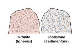
The sandstone will erode much faster because it is not as hard or dense
300
What landform is being created in the satellite image below?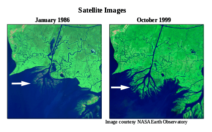
DELTA
300
How are very steep areas represented on a topographic map?
Contour lines that are spaced very close together
300
What could satellite images help us study on Earth's surface
Many answers possible
400
Lines on a topographic map that connect points of equal elevation
Contour lines
400
Which graph accurately shows the relationship for velocity between a river and the body of water it enters into?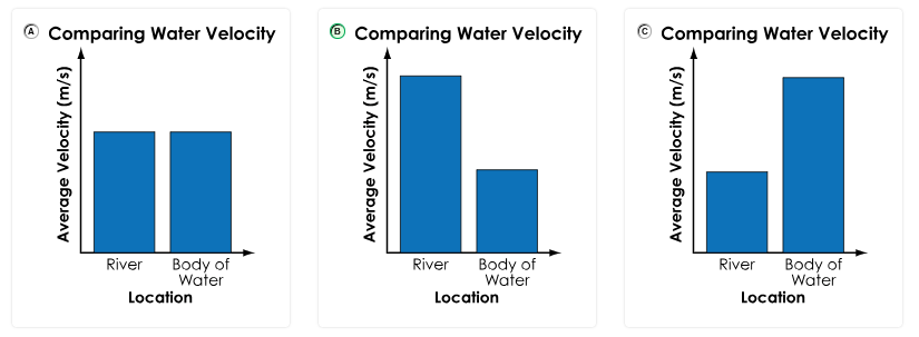
B
400
Which moraine formed when the glacier reached it's maximum advance?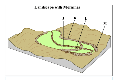
M
400
Which landform matches each labeled section on the map?

Left to Right: Mountain, Canyon, Delta
400
How can satellite images help us study glaciers
They can help track glacier movement/retreat over time
500
A deposit of unsorted rock debris, including boulders, gravel, sand, and clay, that was carried and left behind by a moving glacier
Moraine
500
Which agent of erosion is responsible for forming valleys and canyons?
Water/Rivers
500
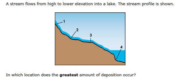
Location 4
500
Identify the process of how each of these features was made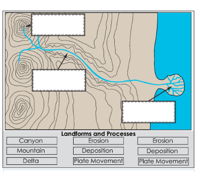
Left to Right: Plate movement, Erosion, Deposition
500
How can this satellite image, taken of the same location a year apart be used

It is used to study flooding and increased water in the area