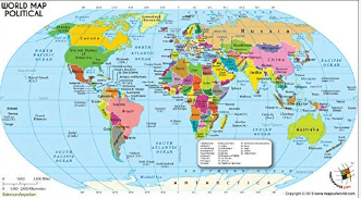
Maps
U1 & U2
U3 & U4
U5 & U6
Pot Pourri
100
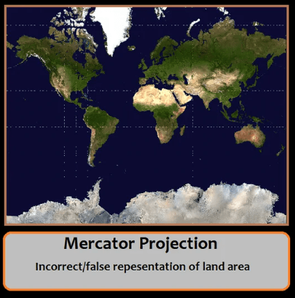
This type of projection has a rounded edge, but ultimately Area, Shape, Size, and Direction are all slightly distorted
What is a Robinson Projection?
100
This type of region share characteristics within a larger region but is distinct in some manner
What is a Subregion?
100
A religion that is focused on a single ethnic group (often in a centralized area) that doesn't attempt to appeal to all people
What is an Ethnic Religion?
100
Slash and Burn agriculture is also known as this
What is Swidden Agriculture?
100
The scattering a of people from their homeland (especially the Jews from the Holy Land)
What is Diaspora?
200
Representation of reality, or theories about reality, to help people see general spatial patterns
What are Geographic Models?
200
This type of region differs from other types because it is defined by the informal sense of place that people prescribe to the area. i.e. "The South"
What is a Perceptual Region?
200
The feeling resulting from the standardization of the built environment; occurs where local distinctiveness is erased and many places end up with similar cultural landscapes
What is Placelessness?
200
The method of describing land boundaries by using natural features like rivers, streams, or man-made markers like roads or stakes
What is Metes and Bounds?
200
These are the areas surrounding the outside of market area
What are the Hinterlands?
300
This Map Projection is the best for Navigating the Open Sea
300
This is the shrinking of "time-distance" between locations because of improved methods transportation and communication
What is Time-space compression?
300
Judging people or traditions based on your own cultural standards
What is Ethnocentrism?
300
This was a push in the 18th and 19th centuries to take land that had formerly been owned in common by all members of a village, or at least available to the public for grazing animals and growing food, and change it to privately owned land, usually with walls, fences or hedges around it.
What is the passage of the Enclosure Acts?
300
This Greek Mathemetician calculated the circumference of the earth in 300 B.C.E. and coined the term Geography
Who is Eratosthenes?
400
Uses Symbols of different sizes to indicate different amounts of something i.e. Major Cities by Population
What is a Graduated Symbol Map?
400
The term when migrants move to the same cities as relatives who had already moved there
What is Chain Migration?
400
An adoption of cultural traits, such as language, by one group under the influence of another
What is Acculturation?
400
This Agricultural Revolution Focused on the transition from older methods to more modern methods focusing on newer machinery
What is the Second Agricultural Revolution?
400
This is the largest city in an urban system that is also AT LEAST twice as large as the next largest city.
What is a Primate City?
500
A topographic Map this type of Map
What is Isoline?
500
This is the name for a contemporary believer in the theories of Thomas Malthus
What is Neo-Malthusian?
500
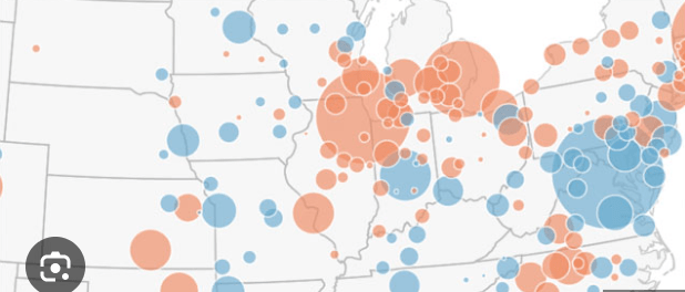
The practice of manipulating electoral district boundaries to favor a particular political party or group. This tactic is often used during the redistricting process to maximize electoral advantage,
What is Gerrymandering?
500
This is occurs when a symbolically relocated capital city usually because of either economic or strategic reasons.
What is a Forward-Thrust Capital?
Ex: Brasilia, Washington D.C. or Astana, Kazakstan
500
Name this city model
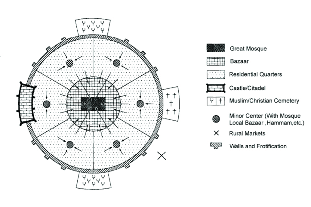
What is the Middle-Eastern City Model?
600
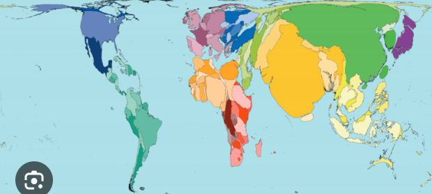
A type of map that changes the sizes of countries to match the representation of a statistic
What is a Cartogram?
600
This is the magic number for fertility to keep a population from declining.
What is 2.1?
600
A trade language, characterized by a very small vocabulary derived from the languages of at least two or more groups in contact
What is a Pidgin language?
600
This model described how different types of land use and housing were all located near the CBD early in a city’s history. Each grew outward as the city expanded, creating wedges (sectors) of land use rather than rings
What is the Hoyt Sector Model?
600
This is the idea that portions of an urban area--regions or zone, within the city-- have specific & distinct purposes
What is Functional Zonation?
700
The state of Georgia can be classified as apart of many different regions, name two with their corresponding definition.
Ex: Climate Region, Functional Region (State or Country, Vernacular or Perceptual Region "The South or Bible Belt",
700
This 19th century Geographer and Cartographer helped define the most common trends about migration
Who is Ernst Georg Ravenstein?
700
English is from the Indo-European Language tree and is the most widely spoken language in the world. Mandarin is the second most spoken language in the world and comes from this tree
What is the Sino-Tibetan Tree?
700
This is a term for a solution to the legal fragmentation of many metro areas in which certain areas of government are handled jointly, across numerous separate municipalities, while other elements of local government continue to be handled by individual municipalities
What is Consolidation?
700

Unit 1: Thinking Geographically
Unit 2: Population and Migration
Unit 3: Cultural Geography
Unit 4: Political Geography
Unit 5: Agricultural and Rural Land Use
Unit 6: Cities and Urban Land Use
Unit 7: Industrial and Economic Development