Mapping
Patterns
Scale & Region
Theoretical
Everything Geography
Final Jeopardy
100
What is the map scale?
regional
Double Jeopardy!
- What is the scale of analysis?
100
movement and change of a space including people, goods and information
flow
100
What scale is larger?
A or B
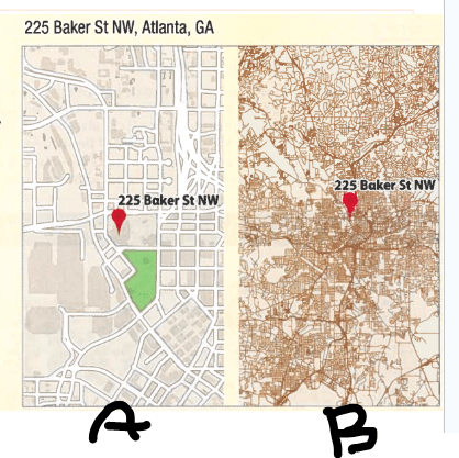
A
100
Possibilism or determinism?
Limitations on agricultural crops based on climate.
Determinism
100
the number of things - people, animals or objects - in a specific area.
density
100
First Period
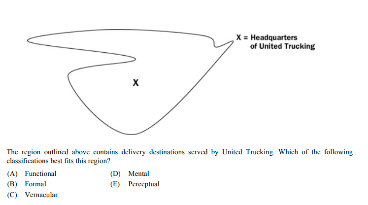
A) Functinal
200
The Mercator map is known for not having accurate depictions of low, mid or high latitudes?
High (But Mercator keeps true direction)
200
What pattern is shown below?
- Cluster
- Dispersed
- Linear
Dispersed
200
What type of region is shown below.
- Culture, Formal, Functional, Industrial, Vernacular
formal
200
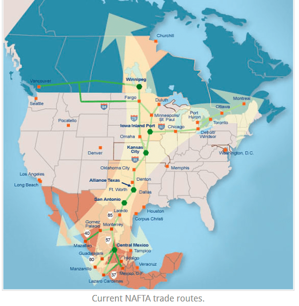
describes the effect of distance on interactions
distance decay model
Double Jeopardy!
- concept states that distance requires time, effort and cost to overcome
200
Budapest's location is 134 miles from Vienna, Austria or about 2 ½ hours away by train or the city is located in the north-central part of Hungary
Is this relative or absolute location?
Relative
200
Eighth Period
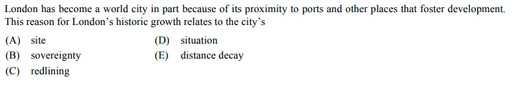
D) Situation
300
What type of map is shown below?
Cartogram
300
What type of data is described?
interpretations of data sources.
field observations, media reports, travel narratives, policy documents, personal interviews, landscape analysis and visuals such as art or photographs.
qualitative
300
What type of region is shown below.
- Culture, Formal, Functional, Industrial, Vernacular/Perceptual

vernacular/perceptual
300
expansion of economic, cultural and political processes on a worldwide scale.
globalization
300
Survey used to gather information about current populations.
Census survey
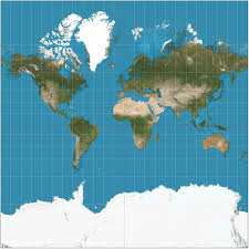
400
What is the term used to describe what happens when 3D layers are represented as 2D layers?
Distortion/stretching
400
Describe one spatial pattern in the map:
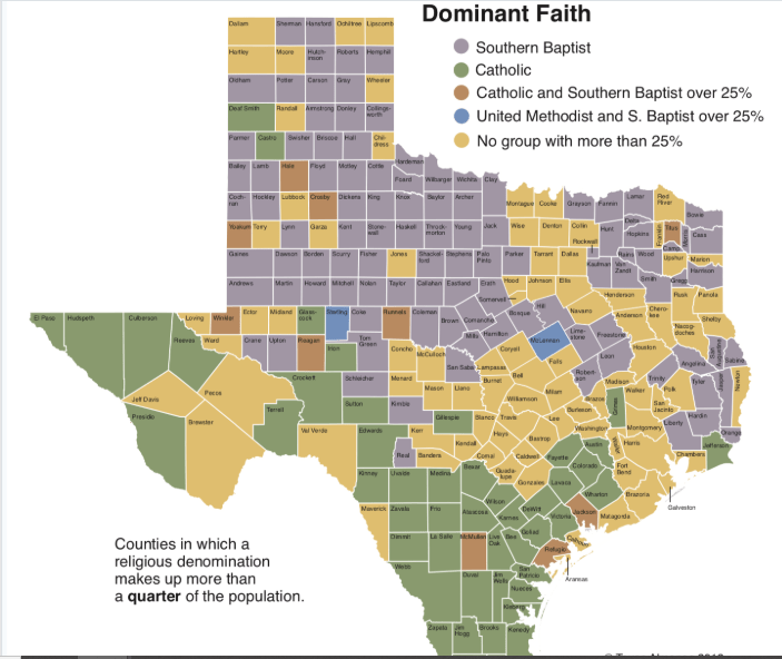
- Christian in general
- Southern Baptist in North
- Non dominant in Central
- Catholic in South (little in East)
400
What is the best identification of the scale of analysis for both maps?
1) Global and regional 2) regional and urban 3) regional and country 4) global and local 5) country and local

3) regional and country
400
Is sustainability the result of determinism or possibilism?
Possibilism
400
the use of Earth’s land and natural resources in ways that ensure they will continue to be available in the future.
Sustainability
500
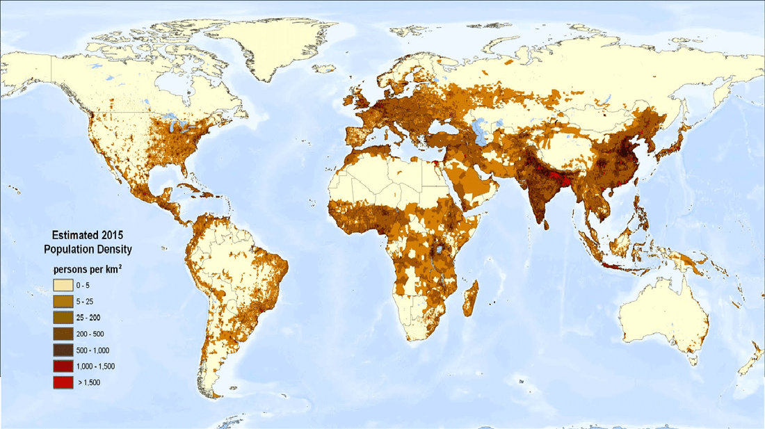
What type of map is this?
Choropleth, Cartogram, Proportional Symbol, Isoline

Choropleth
500
Describe one pattern in the map below.
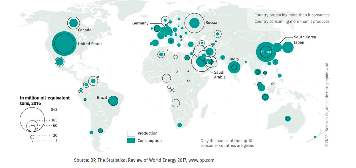
Examples:
- USA consumes more than produces. (Canada opposite)
- NW South America produces more than consumes.
- Africa produces a lot but doesn't consume.
- Europe lots of consumption and little production.
- Russia a lot of production and good amount of consumption.
- Middle East lot of production and some consumption.
- East Asia lots of consumption and little production besides China.
500
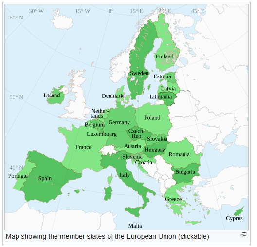
What type of region is described in the map below depicting areas of milk shed (areas that get milk from centrally located dairy farms).
- Culture, Formal, Functional, Industrial, Vernacular
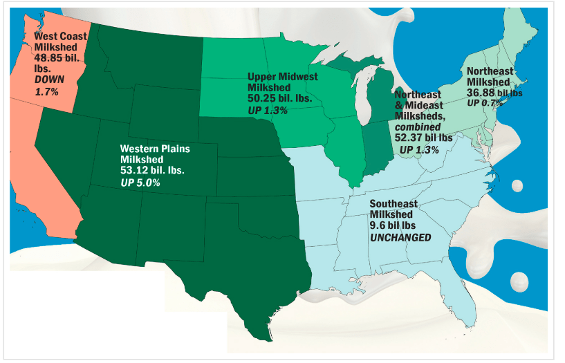
Functional
Double Jeopardy:
What is the central function of a functional region?
500
What spatial pattern is described below?
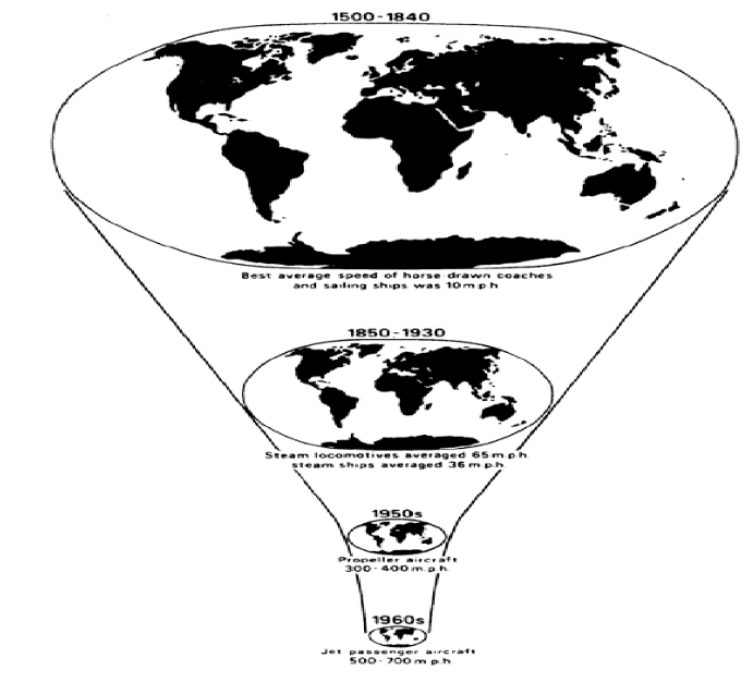
time space compression
500
- What level of Wallerstein's World System Theory is the below description?
Manufacturing
Exporting goods
Increasingly skilled workforce
Better connections
Improving comms and transportation
Semi-Periphery