Thunderstorms & Lightning
Weather RADAR & Convective Products
Fog & Satellite Imagery
Winter Weather & Icing
AWC Products
100
Which state has the highest number of days with SEVERE thunderstorms?
Oklahoma
100
CAPE = 100; LI = 2; KI = 10
(T/F) This scenario indicates a great risk for severe thunderstorm development.
FALSE
100
It's early winter, and the ground is cold over the south-central plains of the U.S. (N. Texas, Oklahoma, Kansas). If an area of high pressure situated the eastern U.S. creates south-southeasterly winds that force warm, moist air from the Gulf of Mexico over the cold surface of the south-central plains, which type of fog would most likely form?
Advection
100
____________________ is the estimate of how long deicing fluid will prevent icing build-up on an aircraft.
Hold-Over Time
100
What is the top of the icing layer?
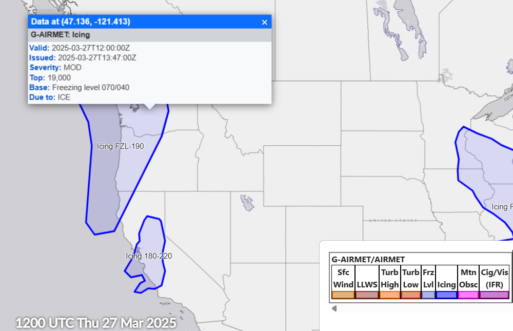
19000 ft
200
The cold air associated with the downdraft from a thunderstorm can spread out upon reaching the ground and provide a lifting mechanism for new thunderstorm growth. This best describes the _____________ of the thunderstorm.
Outflow Boundary/Gust Front
200
(T/F) The national radar mosaic product can have a substantial data lag of 15 to 20 minutes.
TRUE
200
What is the Flight Category for the below METAR?
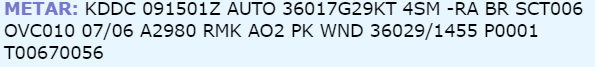
MVFR
200
The following forecast icing potential (FIP) product shows the icing severity with SLD threat at your cruise altitude of 12,000 ft. What is the predominant icing severity in the area within the black box?
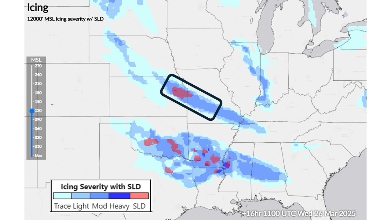
moderate
200
What is the base altitude of the icing threat at the location of the orange star in the following G-AIRMET?
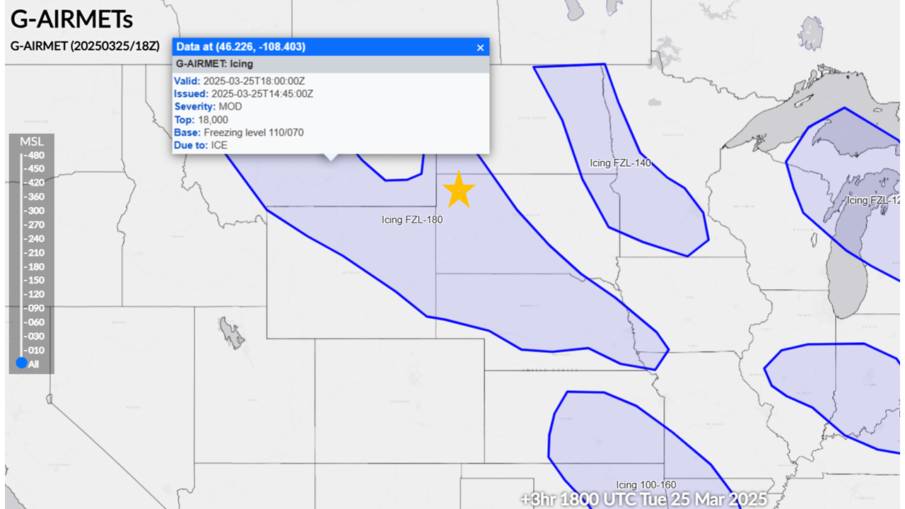
Varying between 7,000 and 11,000 feet
300
Within a storm, where do the most lightning strikes occur?
near the updraft
300
Which image is BASE Reflectivity?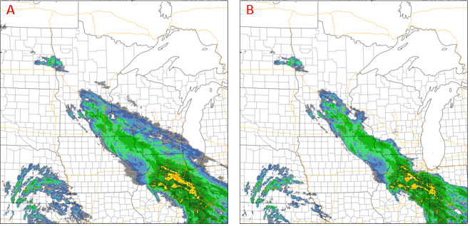
B
300
Below is a colorized IR satellite image (left) and visible satellite image (right) both taken at the same time. Based on both images, what is the most likely cloud type occurring in the circled area? 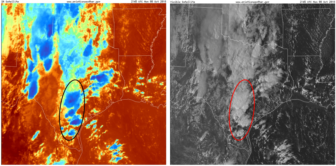
CUMULONIMBUS
300
The outside air temperature is -2∘C. If clouds are present, what type of icing is most likely to occur?
Clear
300
Refer to the Graphical Forecast for Aviation (GFA) product above. MVFR conditions are occurring at location _____.
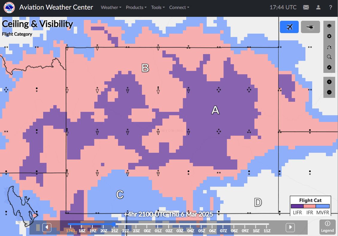
C
400
What are the 3 necessary ingredients for thunderstorm formation?
low-level moisture, conditional instability, lifting mechanism
400
When was the Aviation Weather Center Convective SIGMET issued?
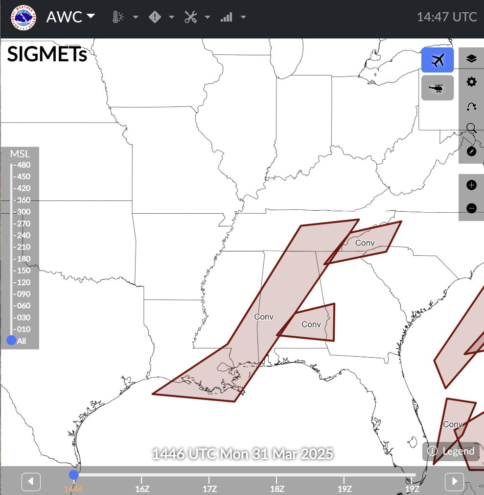
1355Z
400
Where is the most moisture (color or region) on this image?
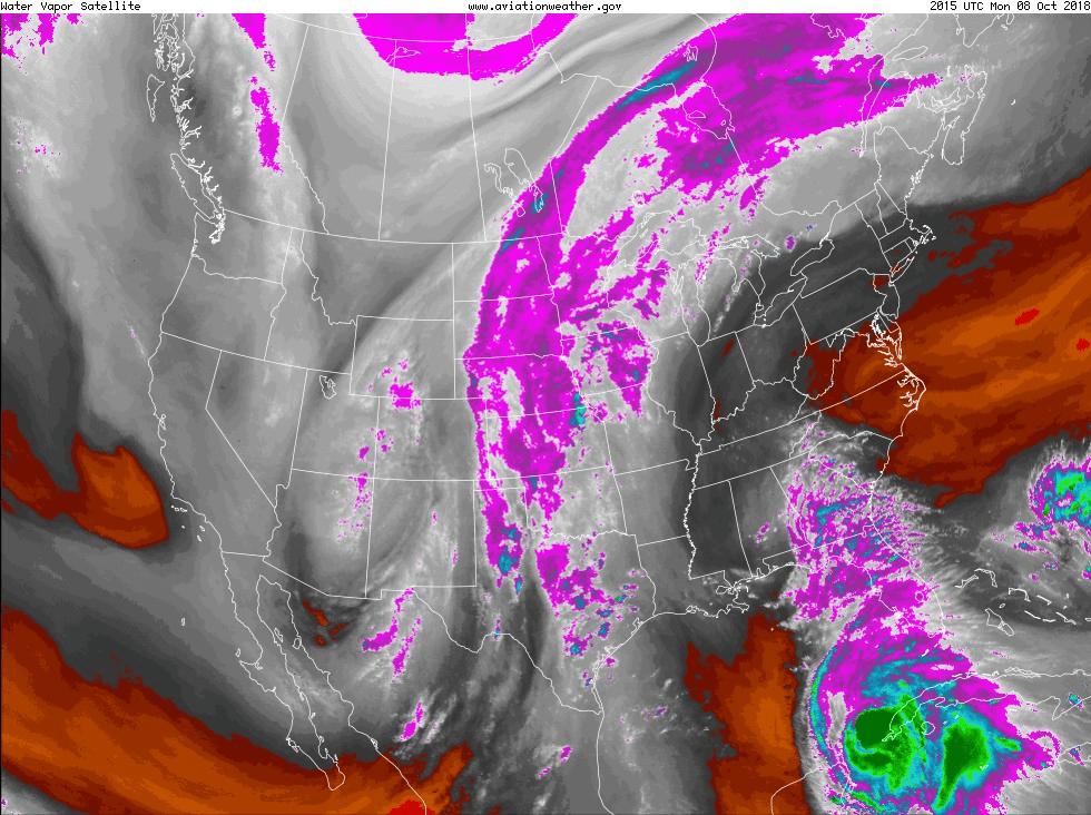
southeast; near florida
400
What is the layer of the greatest icing potential?
680 - 475
400
Refer to the following G-AIRMET map. The icing threat extends to the highest altitudes in which AIRMET polygon?
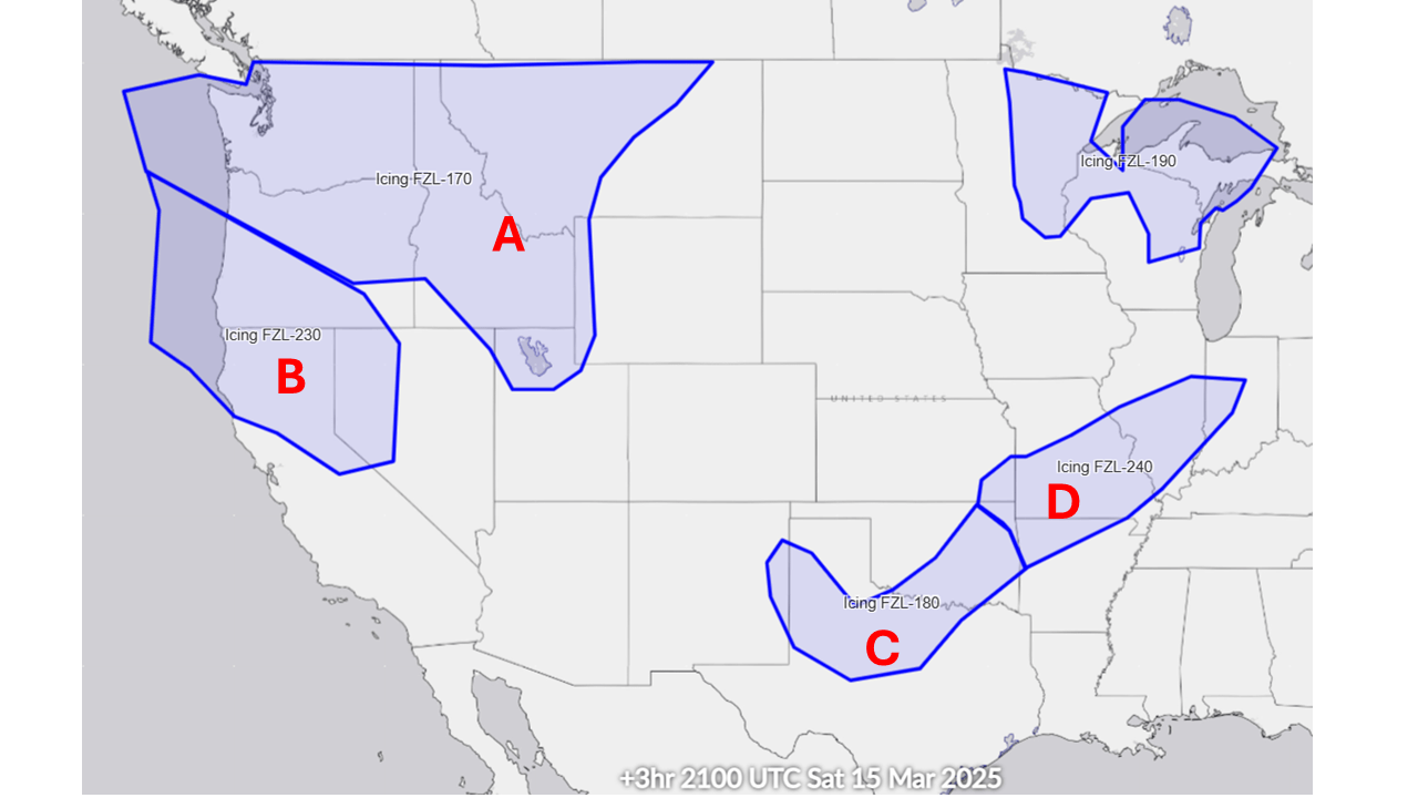
D
500
What are the 3 criteria that the National Weather Service use to classify a severe thunderstorm?
Hail > 1 inch
a tornado
Wind > 50 kts
500
According to the Storm Prediction Center (SPC) Convective Outlook above, severe thunderstorms are predicted but with the greatest coverage and intensity at the ____________ location.
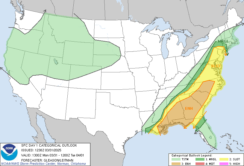
Enhanced
500
What is found at location D?
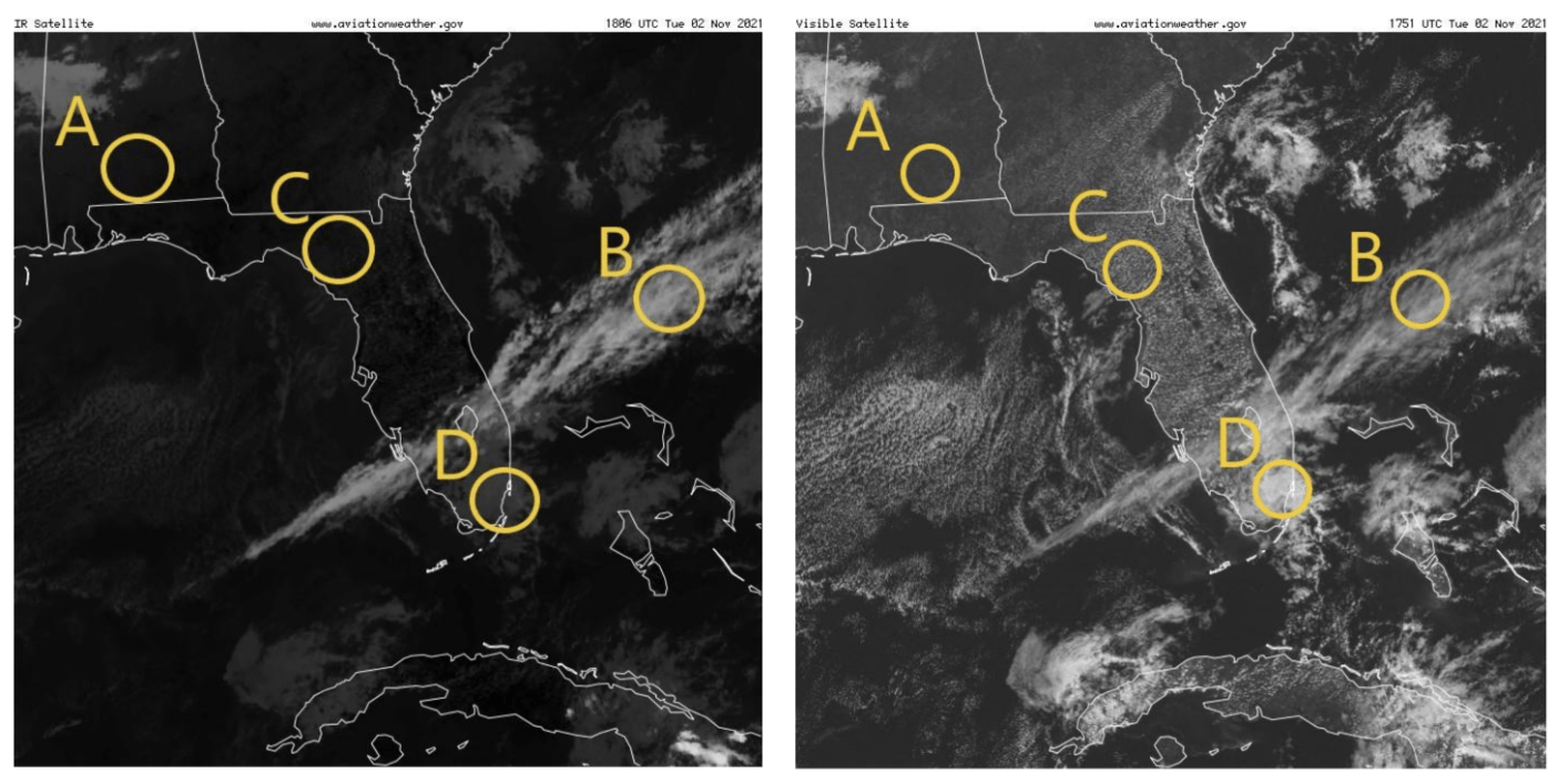
Fog
500
Based on the above PIREP chart, what type of icing was being reported in the region surrounding KPIT?
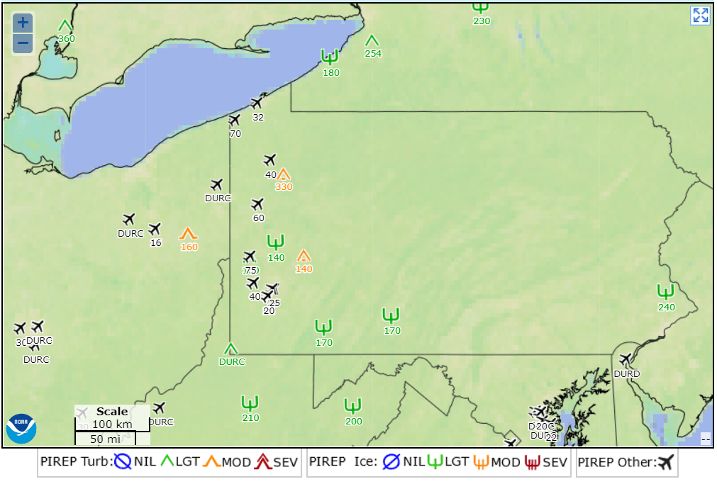
light icing
500
According to the following SIGMET graphic, what kind of hazardous weather can you most likely expect flying along the route indicated by the black line at 1930 UTC on March 9th, 2025? What are the heights of the tops?
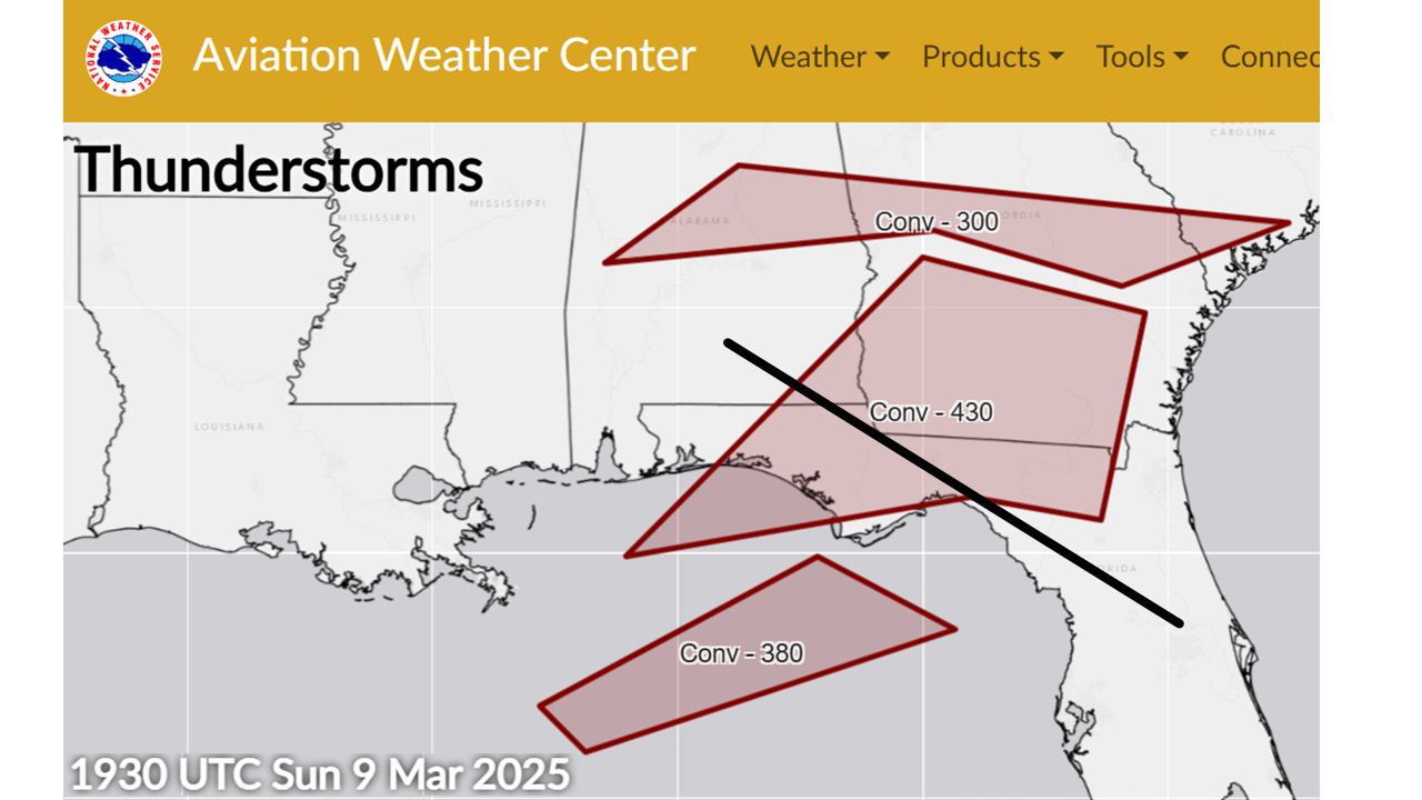
Thunderstorms @ 43000 ft