Toolbox Vocab
Types of Maps
Latitude / Longitude Terms
Finding Lat/Long
Variety
100
7 large landmasses on Earth's surface
Continents
100
You are planning a road trip from Pittsburgh to Philadelphia and need to know which highways and roads you can take to get there.
Road map
100
An imaginary line that circles the globe halfway between the North and South Poles.
Equator
100
Which point is the closest to 0, 20E ?
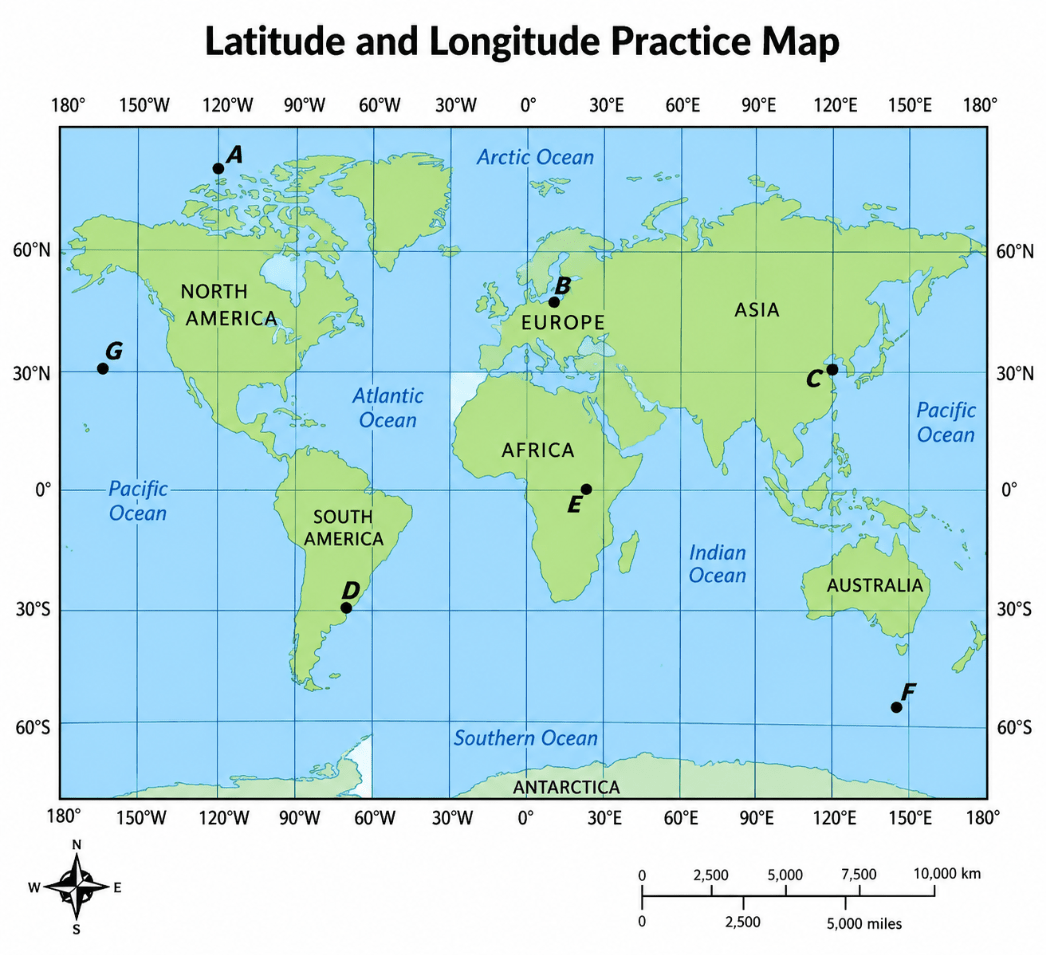
E
100
You are planning a hike through a mountainous area. You need to know where the land gets steeper, the elevation of different areas, and the shape of the hills and valleys so you can choose the safest route.
Topographic Map
200
An imaginary line that divides the globe into east and west halves.
Prime Meridian
200
Your class is studying where different languages, religions, and traditions are common around the world. You want to see how these characteristics vary from one region to another.
Cultural map
200
The name for latitude lines - always the same distance apart
Parallels
200
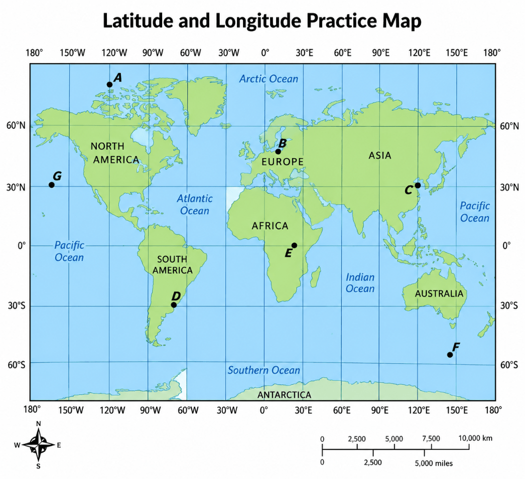 Which point is the closest to 80N, 120W ?
A
200
Which point is the closest to 30S, 70W ?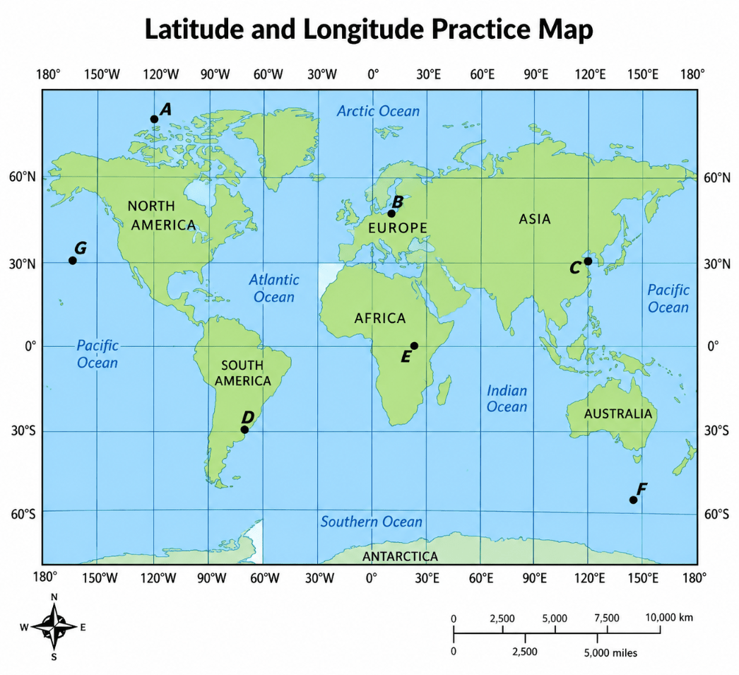
D
300
Satellites collect information for this system that gives the exact location of a given object on Earth.
Global Positioning System (GPS)
300
You are studying the Appalachian Mountains and need to identify mountain ranges, rivers, plains, and other natural features.
Physical map
300
What is one half of the Earth called? Can be northern, southern, eastern, or western
Hemisphere
300
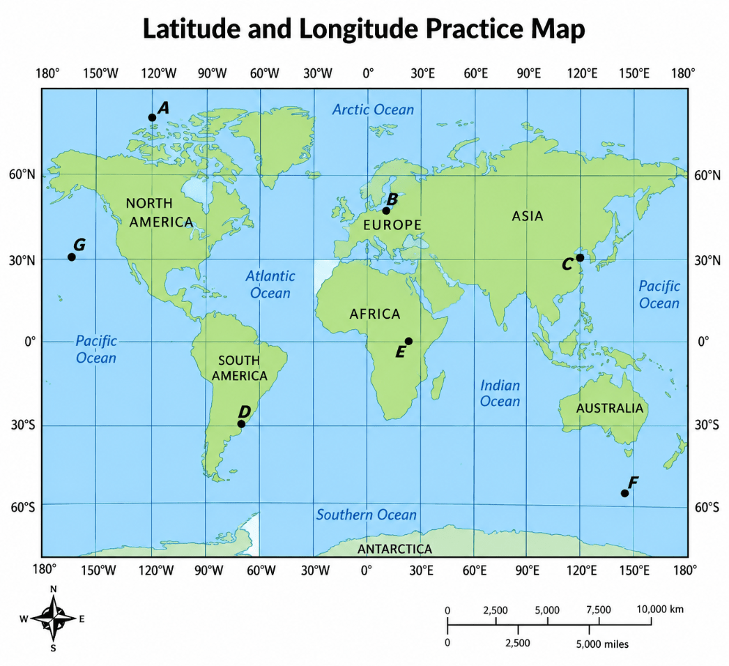 Which point is the closest to 30N, 165W ?
G
300
Which point is the closest to 30N, 120E ?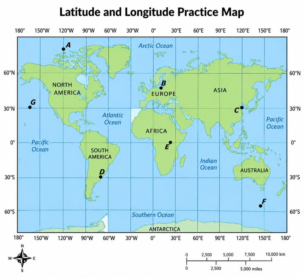
C
400
Degrees (measurement for latitude and longitude) can be further divided into this smaller unit
Minutes
400
A hurricane is moving across the Atlantic Ocean, and meteorologists need to show its predicted path, areas of heavy rainfall, wind speeds, and changing temperatures.
Weather Map
400
The name for the lines of longitude
Meridians
400
Which point is the closest to 50N, 10E ?\
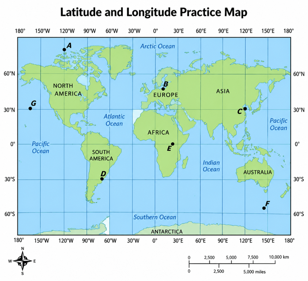
B
400
Mapmakers create different ways to show our world on a flat map, but none of these are 100% accurate.
Map Projections
500
A group of databases used to provide information to answer questions
Geographic Information System (GIS)
500
A researcher wants to study population density across the United States. Instead of showing every individual road or physical feature, the researcher wants each state shaded or colored according to the number of people living per square mile.
Thematic map
500
A pattern of imaginary lines that circle the globe in east-west and north-south directions.
Grid
500
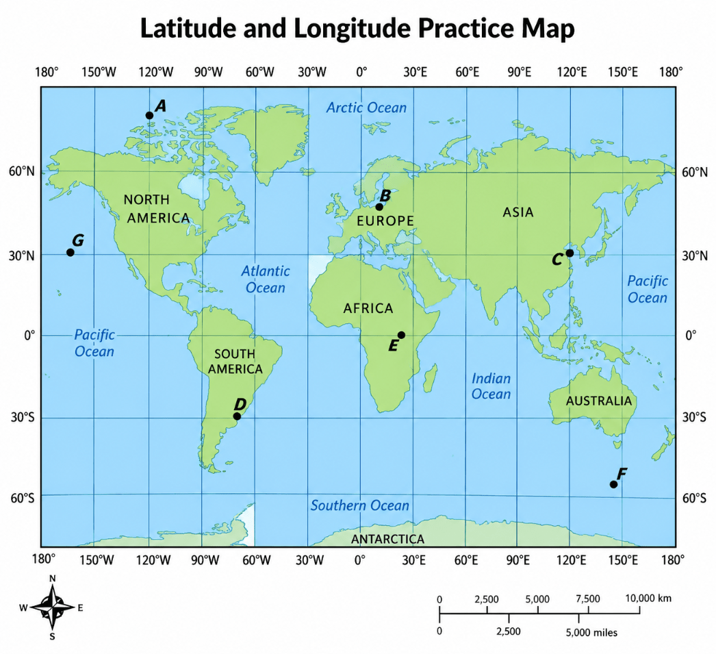 Which point is the closest to 55S, 150E ?
F
500
A team of archaeologists is studying a small ancient city that was located within a much larger modern city.
Inset Map