VOCAB
TOOLS
REGIONS
HUMAN GEOGRAPHY
CORNICOPIA
100
Lines of __________ describe specific locations east or west of the prime meridian and run north and south.
LONGITUDE
100
This item is different from a map or globe because it focuses on a specific feature such as terrain
DIAGRAM
100

What continent is located at 75°S and 75°E?
ANTARCTICA
100
What man made feature stores water to irrigate dry farmland?
DAMS
100
These people study how our physical surroundings affect us. They look closely at the land and water. They look at old objects. They even look at primary source photographs.
GEOGRAPHERS
200
Lines of _______ describe specific locations north or south of the equator and run east to west.
LATITUDE
200
What is geography the study of?
THE PHYSICAL AND HUMAN FEATURES OF THE WORLD
200
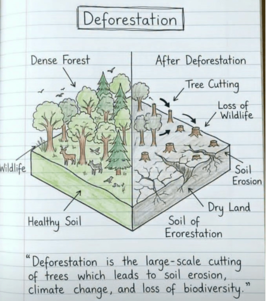
The diagram demonstrates that after deforestation, the land becomes less suitable for farming because of what?
SOIL EROSION
200
Name something that a dam can disrupt
ANIMALS OR PLANTS
200
Which geographer's tool would help predicting the weather?
AERIAL PHOTOGRAPH
300
Maps and globes are representaions of Earth created by....
CARTOGRAPHERS
300
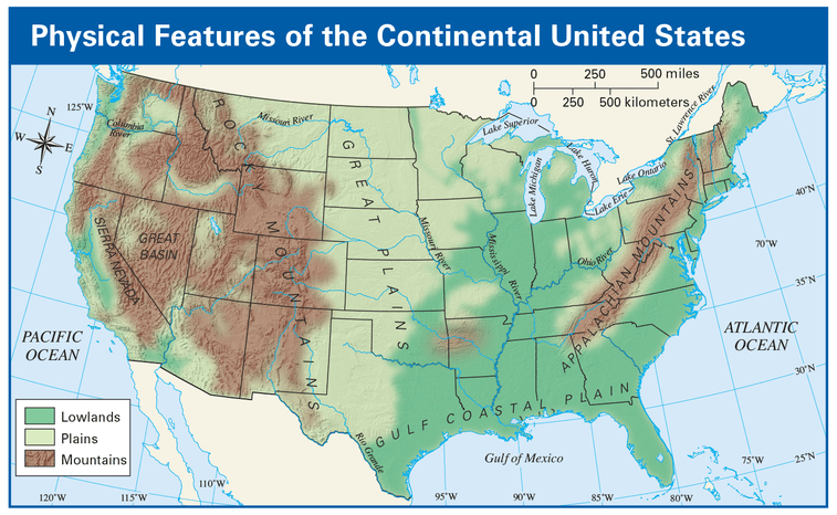 What does the dark green represent on this map?
LOWLANDS
300
The Western Hemisphere is half of the globe (World) west of what?
PRIME MERIDIAN
300
What item(s) can be a positive and negative aspect of human interaction with the environment?
NATURAL RESOURCES
300
What is the name of the starting point for lines of Latitude?
EQUATOR OR 0°
400
Lines of latitude help identify this, or average weather conditions in a location.
CLIMATE
400
Tools such as maps, globes, charts, and photographs help geographers understand the relationship between these two items.
PEOPLE AND LAND
400
The Western Hemisphere is divided into 4 main regions: North America, Mesoamerica, the Caribbean, and this...
SOUTH AMERICA
400
How do a region's physical, economic, and cultural features in the Western Hemisphere shape where people live and how they use the land?
BY INFLUENCING WHERE PEOPLE LIVE
400
The name for a map that you can feel physical features.
RELIEF
500
Lines of latitude and longitude create an imaginary grid called this, that describes locations on Earth
COORDINATE SYSTEM
500
How can examining features on a map or globe help explain how landforms affect people?
BY SHOWING PHYSICAL AND NATURAL FEATURES TO SHOW WHERE PEOPLE LIVE
500
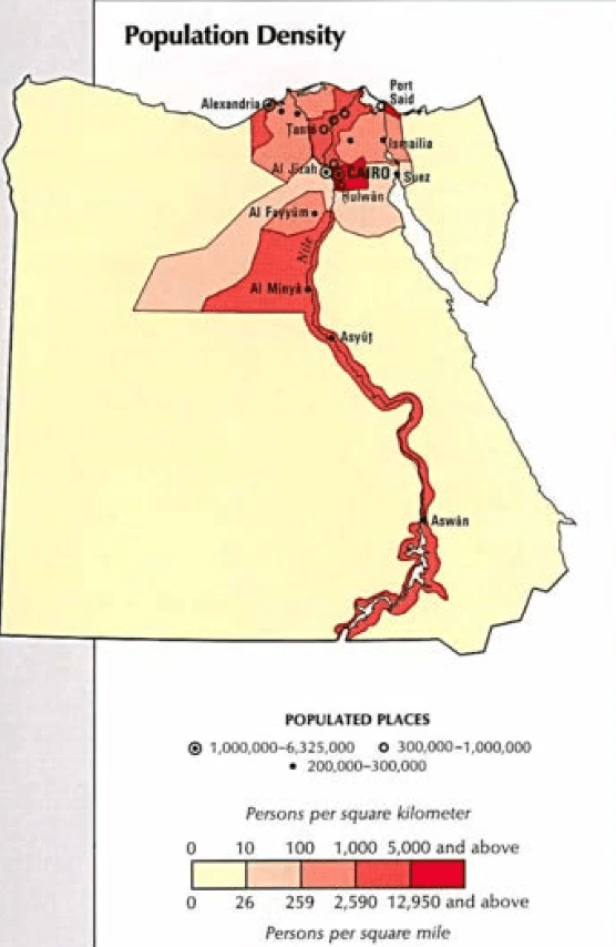 What would cause the population density to be so high on this map?
WATER SOURCE (RIVER) OR CLIMATE
500
Using natural resources can take a toll on the land. For example, removing oil and other natural resources from the ground can cause these 2 things to happen.
AIR AND WATER POLLUTION
500
What was the name of the Nimiipuu (Nez Perce) chief who helped Louis and Clark find the Columbia river?
TWISTED HAIR