The study of the Earth and everything in and on it is what?
Geography
This map shows geographical or physical features, like mountains, rivers, deserts, and plateaus.
Physical Map
Double Jeopardy!
Name three types of geographical tools
maps
aerial photographs
satellites
computer-assissted maps
GIS
Globe
Herman lives in a large urban area near Caira, Egypt. His family wants to migrate to the United States and lets him know he will be attending a rural school district in Hebron, Ohio. Herman, although born in America, has never lived there, and wants to find out how many people he will have to interact with right off the bat. What would suggest he use to find out this information?
population map
What are natural resources?
Materials made by the Earth
another word for plants
vegetation
What type of map is being shown?
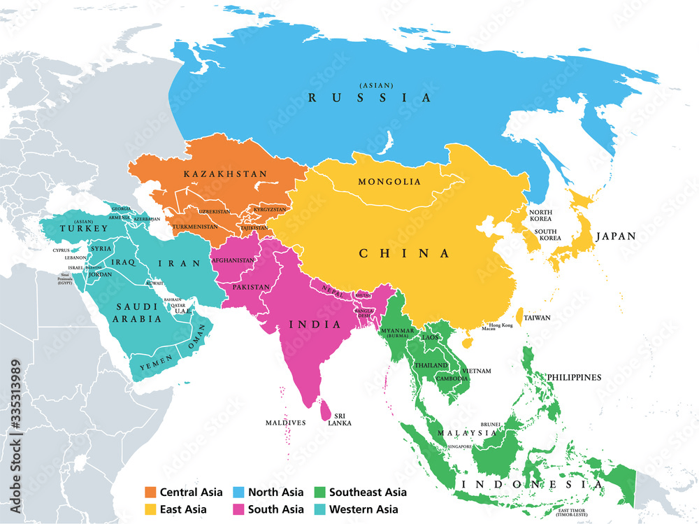
Political Map
Which geographical tool is being used below? How do you know?
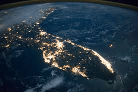
A satellite
Image is coming from outerspace/orbit
Sarah and her friends are going to vacation a Camp Crystal Lake, this summer. Sarah has heard of the infamous place but has never seen it. She's been told it spans almost 50 acres, contains twenty cabins, a mess hall, crafting station, archery area, and of course a lake. She has seen pictures of the camp in the brochure but wants to see it in it's entirity. What should she use to get the best vantage point of the camp and take it all in at once?
aerial photograh? - How
Satellite Image? - Why?
Provide three examples of natural resources
oil
coal
diamonds
fertile soil
etc.
What do you call a person who makes maps?
A Cartographer
Double Jeopardy!
The map below shows specifically the dominant religions around the world and where they are located. What type of map would this be?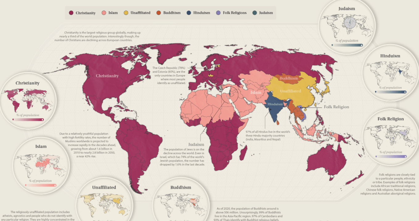
Thematic Map
Look at the geographic tool below, what is it and when would you use it instead of just a thematic map?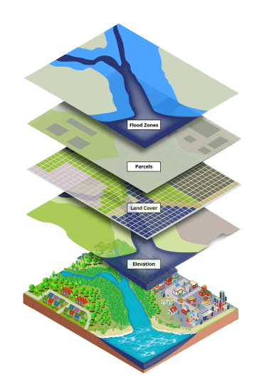
A GIS or Geographic Information System
When you need to know more than one type of geographic information all at the same time
The 911 distpatcher gets a call stating there is a fire on East Main Street and Dodson Road. The fire department that is closest is already on their way but have asked for back up. What geographic tool woud help the dispatcher locate and call the next closest fire department and EMTs.
A Computer Assissted Map
Double Jeopardy
What is another name for a key?
A legend
*Double Jeopardy!!
precipitation means..
rainfall and/or snowfall totals
Use the key below to identify which type of map is below, and explain why.
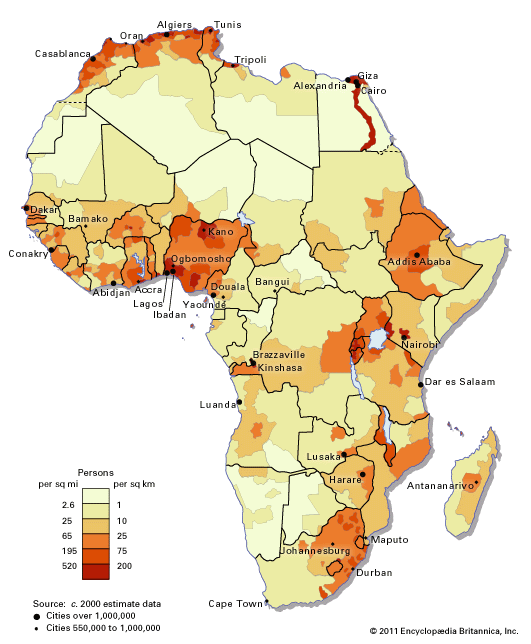
Population Map
Shows the amount of people in the area
What type of geographic tool is below, whats the difference between this and a political map?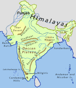
Physical Map
Politcal maps show boundaries and borders
Physical maps show geographical features or landforms
Rumors have spread that somewhere in the Middle East military weapons are being traded between two hositle countries to the United States Government. The U.S. Department of Defense has been asked to see if they can confirm the suspicions of the recent intellegence. Being the most tech savy geographer on the team you suggest they use what to provide evidence of this?
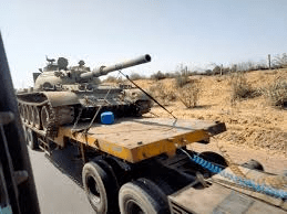
Satellite Imagery
A climate map shows temperatures and precipitation annually.
What is precipitation?
What does annually mean?
rain and snowfall
yearly
Provide three examples of geographic information
population
natural resources
physical features
human features
climate
vegetatio
latitude and longitude
politcal features
human features
Using the title identify which type of map is below and provide two pieces of evidence that you are correct.
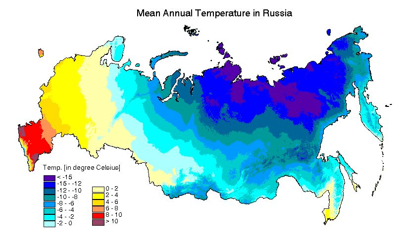
Climate Map
shows mean or avg. temperatures in Russia
Annual = over a year
What type of geographical tool is shown below?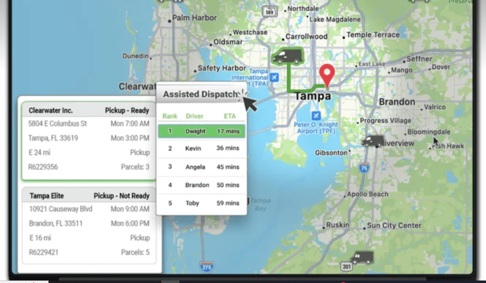
Computer Assissted Map
The local city engineer has been tasked with creating a brand new housing development just east of downtown. She will need to know the topography (elevation levels), the plot lines of the property she needs to purchase, the zoning regulations, the county border lines, and what resources the surrounding area has the ability to utlilize for local trade. Which geographical tool do you suggest she use to get all this information at one point.

A GIS
When will the Geographical Tools Test be taken?
Should you study?
If so what should you use?
Thursday/Tomorrow
Yes
Study Guide
Notes
Textbook