Instruments
Time Zones
Topography
Land forms
Random
100
This geographical instrument shows the physical geography and it looks like the Earth.
Globe model
100
What does GMT mean?
Greenwich Mean Time
100
Who is your favorite teacher?
T. Ciera (LOL)
100
What is the difference between a "mountain" and a "mountain range"?
A mountain range has many mountains together. A mountain is only 1 mountain.
100
What is geography?
The study of the Earth and people
200
What is line dividing the Northern Hemisphere and the Southern Hemisphere?
Equator
200
What time zone is Thailand in?
105° East
200
What does a topographic map show?
A. The temperature
B. The land forms
C. The population of people
D. The best coffee
B. Land forms
200
What is an archipelago?
A group of islands together
200
What are the continents? Please name all of them.
North America, South America, Africa, Europe, Australia, Asia, Antarctica
300
What is the difference between "aerial photography" and "satellite image"?
Aerial photography is done by using a balloon, plane or drone to take a picture. A satellite image is taken from space using the light reflected off the Earth.
300
What is the name of the longitude line at 0° ?
The Prime Meridian
300
What is elevation?
Elevation is how high something is from sea level
300
What is the tallest mountain and what mountain range is it in?
Everest is the tallest mountain and it is located in the Himalayas.
300
What are the 5 regions in Asia?
Central Asia, East Asia, South Asia, Southeast Asia, Southwest Asia
400
Name all 6 geographical instruments that we studied
Globe model, map, compass, aerial photography, satellite image, global positioning system
400
If 15° = 1 hour and England is at 0°, what is the time difference between England and a country at 105° East?
+ 7 hours, GMT +7
400
A topographic map show elevation using color. What else does a map have on it?
scale and legend
400
What countries in Asia are archipelagos? Name 3 countries.
Japan, Indonesia, Philippines, Maldives, and the Andaman Islands
400
What are the borders of Asia?
North: Arctic Ocean
East: Pacific Ocean
South: Indian Ocean
West: Europe, Africa, Caspian Sea, Red Sea, Black Sea
500
How does a compass find north? Draw or describe your answer
The molten core of the Earth generates electricity which creates a magnetic field. 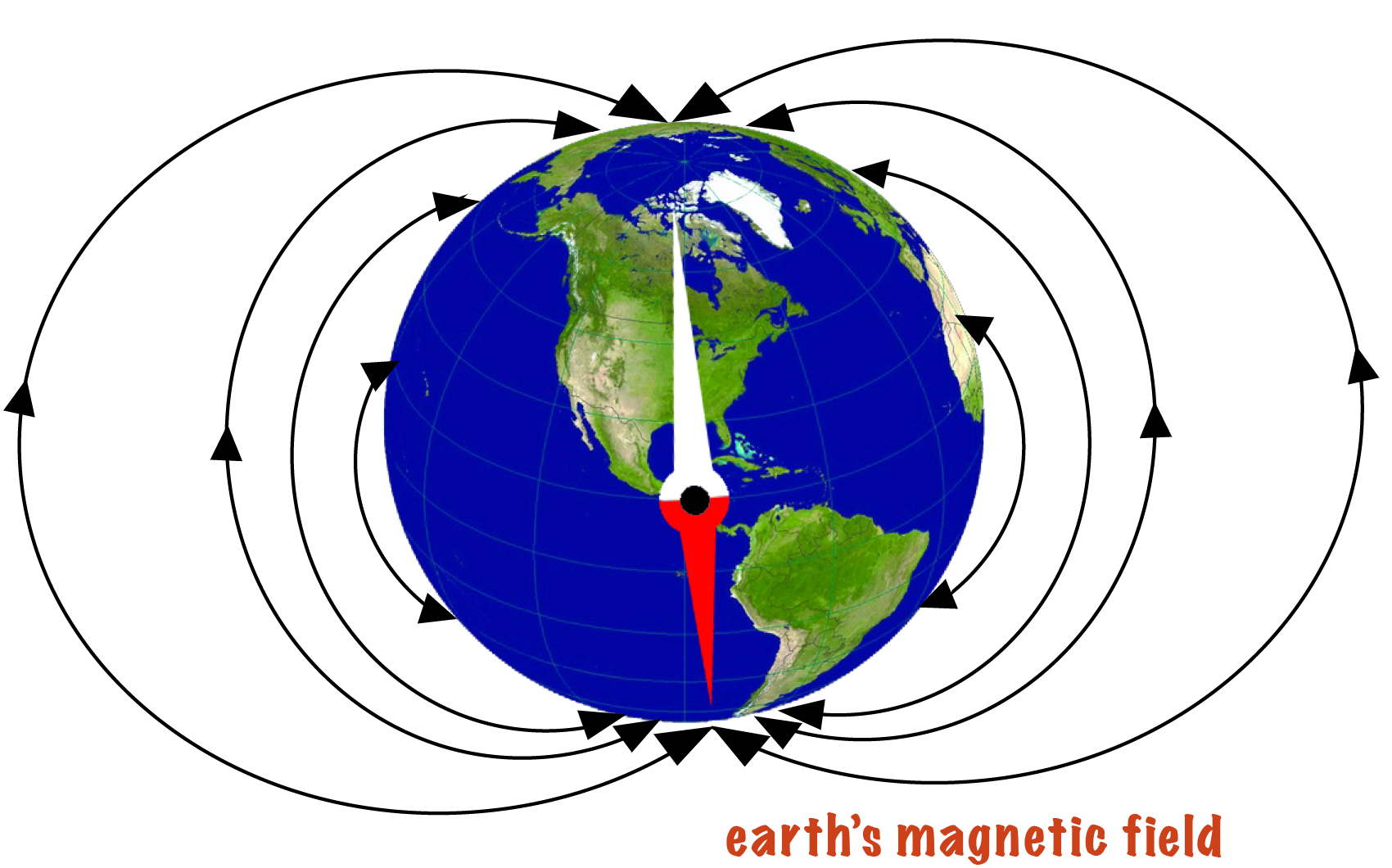
500
It is 7 a.m. in Japan on October 8th and it is 5 a.m. in Thailand.
If it is 8 p.m. in Thailand, what time is it in Japan?
10 p.m. on October 8th
500
What are the 6 types of topography we studied?
Mountain, Plateau, Valley, Hill, Plain, Island/Archipelago
500
Why are many large cities located in the plains? Give 3 reasons.
water, fertile soil, transportation
500
Which country in Asia is completely below the Equator?
Timor-Leste is in the Southern Hemisphere.