Definitions
Time Zones and Rotations
Capitals
Contour Lines and Symbols
Map Details
100
What goes GPS stand for?
Global Positioning System
100
What direction does the Earth rotate?
West to east (or counterclockwise as viewed from above the North Pole) on its axis
100
What is the capital of Newfoundland?
St. Johns
100
50m
100
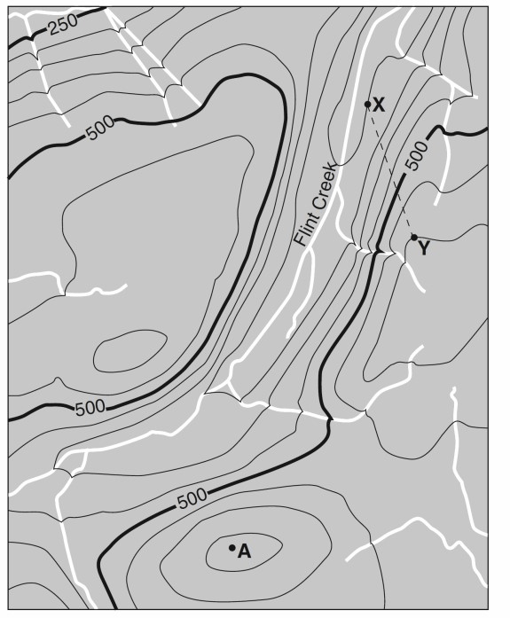
Provide the military grid coordinates for each letter
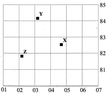
Around:
Z = 022 818
Y = 032 842
X = 047 826
200
What is the term for: a geographic coordinate that specifies a location's north-south position on Earth
Latitude
200
Name the Time Zones of Canada from West to East
Pacific, Mountain, Central, Eastern and Atlantic.
200
What is the captial of Yukon
Whitehorse
200
What does this image represent?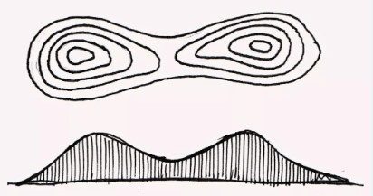
Saddle
200
Convert this statement scale to RF (representative fraction scale)
1cm = 1.5km
1 : 50 000
300
What is "a diagram on a map or compass that shows the cardinal directions (North, South, East, West)"
Compass Rose
300
How many time zones are on earth?
24
300
What is the capital of Northwest Territories?
Yellowknife
300
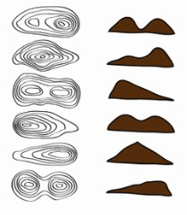
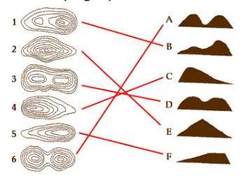
Match the topographic map to the profile view
300
Define vertical exaggeration
A technique used in maps, plans, and technical drawings to emphasize vertical features by making them appear larger relative to the horizontal scale
400
What type of map describes " type of map that portrays the geographic pattern of a particular subject matter (theme) in a geographic area"
Thematic Map
400
According to solar time, at what time is the sun at its highest point?
Solar noon
400
What is the captial of Nunavut?
Iqaluit
400
Which direction does the stream flow?
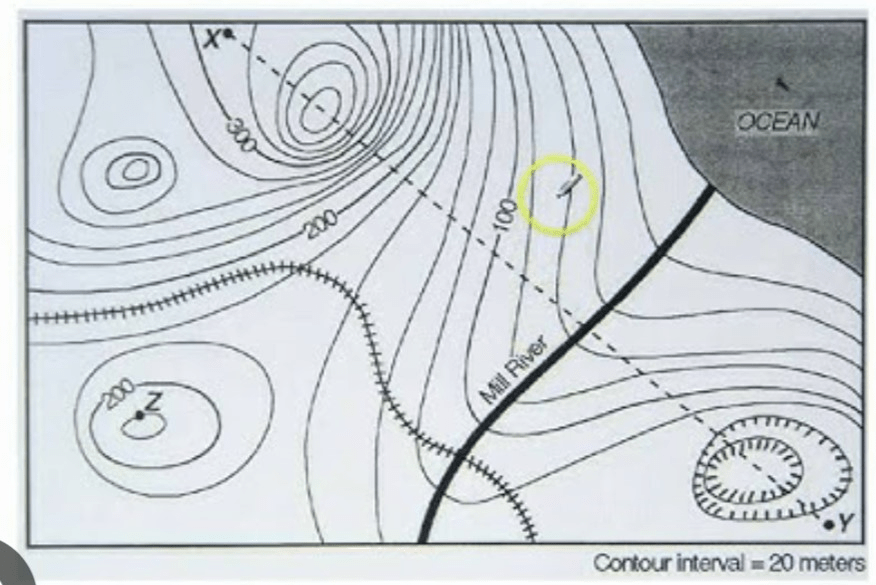
North East
400
A topographic map has a representative fraction (RF) scale of 1:50,000. If the distance between two points on the map measures 8 cm, what is the actual ground distance in kilometers?
The RF scale of 1:50,000 means that 1 cm on the map represents 50,000 cm in reality.
Convert the map distance to real-world distance:
8 cm×50,000=400,000 cm
2. Convert to km 400,000 cm÷100,000=4 km
Thus, the actual ground distance is 4 kilometers.