Compass Points and Bearings
Scale
Topographic and Road Maps
Military Grid System
Time Zones
100
The four points on a compass
What are Cardinal Points?
100
An example of 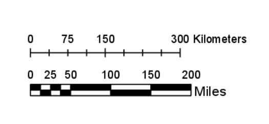
What is a line scale?
100
Show elevation on the land from sea level
What are contour lines?
100
3 R's
What is read right, read up?
100
There are this many times zones around the world
What is 24?
200
8 compass points
What are ordinal points?
200
an example of
1 cm = 10 km
What is a written scale?
200
Boundaries, highways, bridges, schools
What are Human Features?
200
4 Digit Grid reference for 2

What is 28 55?
200
Time zone in Canada that first sees the sun
What is Newfoundland Standard Time?
300
North East bearing
What is 45 degrees?
300
an example of
1: 15 000 000
What is a Ratio or RF scale?
300
Contour lines that are close together
What is a steep slope/cliff?
300
Numbers that run across the bottom of the map
What are Eastings?
300
Canada has this many time zones
What is 6?
400
In between SW and NE
What is North West? (NW)
400
1: 4 000 000 would be this as a written scale in Km's
What is 1 cm = 40 km?
400
Alphanumeric Grid reference for the Heart <3

What is C4?
400
Dividing a square into tenths
What is the 6 figure/digit grid reference?
400
If it's 2 am in Halifax, it's this time in Edmonton
What is 11 pm?
500
WSW bearing
What is 247.5 degrees?
500
1 cm = 5 km would be this as a ratio scale
What is 1: 500 000?
500
The easiest way to measure the distance between two cities on a road map that are very far apart
What is distance triangle?
500
6 digit grid reference for the dark square 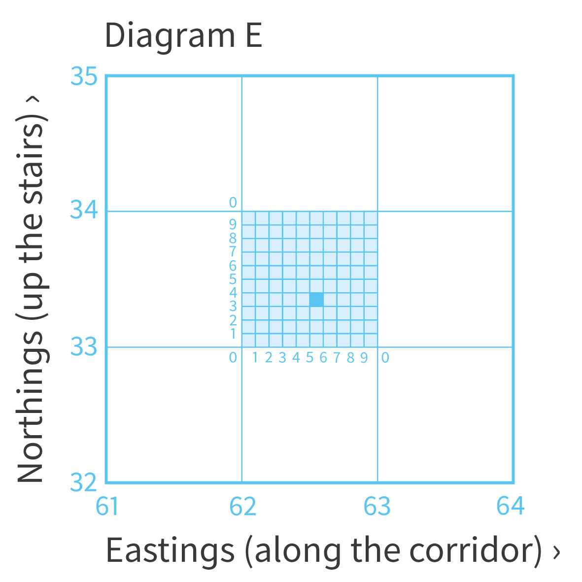
What is 625 333?
500
The line that would experience a 'new day' first
What is the International Date Line?