Map me up
Special Spatial Space
Does it make "census"
Strait Geography
All too Human
100
Starting at the equator 0° these imaginary lines measure north and south. They stretch East & West as parallels around Earth reaching 90° at both poles.
What are latitudinal lines or latitudes?
100
The phenomena (noticeable events) across a geographic space: disease outbreaks and spread, agricultural and rural land-use, cities and urban growth, etc.
What are spatial patterns?
100
This entity (organized group) both conducts census surveys and uses its data to make informed decisions about the population and demographic data collected.
What is government? What are political groups?
100
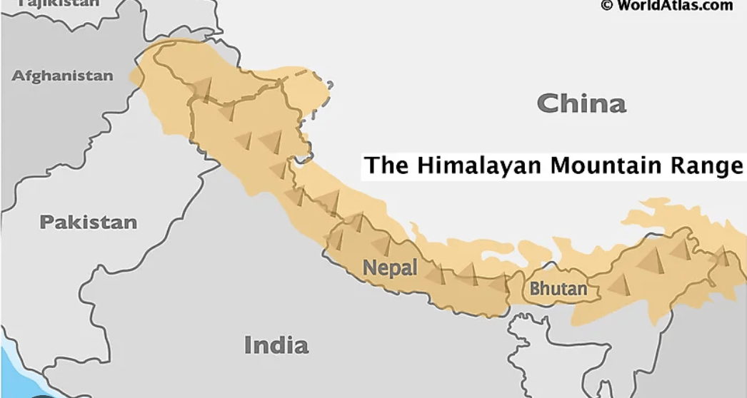
Found on this continent, the following map shows the famous Himalayan mountain range mostly between Nepal and Bhutan, and the Tibet (autonomous region of China)
What is Asia?
100
This model shows the age cohorts on the y axis and male/female on the x axis. Reveals information about potential growth or decline in a country.
What are population pyramids (age-sex structure)?
200
A map with the entire country, or event the world displays few details. Ratio scales has large denominator number and bar scale uses large distance numbers: 1:5,000,000 l___________l 500KM
What is small scale size?
200
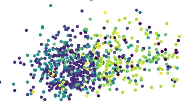
This would be the characteristic of spatial distribution of the illustration above.T
What is clustered/ agglomerated/ aggregated?
200
Information related to ethnicity, religion, income, career/jobs, are called this in data gathering of people.
What is demographics?
200
Between Spain and Morocco is this geopolitical chokepoint which connects the Atlantic ocean with the Mediterranean Sea. 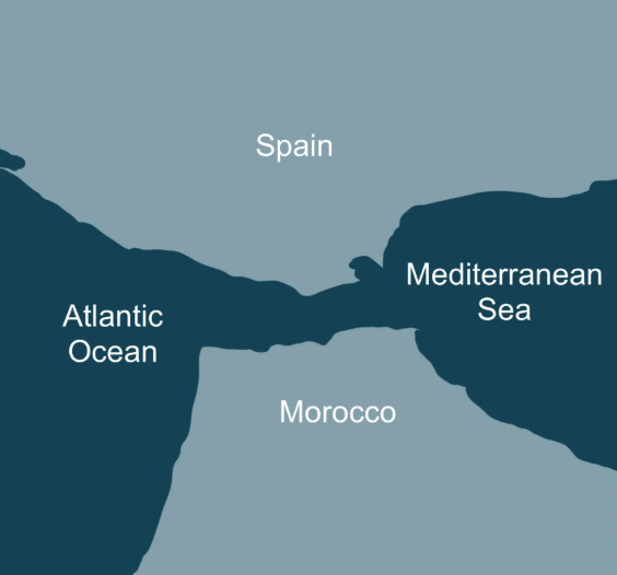
What is the Strait of Girbaltar?
200
The theory which stipulates that human societies and cultures are shaped by their physical surroundings.
What is environmental determinism?
300
These are the four hemisphere as divided by the equator and prime meridian. 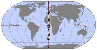
What are the northern, southern, eastern and western hemispheres?
300
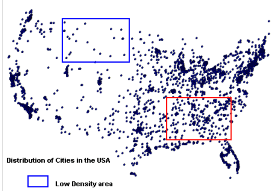 Distribution of cities presented in the blue area is best described as this geospatial pattern; It means spread apart.
What is sparse?
300
In the United States Census data is taken after this many years. It is often called a deci-census.
What is 10 years?
300
This long stretch of mountains and plateaus (5,500 miles) from the southern tip of South America (Chile) to to the northern Caribbean coast of South America (Columbia & Venezuela) have the highest population density in any mountain area around the world clustered around major cities like Bogata, Colombia; Santiago, Chile; Quito, Ecuador.
What are the Andes mountains?
300
Despite it's arid climate and lack of fresh water sources, Las Vegas, Nevada is home to over 650,000 permanent residents, which illustrates this human-environmental interaction theory.
What is Environmental Possibilism?
400
Starting at Prime Meridian 0° these imaginary lines which intersect at the poles are known as this.
What are longitudes, Meridians, longitudinal lines?
400
The patterns, trends, relationships and arrangement of location based data is this type of analysis.
What is spatial analysis or geospatial analysis?
400
This type of demographic data informs private and public organizations on which businesses and services to provide in a certain area.
What is age and income levels?
400
Buffalo, NY; Cleveland, OH; Chicago, IL; Detroit MI; Milwaukee, WI; and Rochester, NY are just a few of the major cities which are situated in this region. 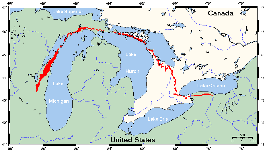
What is the Great Lakes Region?
Lake Superior, Lake Michigan, Lake Huron, Lake Erie, Lake Ontario.
400
Land-uses, and energy fossil fuels which keep in mind the need for future use of these non-renewable resources is known as this in human ecology. Ability to use, reuse and renew.
What is sustainability?
500
Found in these 2 hemispheres, Australia is both a country and a continent. 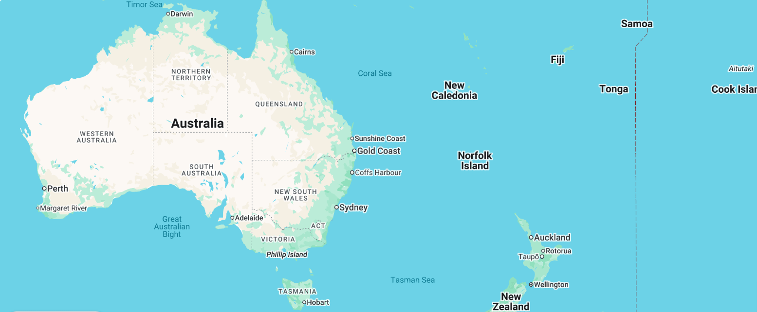
What are the Eastern and Southern hemispheres?
500
This census data illustrates how certain regions are influenced by language, culture, and international influences based on this specific data point.
What is nationality/ethnicity?
500
3 tiny micro states found in Southeast Asia. 
What are Singapore, Brunei and East Timor (Timor-Leste)?
500
This model, developed in the 19th century helps understand the rural land use from the central market or city. Factors such as transportation cost and perishability are taken into account which determine agricultural activity closest to farthest from the city.
What is Von-Thünen model?