Water Cycle
Earth Processes
Water Quality
Earth Engineering
Topographic Maps
100
Snow, Sleet, Rain and Hail are all types of ______________.
Precipitation
100
What most likely created the valley below?

Glacier
100
What is a positive indicator of a healthy stream?
a) Sewage Smell
b) Multiple bugs, insects, and macroinvertebrates
c) Huge Algae Blooms
d) High levels of Nitrogen
c) Multiple bugs, insects, and macroinvertebrates
100
What should engineers consider when building next to a river?
a) Erosion from the river
b) Flood potential
c) Keeping a clean job site so construction material doesn't runoff into the river?
d) All of the above?
d) All of the above
100
When contour lines are more spread out on a topo map that indicates ___________ terain. When contour lines are closer on a topo map that indicates __________ terain?
Less steep or gradual / Steep
200
Where does Colorado get the majority of its water?
a) Rain
b) Underground springs
c) Snowmelt
b) Groundwater
c) Snowmelt
200
The picture below shows what Earth process?

Deposition
200
What could be a cause of the increase in nitrogen levels in a river?
Fertilizer runoff from agriculture
200
What Earth Process threatens these homes?

Erosion
200
Which of these topo maps show two peaks?
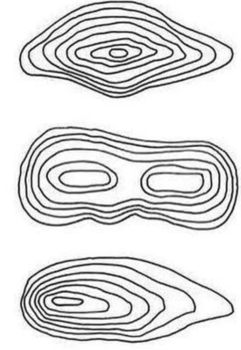
The middle or B
300
Where is the majority of water on earth?
a) Ice Caps
b) Oceans
c) Rivers
d) Lakes
b) Oceans
300
The picture below shows what Earth process?
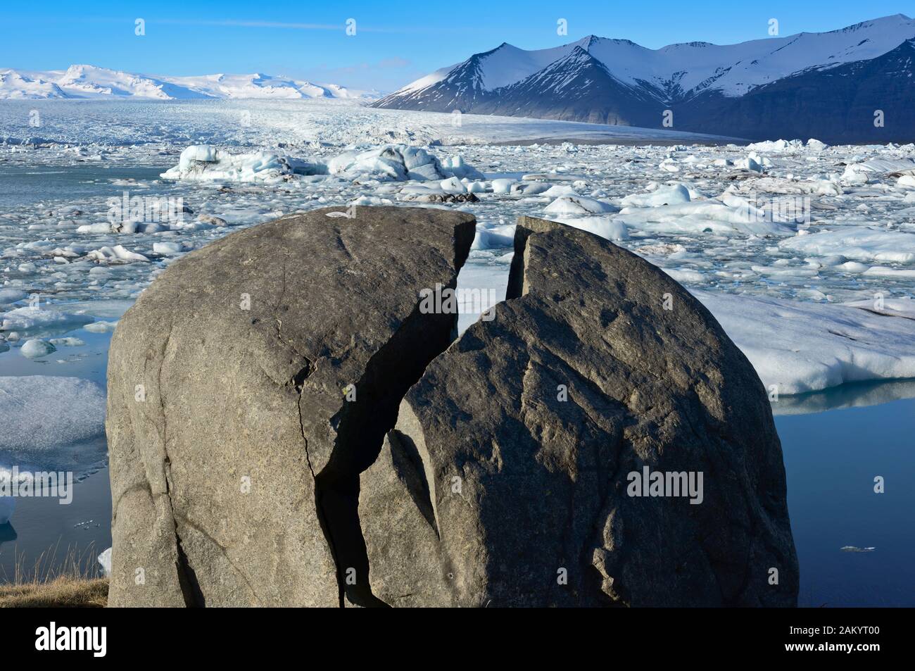
Weathering / Ice Wedging
300
Describe how dead zones are formed in 3-4 steps.
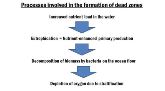
300
What is a clear example of humans disrupting Earth processes?
a) Dam built by beavers
b) A home being built with minimal disruption to the environment around it.
c) Using eco-friendly fertilization
d) A hydroelectric dam that generates power, but holds back nutrient-rich sediment from moving downstream
d) A hydroelectric dam that generates power, but holds back nutrient-rich sediment from moving downstream
300
What is the low point and the high point of this map?

Low point: 1000
High Point 13000
400
Which of the following water cycle vocabulary is caused by the Sun's energy?
a) Ground Water
b) Evaporation
c) Precipitation
d) Runoff
B) Evaporation
400
What earth process most likely occurs at the cut bank?
Erosion
400
Which of the following is NOT an indicator of water quality?
a) Turbidity
b) Dissolved Oxygen
c) Dissolved Solids
d) Human Population
Human Populaiton
400
Create a list of things politicians and engineers need to take into account before building in a given area. Try to come up with 3 examples.
1. Earth Processes : Weathering, Erosion, and Deposition
2. Animal Habitat
3. Cost
4. Water Quality
5. Location of the build site (will it be easy to get equipment to or will that require more construction?)
400
Elevation on topographic maps is shown with
a) Shaded areas
b) Dotted lines
c) contour lines
d) elevation lines
c) Contour lines
500
Where is the majority of our freshwater stored on Earth?
Ice caps
500
What earth process most likely occurs at the point bar?
Deposition
500
What is the term we use to determine how cloudy or sediment-heavy a source of water is?

Turbidity
500
Why do humans need to be aware of Earth processes, weathering, erosion, and deposition, before choosing where to build?
Answers will vary, but in general these processes could destroy the structure humans are trying to build and disrupt the natural movement of sediments and nutrients on earth.
500
Describe how using topographic maps from past years can be helpful for an engineer/town council who is trying to find a suitable build site for a large building?
Studying topo maps can allow an engineer to identify areas of heavy erosion and deposition. This will allow an engineer to identify where the less geological processes are occurring so they can find a more suitable build site with less impact from the geology.