The imaginary line that divides the earth into the northern hemisphere and the southern hemisphere is known as the _____________.
Equator
Texas is an example of a _______________.
State
A(n) ____________ is land that is surrounded by water on all sides.
Island
___________ occur when tectonic plates rub against each at fault lines
Earthquakes
___________ is spoken history that one person tells to another
Oral History
What direction is always up on a compass?
North
Lines of ____________ run north to south on a globe or map.
Longitude
A __________ is a two-dimensional representation of a an item or nation.
Map
Florida is an example of a(n) ___________
peninsula
______________ are firsthand (eyewitness) accounts or original objects and documents from the past
Primary Sources
The Prime Meridian divides the Earth into the ___________ hemisphere and the ____________ hemisphere
Eastern and Western
How many continents are on earth?
7
A(n) ________________ is land that is surrounded by water on three sides
Peninsula
The outermost layer of the earth is known as the _________
Crust
________ means understanding events and people based on the accepted ideas and values of the time period being studied
Perspective
A ___________ is a 3D depiction of the world
Globe
North America is an example of a _______________
Continent
What is the smallest continent that happens to also be an island?
Australia
There are ____ states in the United States
50
___________ are objects people made or used in the past
Artifacts
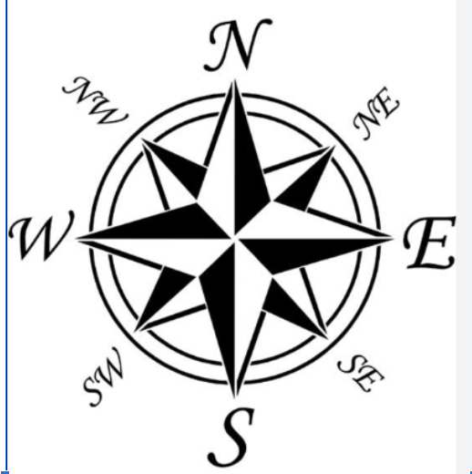
The image below is a(n) _____________

Compass Rose
Lines of _______________ run east to west on a globe or map.
Latitude
Before the continents split up, they were part of a super-continent known as ____________
Pangae
Hawaii is an example of a(n) ____________
island
___________ is a one-sided point of view
Bias