On the World Map
Landforms
Landforms
Where I live
Globes
100
What do you call a round/sphere representation of a map?
A Globe
100
What is a large salty body of water?
Ocean
100
What is a large body of water with land all around it?
A lake
100
What is the name of the State that we live in?
North Carolina
100
The seven largest bodies of land are called what?
Continents
200
What would you use to figure out directions on a map?
A compass rose
200
Long streams of water that flow across land are called?
A river
200
Shorter and rounder mountains are called what?
Hills
200
What city do we live in?
Hillsborough
200
The five large bodies of water are called what?
Oceans
300
A box in which all symbols of a map are explained
A Key or Legend
300
An area with a very dry climate is called?
Desert
300
An opening in the Earth's crust that allows lava to come to the surface which may cause mountains is known as what?
A volcano
300
What is the capital of North Carolina?
Raleigh
300
The imaginary lines on a map that go up and down/ north and south are called what?
Longitude
400
What is a map that shows landforms such as rivers, lakes, and mountains called?
A physical map
Picture of the difference between physical and political map:

400
What is high land that is also flat called?
Plateau

400
What is wide, flat land called?
Plains

400
Name a state that borders North Carolina
South Carolina, Virginia, Tennessee, Georgia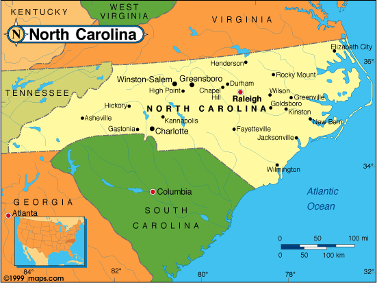
400
The imaginary lines that go left to right or East to West on a map are called what?
Latitude 