Water
Picture Perfect
Homeland
Land
Changes
100
A body of water with land on all sides
Lake
100
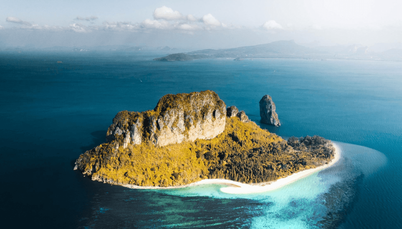
Island.
100
These two major water landforms can be found in Kamloops (Bonus point for the names)
Lake & River.
(Kamloops Lake & the North & South Thompson River)
100
Large areas of land that are mostly flat.
Plains
100
The rate (time it takes) for landforms to change
Very slowly
200
Large body of salt water
Ocean
200
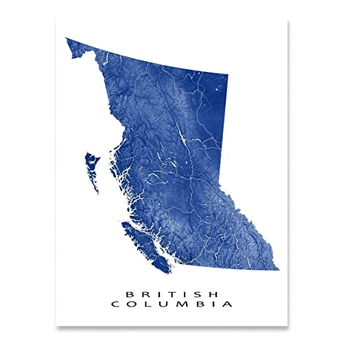 The name of the major landform off the coast of BC seen of the map
Vancouver Island
200
Name three landforms close to KSA
Mountain, hill, valley, plains, river
200
A landform that rises high above its surroundings.
Mountain
200
These three natural processes cause erosion
Wind, water, and ice
300
A body of water that flows downhill, eventually meeting an ocean.
River
300
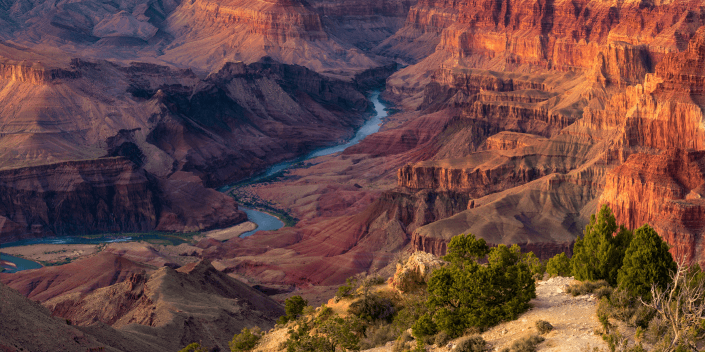
U.S Landform
Grand Canyon
300
The Secwepmec name for Kamloops
Tkʼemlúps
300
Low land between hills or mountains
Valley
300
Sand forms when ____ break down from weathering and eroding over thousands and even millions of years.
Rocks
400
A place in a river where water spills suddenly downward
Waterfall
400
 This landform is commonly mistaken from the items in this picture.
Desert
400
This plant can be seen blowing around in the wind in Kamloops during the warmer months and takes the shape of a circle
sagebrush
400
I am a rounded piece of earth that rises above the land and is smaller than a mountain.
Hill
400
Humans change landforms all the time, name one way we might change a landform.
Build roads, mining, cut down trees
500
These two landforms are created from moving water over a very long period of time.
Valleys & Canyons
500
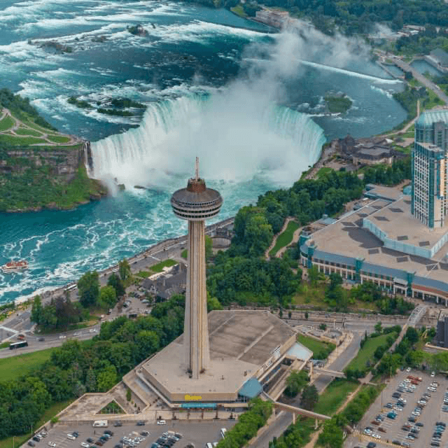
Waterfall in Canada
Niagara Falls
500
This landform is best for building houses and cities on
Plains
500
An area of land that receives no more than 25 centimeters (10 inches) of precipitation a year.
Desert
500
A process in which earth materials are broken down and moved from one location to another
Erosion