Countries in the Americas 1
Countries in the Americas 2
Countries in the Americas and US states
US states 1
US states 2
100

Colombia
100
The country north of the United States
Canada
100
The country on "Image C"
Belize
100
This state is in the middle of the Pacific Ocean
Hawaii
100
The state directly west of Rhode Island
Connecticut
200
The country between Honduras and Costa Rica
Nicaragua
200
The name of the area where Cuba, Puerto Rico, Jamaica, Haiti, the Dominican Republic, and the US Virgin Islands are
The Caribbean
200
The country directly south of Ecuador
Perú
200
The state directly east of New Hampshire
Maine
200
The state directly west of Alabama
Mississippi
300
These are the only 2 countries in South America with no coasts on any ocean (no exit to the sea)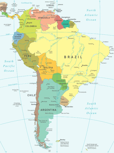
Bolivia and Paraguay
300
These countries are directly south of Mexico
Guatemala and Belize
300
The state directly between Kentucky and Alabama
Tennessee
300
The state directly east of North Dakota and South Dakota
Minnesota
300
The state directly east of Texas
Louisiana
400
This country is south of Cuba and east of Haiti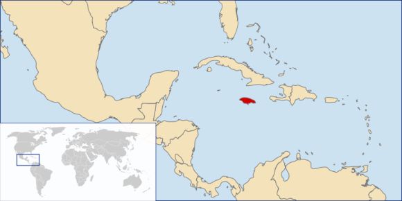
Jamaica
400
The country on "Image B"
Panama
400
The state directly north of Pennsylvania
New York
400
The state between Indiana and Pennsylvania
Ohio
400
The state directly west of Utah
Nevada
500

Chile
500
This is the largest country in South America
Brazil
500
The country on "Image E"
Cuba
500
The states traditionally known as "the Pacific Northwest"
Washington and Oregon
500
The state between Texas and Arizona
New Mexico