Mappy Maps
Take a Look
Forecast
Grab Bag
Define Me
100
Shows the average weather of a region, taking into consideration, temperature, precipitation, humidity, etc.
CLIMATE MAP
100
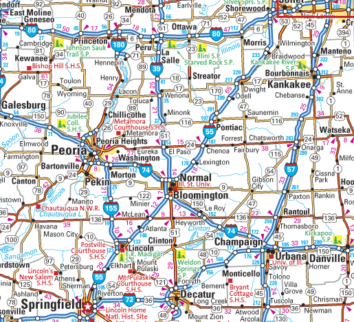
ROAD MAP
100
The day to day condition of the atmosphere. This includes temperature, rainfall and wind.
WEATHER
100
Shows a detailed depiction of roads in a given area. (ex. neighborhood streets, highways, interstates, toll roads)
ROAD MAP
100
Defined as the height above the ground or other surface, or a place or position of height. An example of ________ is a plane flying at 36,000 feet above the ground.
ELEVATION
200
Shows features of an area such as elevation, or height above sea level, mountains, rivers, lakes, etc.
PHYSICAL MAP
200

CLIMATE MAP
200
The weather conditions prevailing in an area in general or over a long period.
CLIMATE
200
The most important city or town of a country or region, usually its seat of government and administrative center.
CAPITAL
200
These things found on Earth's surface are formed by nature; Example: Trees, mountains, oceans, rivers, lakes, height above sea level, elevation, etc.
PHYSICAL FEATURES
300
Shows the political boundaries (borders) of states or countries, captials, and/or major cities.
POLITICAL MAP
300

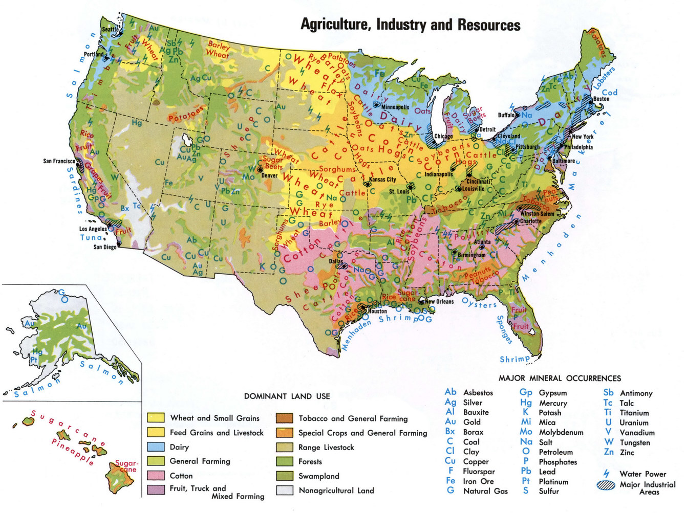
NATURAL RESOURCE MAP
300
Any form of moisture which falls to the earth. This includes rain, snow, hail and sleet.
PRECIPITATION
300

POLITICAL MAP
300
The number of people in a geographic area. It can also be used for subgroups of people or animals.
POPULATION
400
Shows the distribution of resources such as crops, minerals, animals, or plants.
NATURAL RESOURCE MAP
400

POPULATION DENSITY MAP
400
The degree of hotness or coldness of the atmosphere on some chosen scale. It is commonly measured in Celsius or Fahrenheit
TEMPERATURE
400

POPULATION DENSITY
400
A line that marks the limits of an area; a dividing line.
BOUNDARY
500
Shows how many people live per unit of land (ex. per square mile) in a given area.
POPULATION DENSITY MAP
500

PHYSICAL MAP
500
The amount of water vapor in the air. If there is a lot of water vapor in the air, the ______ will be high. The higher the______, the wetter it feels outside.
HUMIDITY
500
NAUTRAL RESOURCE MAP
500
Refers to the way something is spread out or arranged over a geographic area. The concept of _______ can be applied to nearly everything on Earth, from animal and plant species, to disease infections, weather patterns, and man-made structures.
DISTRIBUTION