Geography
Maps and Globes
Map Features
Map Grids
Latitude and Longitude
100
California is an example of a ________
State
100
Which is sphere shaped? A map or a globe?
A globe
100
What are the 4 main directions?
North South East and West
100
What object can be found in square D4?
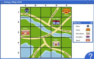
The police station
100
Anything above the equator is labeled as _______
N for North
200
Which is bigger, a county or a country?
A country
200
Which helps people travel from place to place? A map or a globe?
Both!
200
What is a map legend?
A key that tells us what the symbols represent.
200
Tell me where the shipwreck is on this map.

E4 or 4E
200
What is the equator?
The latitude line that runs down the middle of the earth
300
Name 4 continents
North America
South America
Europe
Asia
Africa
Antarctica
Australia
300
How do many globes represent mountains?
By bumps on the globe!
300
Why are map titles important?
They tell us what the map is showing us!
300
Why are map grids useful?
They can help tell an exact location on a map!
300
The equator is at _____ degrees latitude
0
400
Name 3 oceans
Pacific
Atlantic
Indian
Arctic
Southern
400
What is one benefit to a globe over a map?
A globe can show the whole earth at once!
400
Explain a map scale.
A map scale is the relationship of the distance on the map vs the distance in real life.
400
What 2 squares are the mountains found in?
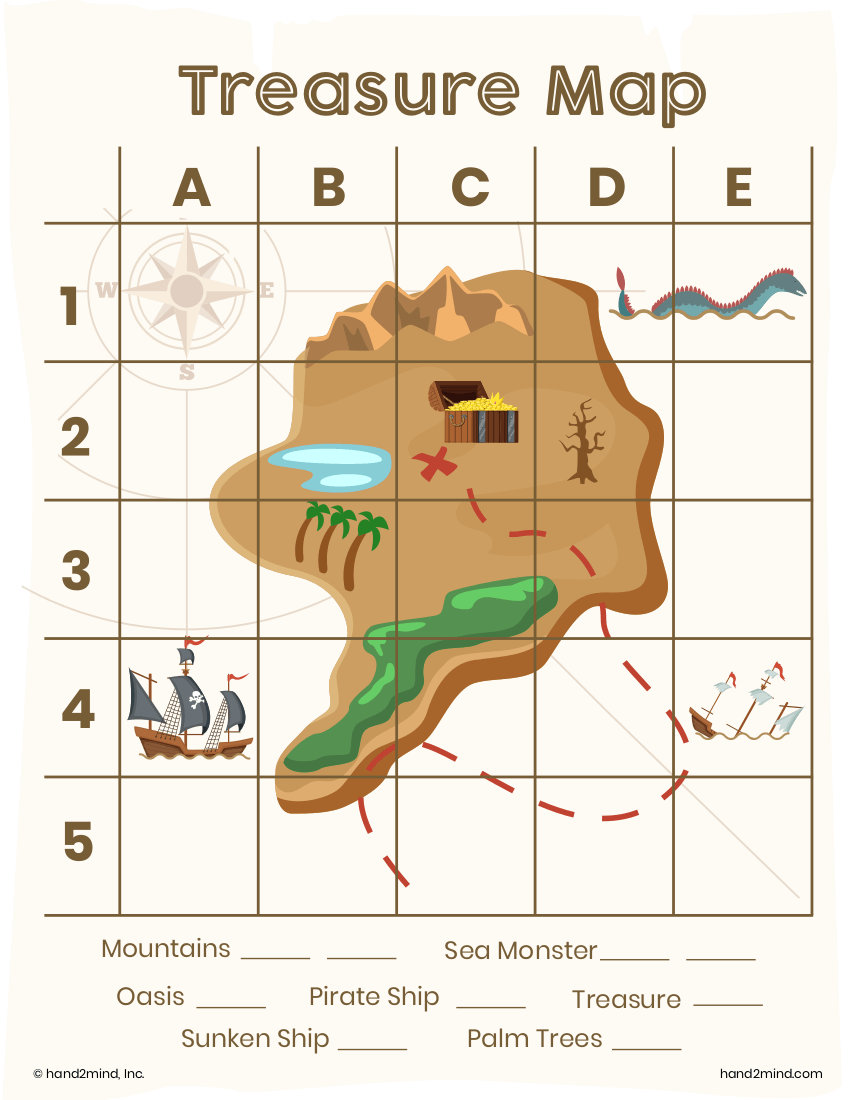
B1 and C1
400
Latitude and longitude are measured in ______
degrees
500
Fill in the blanks
Globe ---> Continent ---> _______ --> State ---> County ---> _______
Country
City/Town
500
What is one benefit of a map over a globe?
A map can show much more detail of certain areas than a globe can.
500
What is the name of the map feature that tells you what direction things are?
A compass rose.
500
Which squares does elm street go through?

C4, D5, E5
500
What is the longitude line that runs down the middle of the earth called?
The prime meridian