Map Tools
Easy
Location
Divide the Earth
Lines
100
What does a scale measure on a map?
Distance
100
We will be using Maps a lot in this class.
Geography!
100
Name the cardinal directions
North, South, East, West
100
An imaginary line of latitude dividing the northern hemisphere from the southern hemisphere.
Equator
100
True Or False...Two different days on Earth can be only 1 mile apart in distance.
True
200
What box has symbols that are used on the map?
Legend
200
What does a political map show?
country/state borders, city boundaries and names
200
A professional mapmaker
Cartographer
200
An imaginary line of longitude dividing the eastern hemisphere from the western hemisphere.
Prime Meridian
200
Vertical lines that measure the earth from 0 - 180 degrees.
Lines of Longitude
300
What is this called? 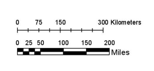
A scale
300
This type of map shows landforms like deserts, mountains, plains, rivers, and lakes.
Topographic maps
300
If I am looking for the exact location of something, I am using it's _______ location.
Absolute
300
How do you know what the map you are looking at represents?
The Title
300
Horizontal Lines that measure the earth from 0-90 degrees in the Northern and Southern Hemispheres
Lines of Latitude
400
What would you use to show a building on a map?
Varies
400
What is one example of a map projection?
Robinson, Goode, Mercator, Eckhart IV
400
If I am looking for a region, I would be looking for ________ location.
Relative
400
The reason we have seasons on Earth.
The tilt of the Earth's axis.
400
The line that divides the Earth into two separate days
International Date Line
500
What would you use to show a certain distance on a map?
Varies
500
The Mercator map has a lot of this, in which land masses do not match the original shape and size of continents on Earth.
Distortion
500
This map feature will help me locate places easily by using latitude and longitude lines.
coordinate grid
500
If it is Summer in the Northern Hemisphere, it is ________ in the Southern Hemisphere.
Winter
500
What gives us a precise location on earth using degrees, minutes, and seconds?
Geographic Coordinates