People & Cultures
Physical Features
Oceania
Maps
Virtual Field Trip
to Australia
to Australia
100
In addition to the location of the stars, the Polynesians relied heavily on these to help them navigate.
What are ocean swells?
100
A piece of land almost surrounded by water or projecting out into a body of water.
What is a peninsula?
100
Approximately 250 million years ago, Australia was part of this supercontinent.
What was Pangaea?
100
This feature describes the theme or subject of a map.
What is a map title?
100
These tree dwelling creatures spend their days sleeping and eating eucalyptus leaves.
What are koalas?
200
Navigators used clouds, the flight patterns of birds, and types of fish to help them locate these.
What are islands?
200
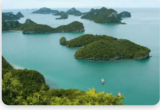
What is an archipelago?
200
Australia is the largest landmass in this region of Oceania.
What is Australasia?
200
This box explains the meaning of different symbols and colors on a map.
What is a map key or map legend?
200
Sometimes called "salties", these predators can reach 20 feet (6 meters) in length!
What is a saltwater crocodile?
300
The first human inhabitants of this area likely walked there about 40,000 years ago.
What is Australa?
300
This type of island is formed when a landmass is cut off from a larger continent by rising sea levels.
What is a continental island?
300
Consisting of over 2,000 islands, this region of Oceania consists mainly of low-lying coral islands. It's name literally means "tiny islands".
What is micronesia?
300
The is used to measure distance on a map.
What is a map scale?
300
Kangaroos and koalas are both members of this group of mammals, which are known for carrying their young in a pouch.
What are marsupials?
400
Originally serving as a penal colony for Great Britain, gold was discovered here in 1851.
What is Australia?
400
This type of island is formed as a result of volcanic activity.
What is a volcanic island?
400
Found in southern Australia and the west coast of the United States, this vegetation zone consists mainly of small trees and bushes adapted to a Mediterranean climate.
What is chaparral?
400
This is a network of evenly spaced horizontal and vertical lines used to identify locations on a map. Latitude and longitude lines are an example.
What is a map grid?
400
This Australian spider is known for preying on snakes and lizards. It can be identified by the unique red pattern on its back.
What is the redback spider?
500
A seafaring people from this island likely first arrived in New Guinea about 3,500 years ago, mingling with the aboriginal Papuan people to form the Melanesia culture.
What is Taiwan?
500
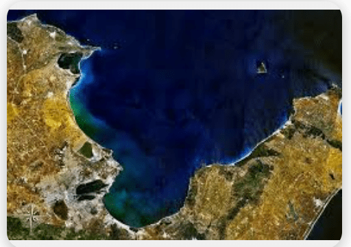
What is a gulf?
500
Found in Australia, this is the oldest rainforest in the world. It is home to the cassowary, which is a type of large, flightless bird.
What is the Daintree Rainforest?
500
This type of map shows the borders of states and countries.
What is a political map?
500
This type of bird laughs at potential invaders to warn them they are entering its territory.
What is a kookaburra?
600
Until the 1970's, the "white Australia" policy required any person who wanted to immigrate to pass this type of test to prove that they were of European descent.
What was a "dictation test".
600
This type of island forms as a result of sediment settling on a coral reef.
What is an atoll?
600
A "hole" in this layer of the atmosphere, caused mainly by chemicals known as chlorofluorocarbons, has resulted in Australia having one of the highest rates of skin cancer in the world.
What is the ozone layer?
600
Sometimes called a relief map, this type of map shows the elevation of landforms and the locations of rivers and bodies of water.
What is a physical map?
600
This is the most venomous snake in all of Australia. A single bite from it delivers a venom potent enough to kill 100 full grown men!
What is an inland taipan?