Latitude and Longitude
Landforms-Oceans-Continents
Reading and Analyzing Maps
Vocabulary
Map Types
100
Name the line of latitude that breaks the world into a N & S Hemisphere.
Equator
100
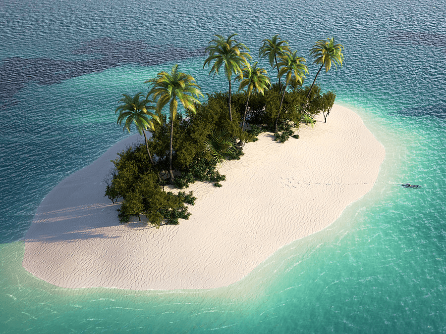
What type of landform is this?
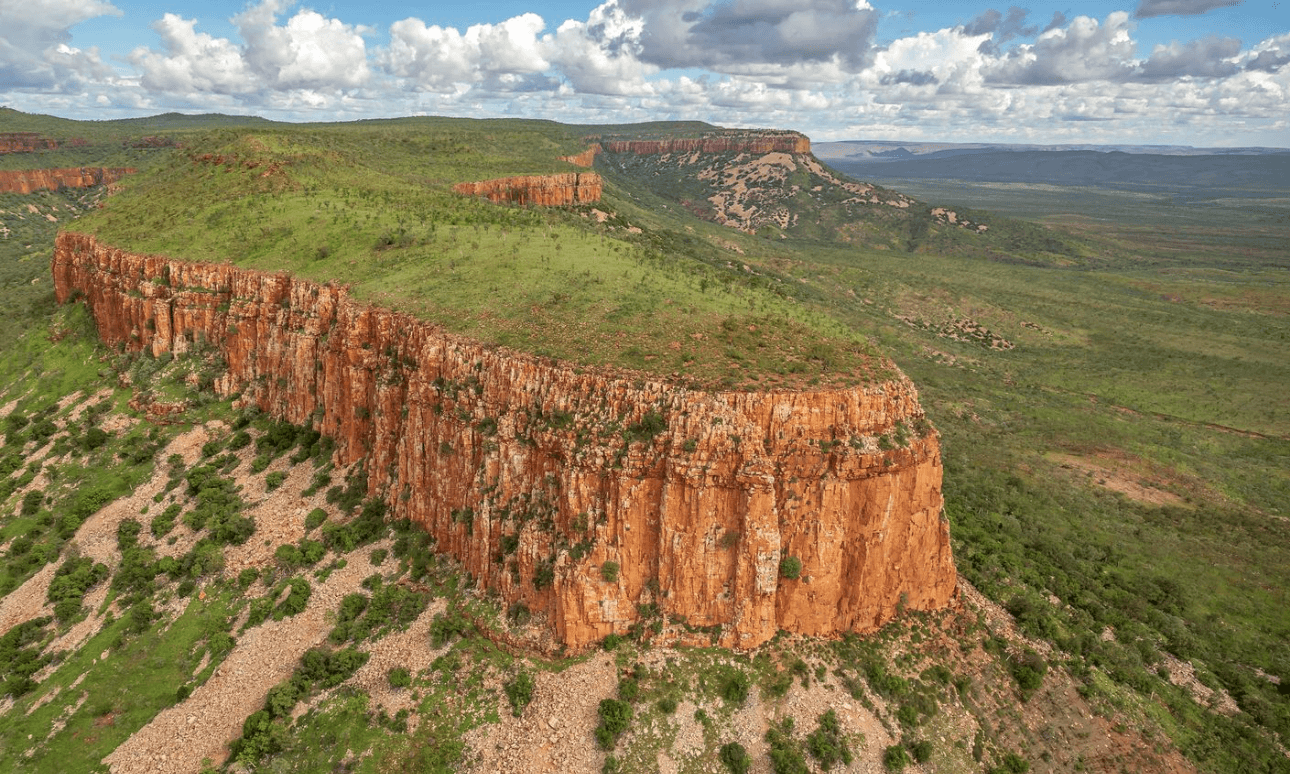
A plateau
100
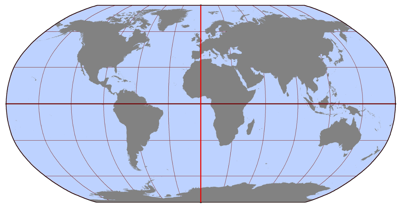
Which hemisphere does this map show the most of?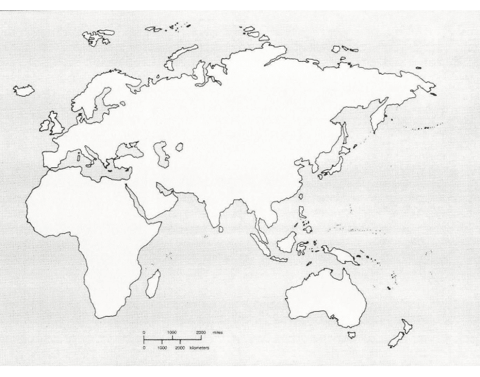
The Eastern
100
what is another name for a key?
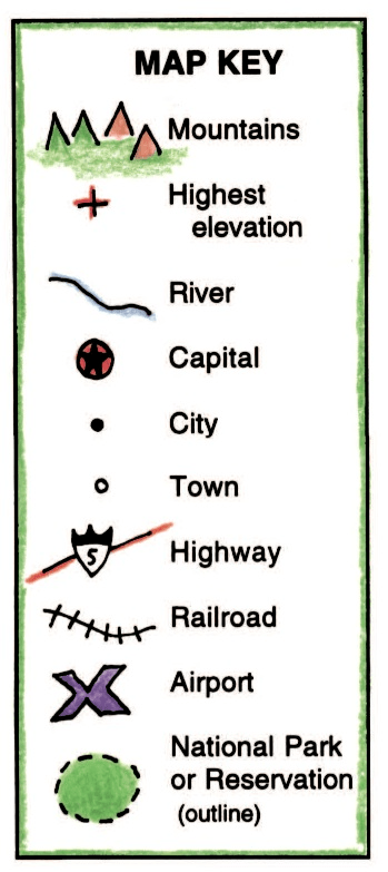
A legend
100
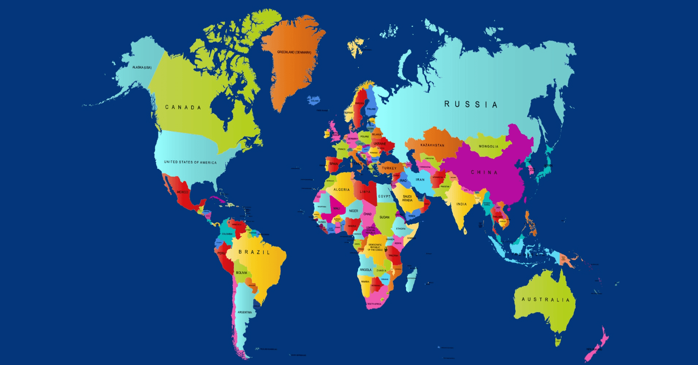
What kind of map is this? What does it show?
Political Map
Boundaries and border of COUNTRIES or STATE or Provinces!
200
Name the line of longitude that breaks the world into the E & W Hemispheres. 
Prime Meridian
200
What landform is this? Describe it.
Island
A piece of land with water on all sides
Made from volcanoes eruptions under the sea.
200
This is a map of the continent of Africa. It is broken down into boundaries and borders of what?
This means it is what type of map?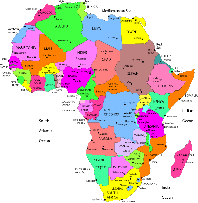
Countries
Physical map
200
which lines run east to west on the globe
which lines run north to south on the globe
latitude lines
longitude lines
200
What type of map do we see below?
What three things CAN this map show?
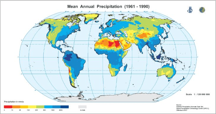
Climate Map
Precipitation, Temperatures, and Climate Zones
300
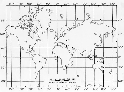 Where would I be if I were at 20 degrees south and 60 degrees west?
South America
300
Identify the continents by number.
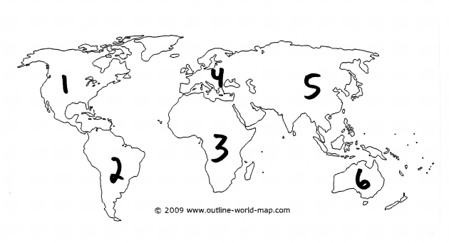
1. North America
2. South America
3. Africa
4. Europe
5. Asia
6. Not shown- Antarctica
300
When people took the Silk Road Route from India into Egypt they took their goods with them in order to gain or get in return money or resources they did not have.
What is this called (economically speaking)?
According to the map below where else did people travel with their goods?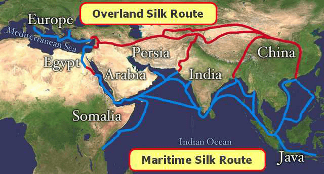
Trade
Arabia
Persia
Europe
Somalia
Java
300
What is precipitation and what kind of map would you find it on?
rain-snow-hail-sleet
A climate map
300
This type of map shows what?
What do we call this kind of map?
Which continent is this a map of?
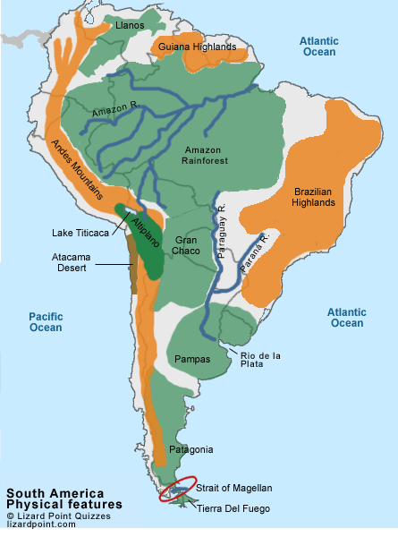
Landforms
Physical Map
South America
400
Where would I be if I were at 15 degrees north and 20 degrees east?
Africa
400
Identify the oceans by their numbers.
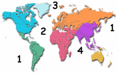
1. Pacific
2. Atlantic
3. Arctic
4. Indian
5. Southern Ocean- not numbered
400
Which continent is the most populated in the whole world?
Which is the least populated?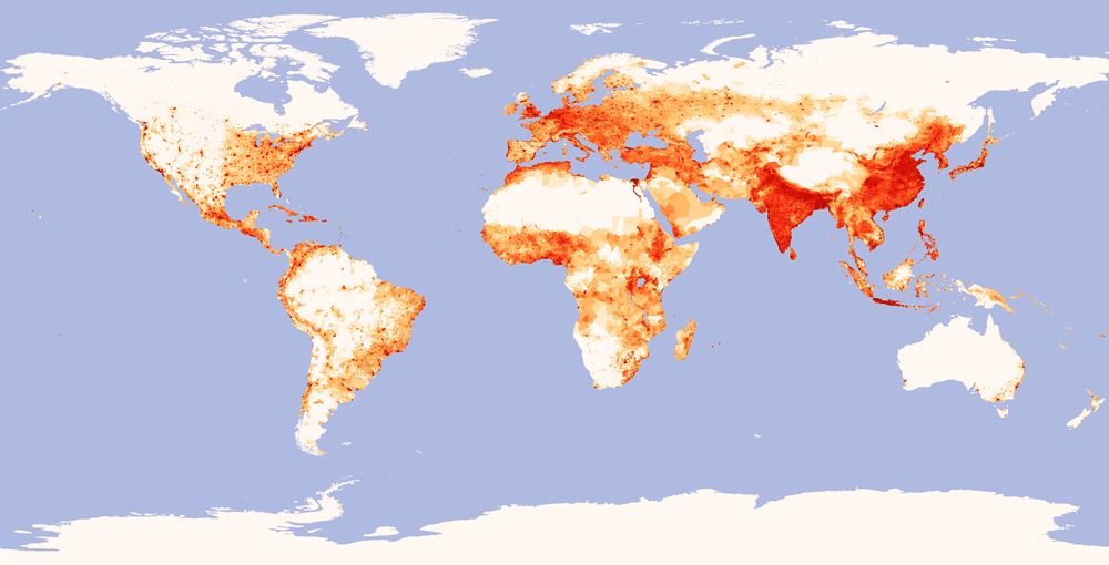
Asia
Australia
400
What is a plateau verses a plain?
Plateaus are similar to mountains without peaks, instead they have a high elevation and are flat on top.
Plains are lower lands that are grassy and usually used for farming or pastures for animals.
400
What type of map do we see below? What can they be used for? What is this particular map about?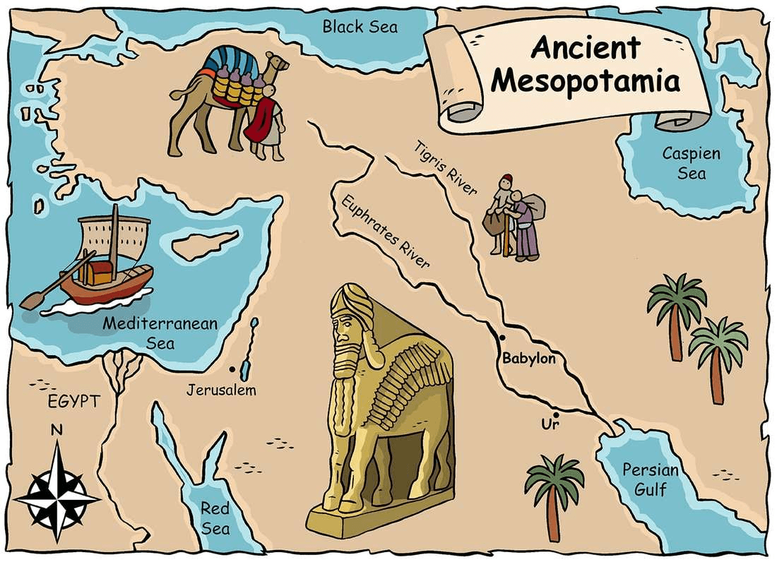
A historical map
Used to learn about the past people, places, things.
Ancient Mesopotamia
500
Where would I be if I were at zero degrees latitude and zero degrees longitude and what are the two different synonyms for latitude line and longitude lines
The Atlantic Ocean
Latitude = parallels
Longitude = Meridians
500
Sometimes landforms are called geographical features because they are made by the earth. Another higher level name for landforms is ...
Physical features
500
What is a natural resource?
Give three examples.
Why do people live near natural resources? 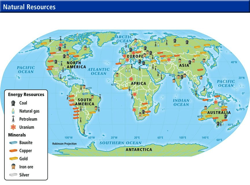
a. A resource created by nature/earth.
b. Gold, Silver, Oil, Trees/timber, water, etc.
c. To survive- make weapons- find food- fresh water- farm- trade
500
What shows directions on a map?
What are the two types of directions called?
Identify each directions.
Draw a one on the board!
compass rose
cardinal and intermediate
Cardinal- N-E-S-W
Intermediate- NE- SE-SW-NW
500
Can countries ever be considered a physical feature? Why or why not?
No
Because the borders and boundaries are man-made not made by nature.