Latitude and Longitude
Regions and Great Lakes
Compass Rose
Continents
Oceans
100
What is the definition of latitude?
imaginary lines on a map that go around the Earth to show how far north or south a place is
100
How many Great Lakes are in the United States?
5
100
What are the 4 cardinal directions?
North, East, South, West
100

What continent is #1?
North America
100

What ocean is A?
Pacific Ocean
200
What is the definition of longitude?
imaginary lines on a map that go from the North to South Pole to show how far east or west a place is
200
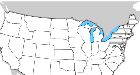
What region is the shaded area?
Northeast
200
What are the 4 intermediate directions?
Northeast, Southeast, Southwest, Northwest
200

What continent is #2?
South America
200
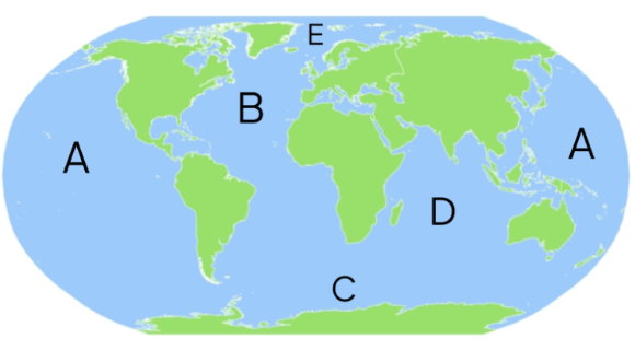
What ocean is B?
Atlantic Ocean
300
What line of latitude is the equator located at?
0 Degrees latitude
300
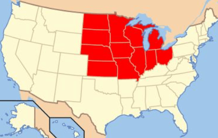
What region is the shaded area?
Midwest
300
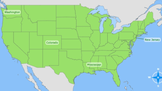
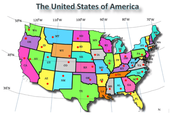
Which state is farthest South?
Mississippi
300

What continent is #3?
Antarctica
300

What ocean is C?
Southern Ocean
400
What line of longitude is the Prime Meridian located at?
0 Degrees
400
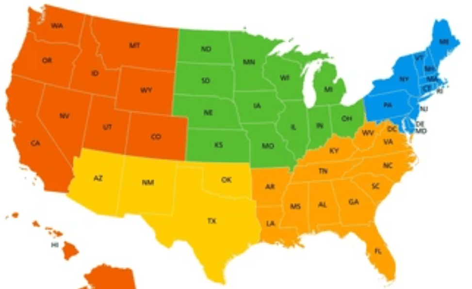
What region is the yellow area?
Southwest
400

Which state is farthest East?
New Jersey
400

What continent is #5?
Europe
400

What ocean is D?
Indian Ocean
500
 What state can be found at 31° N and 98° W?
Texas (TX)
500
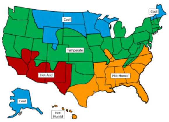
Which region gets the least precipitation?
Southwest (Hot-Arid)
500

Which state is farthest West?
Arizona
500
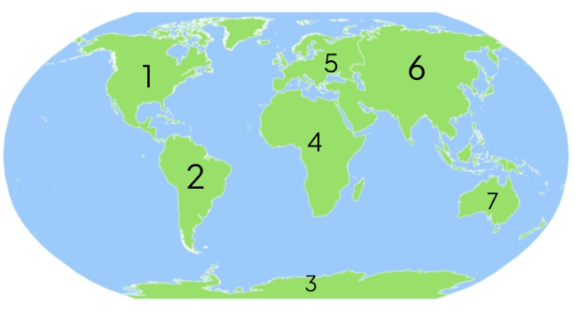
What continent is #6?
Asia
500

What ocean is E?
Arctic Ocean
600

What state can be found at 41° N and 83° W?
Ohio (OH)
600
What are the names of the 5 Great Lakes?
Lake Superior, Lake Michigan, Lake Huron, Lake Erie, Lake Ontario
600
 Which state is farthest North?
Missouri
600

What continent is #7?
Australia
700

What state can be found at 40° N and 105° W?
Colorado
700
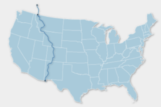
What does the line in the map represent?
Continental Divide
700
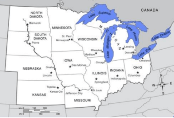
Which lake is Southeast of Lansing?
Lake Erie
700

What continent is #4?
Africa