What is Geography?
Parts of a Map
Map Projections
Continents and Oceans
5 themes of Geography
100
Geography is the study of __________
earth
100
What part of the map is shown here?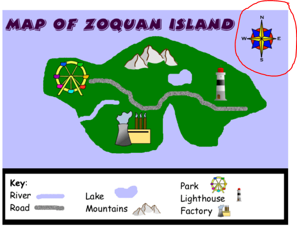
the compass rose
100
What map projection is most commonly used by schools and Google Maps?
The Mercator map
100
What continent is being shown on this map?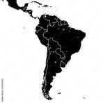
South America
100
List the 5 themes of Geography!
Movement
Regions
Location
Human-Environment Interaction
Place
200
Finish the quote from your notes:
"History is about ____________,
Geography is about __________."
"History is about TIME,
Geography is about SPACE."
200
The part of a map that explains how to read the map and tells what the SYMBOLS indicate is called the ___________.
Legend
or
Key
200
Why are ALL 2D (flat) maps WRONG?
Something (size or shape) must be distorted (changed) when making a 3D object 2D.
200
If you were surfing while on vacation in California which ocean would you be swimming in?
The Pacific Ocean
200
What is the RELATIVE LOCATION of Central High School?
*across the street from the Central Park Pool
* one block away from the Starbuck on Knoxville
*Next to the bridge over Interstate 74
300
Name a 3 PLACES unique to Peoria:
Riverfront Museum, McClugage Bridge, etc.
300
True or False: ALL maps show distortions except globes
True
300
What is the main problem with the Mercator projection?
A. It distorts the shape of countries.
B. It is difficult to use for navigation.
C. It does not accurately represent the size of countries.
D. It is not a rectangular projection.
C. It does not accurately represent the size of countries
300
What ocean is directly EAST of Africa?
The Indian Ocean
300
The fire on the Cuyahoga River in New York was an example of which of the 5 themes of Geography?
Human-Environment Interaction
400
Name a famous desert NOT in North America or Africa.
Antarctica, Great Australian Desert, Arabian Desert, etc.
400
The part of the map that tells the distances shown in Kilometers and Miles is called the ___________
Scale
400
Which of the following options is the most accurate way to read a map of the earth with the fewest distortions in size or distance?
* Mercator Projection
*Globe
*Gall-Peters Map
*Waterman-Butterfly
a globe!
400
The Atlantic Ocean and Pacific Ocean are split into North and South by the ________________.
Equator
400
Using a GPS to get latitude and longitudinal coordinates is an example of what type of LOCATION?
ABSOLUTE location
(as opposed to relative location)
500
If you were the president of the united states, give one example of how learning Geography would help you do your job!
* knowing where other countries are
*Knowing about how other countries or cultures interact with each other
*knowing about the history of your own country
etc.
500
What 3 parts are missing from this map: the title, scale, compass rose, key/legend, or grid? 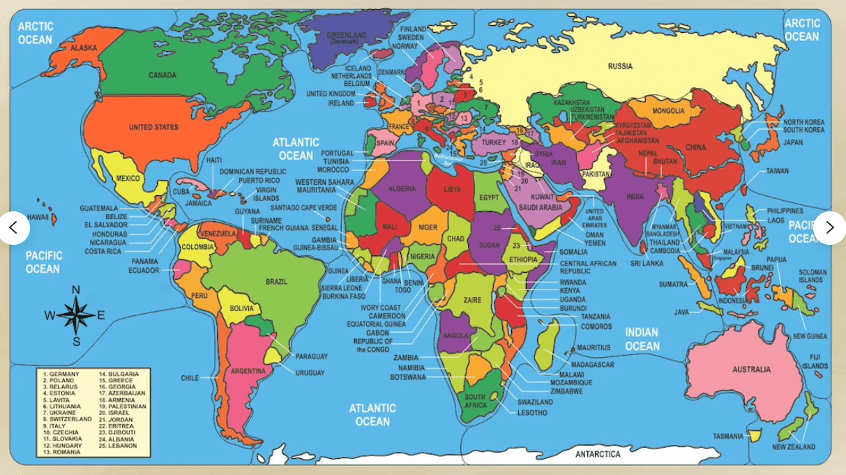
Title, Scale, and Grid
500
What is the main advantage of the Gall-Peters projection?
A. It accurately represents the shape of countries.
B. It is the most widely used projection.
C. It accurately represents the size of countries.
D. It is the most aesthetically pleasing (pretty) projection.
C. It accurately represents the size of countries.
500
The world is split into the Eastern and Western Hemispheres by the _____________________.
Prime Meridian
500
"The Midwest" is an example of which type of region?
*Formal region
*functional region
*Vernacular/perceptual region
Vernacular region
(perceptual region)