Interface
Vessel Data Card
Wildcard
Activity
Data
100
What is the function in SeaVision?

Map Filters
100
What is the nine-digit number assigned to vessels, coast stations, and other maritime communication devices that is used for identification and communication in systems like AIS?
Maritime Mobile Service Identity (MMSI)
100
This term refers to a vessel flying the flag of a country it is not legally registered with.
False Flag
100
Send a "Good Morning" message in the Training_Pacific chat room.
Good Morning
100
This system, mandated for most commercial vessels, transmits ship identity, position, speed, and course to improve maritime safety.
Automatic Identification System (AIS)
200
Which static layer is active?
Warnings
200
What is the name of the international organization responsible for regulating safety, security, and environmental standards for shipping, including the requirement for AIS equipment on certain vessels?
International Maritime Organization (IMO)
200
A ship departs from a known position and sails on a course of 090° (due east) at a constant speed of 12 knots. Using dead reckoning (DR), calculate the total distance traveled by the ship after 3 hours.
A. 24 nautical miles
B. 36 nautical miles
C. 48 nautical miles
D. 60 nautical miles
B. 36 nautical miles
200
Find the cargo vessel Fu Yuan Yu Yun 991, What is their registered MMSI number?
412440834
200
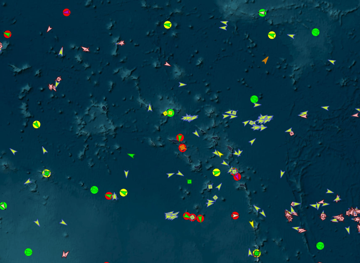
What does this vessel symbol mean?
The vessels are anchored.
300
What are these two features called in SeaVision?
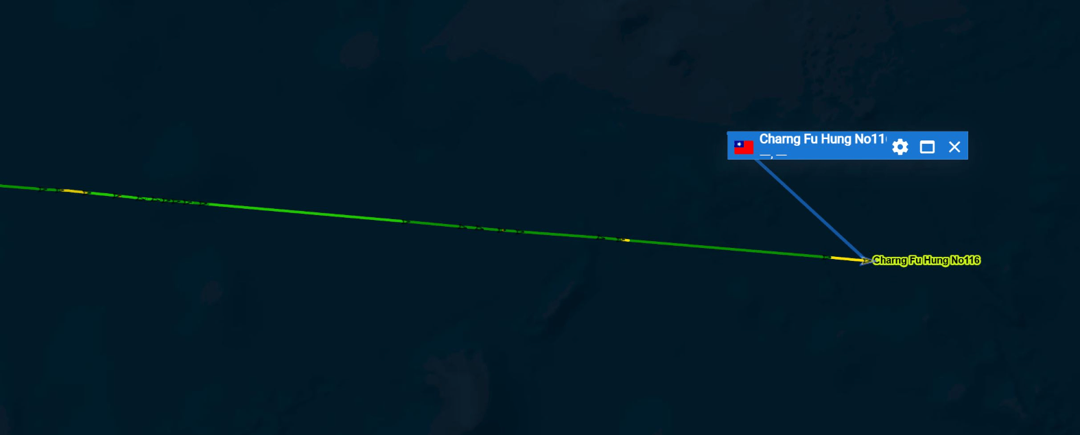
History Trail & Speed Indicator
300
According to the UN/LOCODE, which of the following is the correct way for a vessel to input their destination when traveling to the port of Majuro, Marshall Islands?
A. Majuro
B. MHMAJ
C. MH MAJURO
D. Majuro Marshall Is
B. MHMAJ
300
Once a Rule or Alert is created, how long will it stay active?
30 Days
300
Cargo Vessel Xinshiji is not transmitting IMO number on AIS. Find the true IMO number of this vessel.
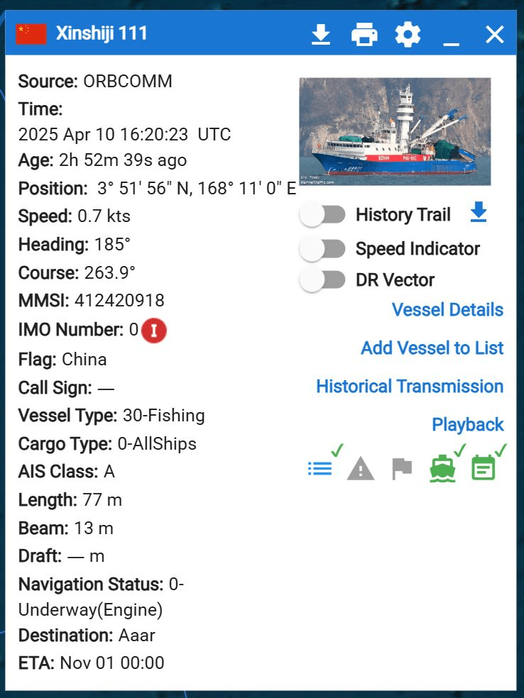
IMO 9781645
300
Commercial companies like ORBCOMM and SPIRE use this method to track vessels beyond coastal coverage by receiving ship's data from space.
Satellite AIS
400
What Static Layer is active?
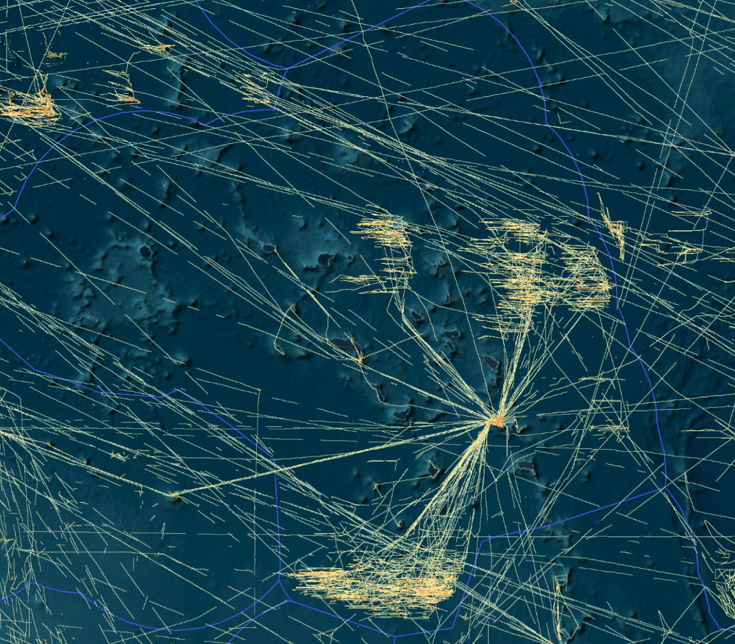
Historical Heatmap
400
What is the primary difference between heading and course over ground (COG)?
Heading is the direction the vessel is pointed, while COG is the actual direction the vessel is moving.
400
True or False:
Once a vessel is decommissioned and scrapped, its IMO number can be reassigned to another vessel.
False
400
How many vessels are and operated by the company Zhejiang Ocean Family Co Ltd and In Service/Commission?
34
400
What type of data is displayed on SeaVision? 
Satellite Electro-Optical (SAT-EO)
500
Which Static Layers are activated? (Three)
Vessel Name
Vessel Age
Dead Reckoning
500
Which of the following IMO numbers are incorrect with invalid checksums.
A. 1021245
B. 9220653
C. 1193859
C. 1193859
500
This map tool visualizes historical ship movement on the map in a user-defined timeframe.
Time Machine - Playback
500
A German flag cargo vessel with call sign DDOQ2 changed it's flag state and MMSI number on 11 February 2025 while at port of Valencia, Spain. What is the new name, flag, and call sign of the vessel now?
Vessel Name: Ulsan Express
Flag: Liberia
Call Sign: 5LVB5
500
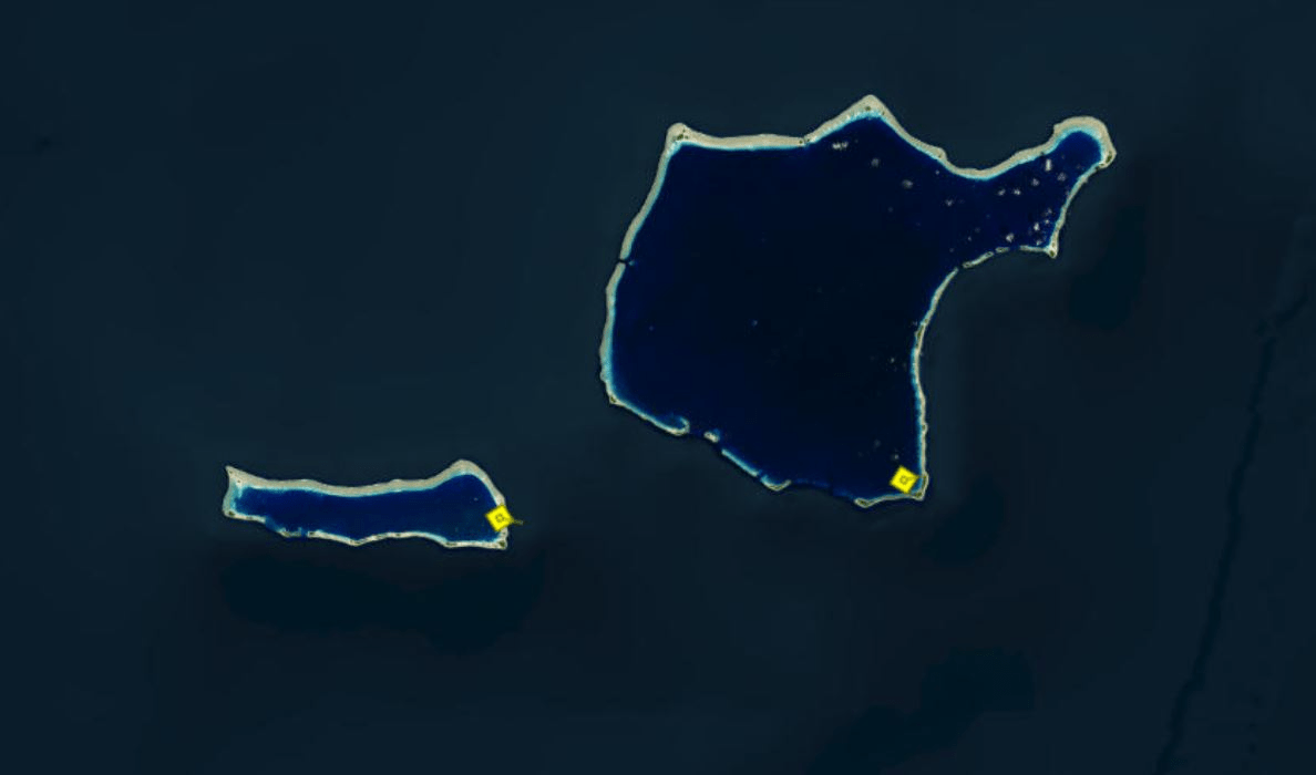
How many cargo vessels made a port call to Majuro Atoll port between 1 December 2024 00:00 UTC to 15 December 2024 23:59 UTC.
65