Different Kinds of Maps
China
Japan
Continents
East Asian Landforms
India Geography
Parts of a Map
100
Which map displays state and country boundaries?
Political
100
What is the name of the dictator that ruled China for about 30 years?
Mao Zedong
100
A _______________ happens when economy and businesses shrink.
recession
100
Which continent includes such countries as China, Japan, and India?
Asia
100
Which country should not be included in East Asia? Korea, China, Mongolia, Taiwan, Papua New Guinea
PNG
100
What large landform makes up the northernmost part of India?
Himalayan Mountains
100
Which part tells the four cardinal directions?
Compass Rose
200
What kind of map is this? 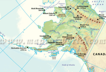
Physical
200
Mao started something called the _________________, which was supposed to increase farm production.
Great Leap Forward
200
What are service industries and how are they different than manufacturing?
banking, communications, sales, hotels, and restaurants are examples of service industries. Service industries offer a service rather than an actual physical product.
200
How many continents are there?
7
200
Eastern Asia has many _______________, or raised areas of level land bordered by one or more sides by steep cliffs
plateaus
200
Name a river in India.
Indus or Ganges
200
What is this and what does it do? 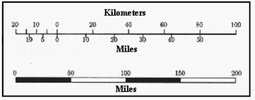
Map scale and it compares the distance on a map to real life distance on the ground.
300
What type of map is this and what does it show? 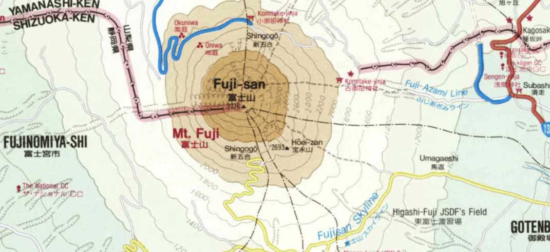
Topographical map. Shows Mt. Fuji in Japan.
300
________________ were bands of student radicals
red guards
300
Japan's population is in decline because of the low _________________.
birthrate
300
Which continent is the least habited?
Antarctica
300
Japan's most famous landform is a volcano called _______________.
Mt. Fuji
300
What are alluvial plains?
soil deposited by rivers
300
What important feature/features is this map missing? 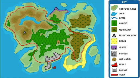
Title, compass rose, scale, grid
400
What type of map is this and what would a good title for it be? 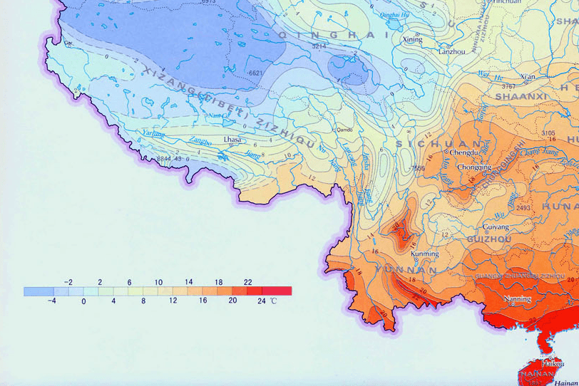
Climate map. "Climate of South China"
400
Who took over factories, businesses, and farmland during Mao's reign?
The Chinese government
400
True or false: Japan has a large number of workforce. (tell why)
False due to the low birthrate and Japan's limited immigration.
400
Which continent do we live in?
North America
400
______________ and _______________ make up most of China's land.
Mountains and deserts
400
How many monsoons does India get per year?
2 - summer and winter
400
What two directional helps make up a grid of the world? Comprised of imaginary lines.
Longitude and latitude
500
"India Standard Time" most likely refers to what? Use the map below for a hint and also tell what kind of map it is. 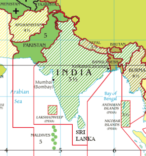
What time it is in India.
Time Zone Map
500
Name 3 similarities about China under Mao Zedong and China after Mao Zedong.
There are 5 similarities between China under Mao Zedong and after Mao Zedong's reign:
1. Both before and after offered programs
2. a leader was in charge of the country
3. both leaders proposed new economic plans
4. still a Communist party country
5. used violence and control with its people.
500
How has the role of women in the Japanese work force changed since WWII?
Before the war, few women in Japan worked outside of the home; today more women work full or part time than those who stay at home full time, and half of Japan's work force is made up of women.
500
Name all 7 continents in alphabetical order.
Africa
Antarctica
Asia
Australia
Europe
North America
South America
500
The Himalayan Mountains include the highest mountain in the world, ________________.
Mount Everest
500
Name 3 of India's cash crops.
tea, cotton, coffee, sugar
500
How many parking areas are there?
What is represented by the green?
What is this map missing? What would you do for this missing piece?
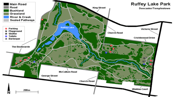
8 parking areas
bushland
title - Ruffey Lake Reservoir (or comparable)