Weathering
Topographic Maps
Fossils/Rock Layers
Soil
Erosion/Deposition
100
This is the process by which rocks are broken down by breaking and banging.
What is physical weathering?
100
This is a map that uses contour lines to show the shape and elevation of the land.
What is a Topographic Map?
100
These are any remains, trace, or imprint of animal or plant life preserved in Earth's crust.
What are fossils?
100
This is bits of dead plant and animal parts in the soil.
What is humus?
100
This is the rubbing, grinding, and bumping of rocks that cause physical weathering.
What is abrasion?
200
This is the process by which minerals in a rock can change due to chemicals in water and air.
What is chemical weathering?
200
These are the curved lines on a topographic map that represent a specific elevation.
What are contour lines?
200

Following the Law of Superposition, this is the oldest layer in the picture shown above.
What is Tapeats Sandstone?
200
This is a mix of humus, sand, silt, clay, gravel, and/or pebble.
What is soil?
200
This is the carrying away of weathered earth material by water, wind, or ice.
What is erosion?
300

This is what could have caused this rock to crack.
Answers May Vary.
300

What is 40 meters?
300
Following the Law of Superposition, this is the most recent layer in the picture shown above.
What is Kaibab Formation?
300
This is a location where a lot of humus is found in soil.
Where is the forest?
300
This is the settling of sediments.
What is deposition?
400
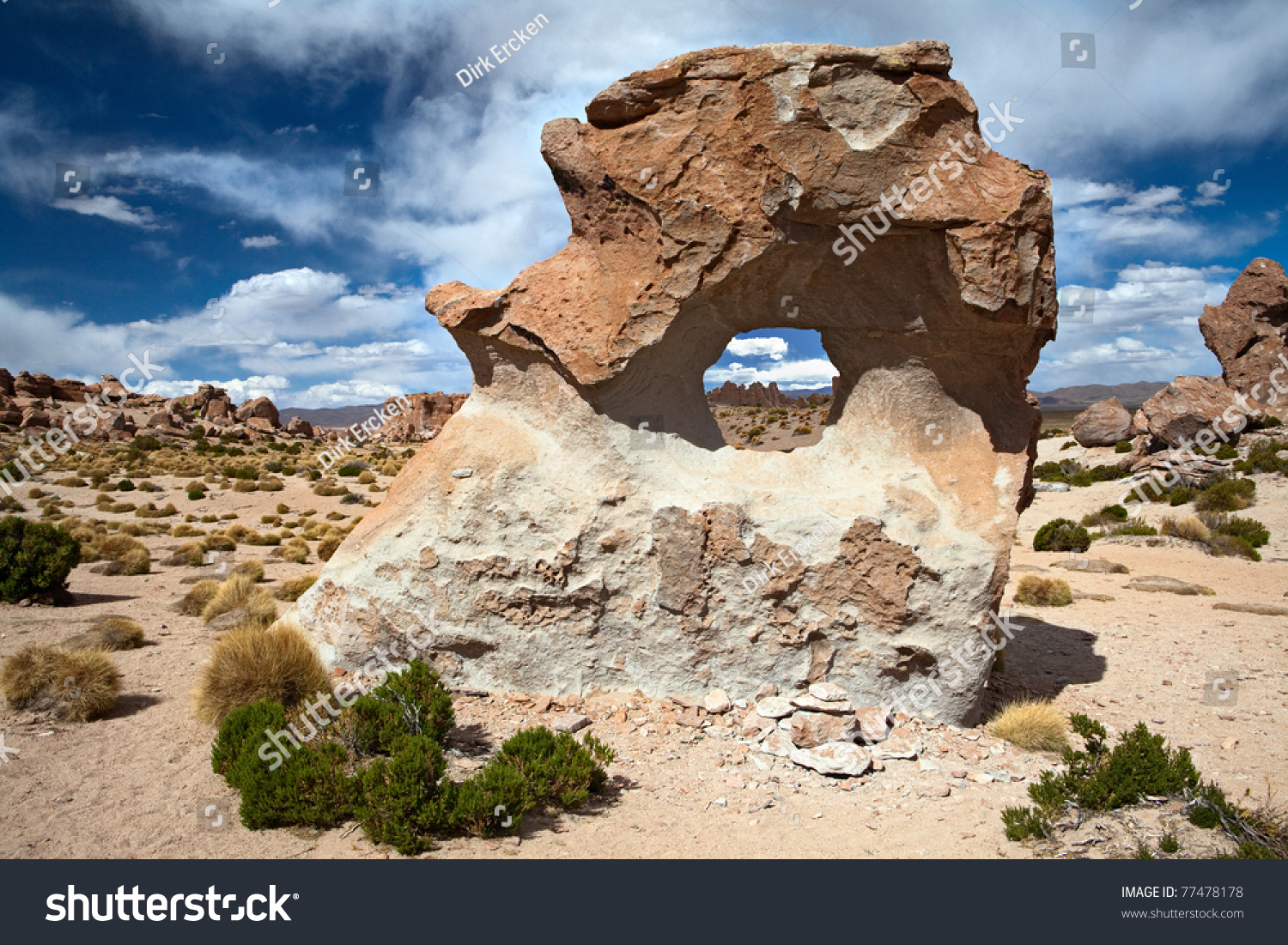
This is the type of weathering that most likely caused the rock shapes you see above.
What is sand blown by wind?
400
This is the vertical distance or height above the sea level.
What is elevation?
400
This is the principle that rock layers and the fossils they contain are arranged in layers and that lower sedimentary layers are older than higher layers of rock.
What is superposition?
400
This is pieces of weathered rock such as sand, deposited by wind, water, ice
What is sediment?
400

Looking at the picture and the map key, the dashed symbol this earth material.
What is clay?