Political Map
Physical Map
Vocabulary
More Vocabulary
Physical Geography
100
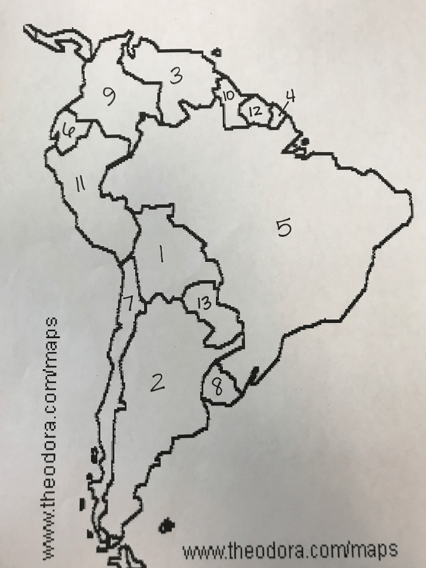 This is the name of the country that is represented by a number 5 on the map.
What is Brazil?
100
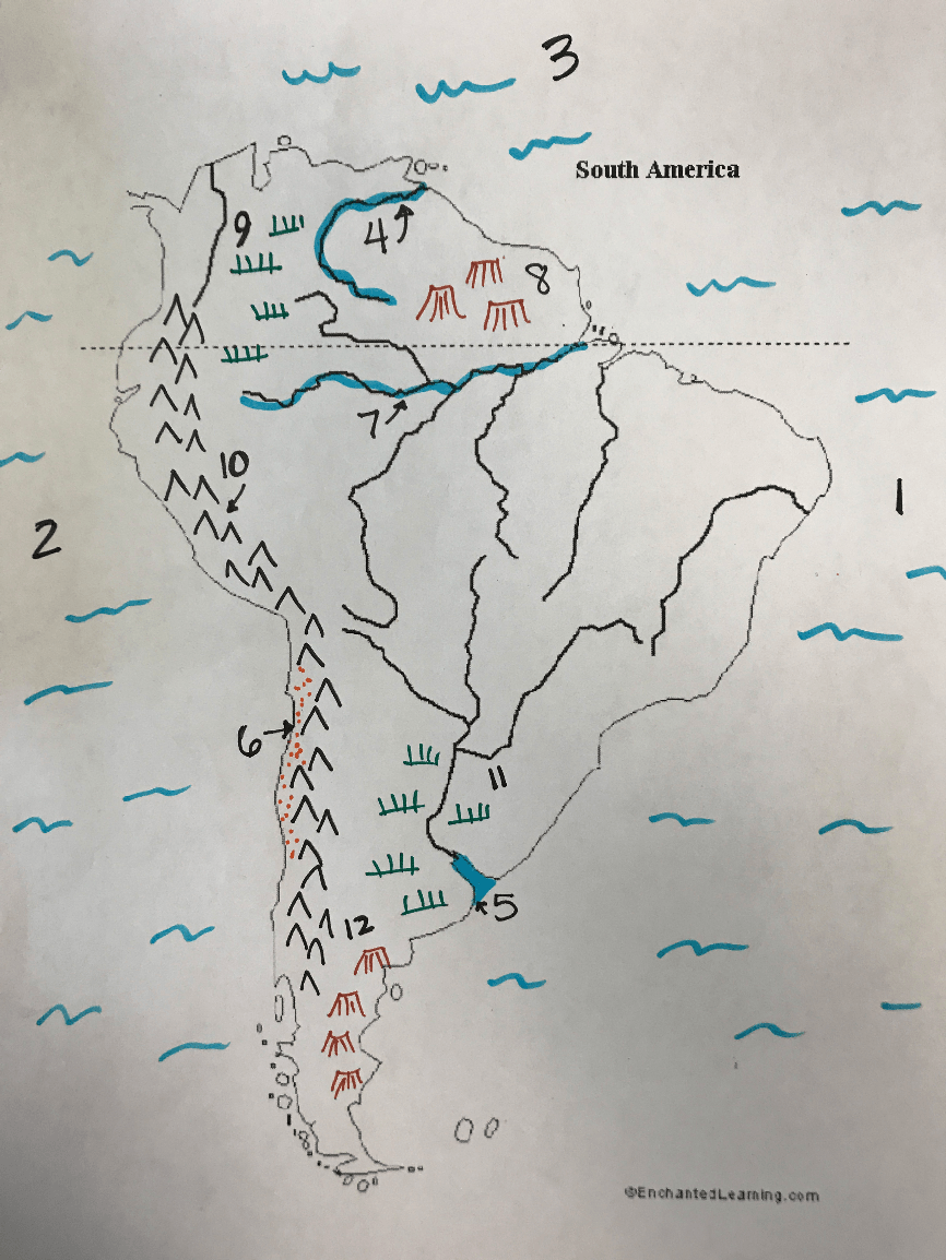
 This is the physical feature that is represented by the number 10 on the map.
What is the Andes Mountains?
100
This happens when soil becomes infertile as it loses nutrients due to the same crops being grown in it year after year.
What is soil exhaustion?
100
This is the longest mountain range in the world (above sea level) and runs along the Pacific coast of South America
What are the Andes?
100
This generally happens to the climate as elevation increases.
What are it gets colder and drier?
200
 This is the country that is represented by the number 7 on the map.
What is Chile?
200
 This is the physical feature that is represented on the map by the number 7.
What is the Amazon River?
200
The Rio de la Plata is an example of one of these partially enclosed areas where salt water and fresh water mix.
What is an estuary?
200
This is the largest river system in the world and flows through 7 countries in South America.
What is the Amazon River?
200
This generally happens to vegetation as elevation increases.
What is less plants can grow?
300
 This is the country that is represented by the number 2 on the map?
What is Argentina?
300
 This is the body of water that is represented by the number 3 on the map.
What is the Caribbean Sea?
300
This is a high plains area located between the ranges of the northern Andes.
What is the altiplano?
300
This clearing of trees in the Amazon Rainforest is a problem that impacts the world's population since these trees create 20% of the oxygen that we breathe.
What is deforestation?
300
This has a greater impact than latitude on the climates of western South America.
What is elevation?
400
 This is the country that is represented by the number 11 on the map.
What is Peru?
400
 This is the physical feature that is represented by the number 9 on the map.
What is the Llanos?
400
This warm ocean current impacts the weather of North and South America.
What is El Nino?
400
One of the two plains areas in South America where farming and ranching are important industries.
What are the Llanos or Pampas?
400
This is what generally happens to temperatures as you move south through South America.
What is it gets colder?
500
 This is the country that is represented by the number 9 on the map.
What is Colombia?
500
 This is the physical feature that is represented by the number 8 on the map.
What is the Guiana Highlands?
500
The Andes are an example of one of these mountain systems made up of roughly parallel ranges.
What is a cordillera?
500
There is one of these narrow strips of water at the southern tip of South America connecting the Atlantic and Pacific Oceans.
What is a strait?
500
These are the starting and ending points of the Amazon River.
What are the Andes and the Atlantic Ocean?