Key Terms
Mapping
Around the Globe
Regions
Geographic Data
100
This is a continuous land mass.
What is a continent?
100
This shows a ratio of distance on a map to actual distance.
What is a scale?
100
This line goes through the center of the Earth at 0 degrees North or South.
What is the Equator?
100
This type of region is based on data and has set borders.
What is a formal region?
100
This is what geographers look for when studying the Earth.
What is patterns?
200
This is a list of symbols found on a map & what they mean.
What is a legend (or key)?
200
This measures distance North or South from the Equator.
What is latitude?
200
This ocean surrounds the continent of Antarctica.
What is the Southern Ocean?
200
This type of region is based on people's attitudes and feelings.
What is a perceptual region?
200
Types of languages spoken in an area would be part of this type of geography.
What is human geography (cultural geography)?
300
This is an area with similar characteristics.
What is a region?
300
This type of map shows landforms of an area.

What is a physical map?
300
This continent is in the Western Hemisphere and the Northern Hemisphere.
What is North America?
300
This type of region has some sort of use to society.
What is a functional region?
300
This tool can be used to layer geographic data.
What is Geographic Information Systems (GIS)?
400
This type of technology uses satellites to determine a location.
What is global positioning system (GPS)?
400
This type of map shows the states and borders of Mexico.

What is a political map?
400
This country is split between the continents of Europe and Asia.
What is Russia?
400
The European Union would be considered this type of region.
What is a formal region?
400
This type of photography is capable of capturing this image of the Rocky Mountains.
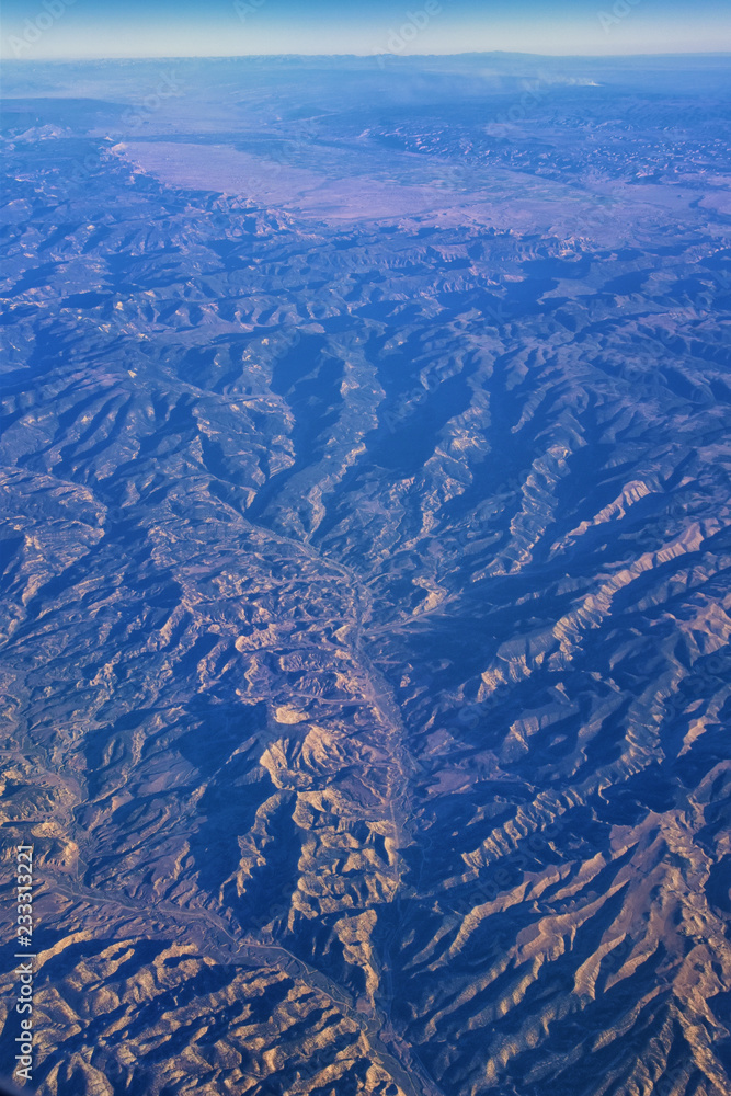
What is Aerial Photography?
500
This term is described by the physical and human characteristics of an area.
What is place?
500
The population density map of France, as seen below, would be considered this type of map.
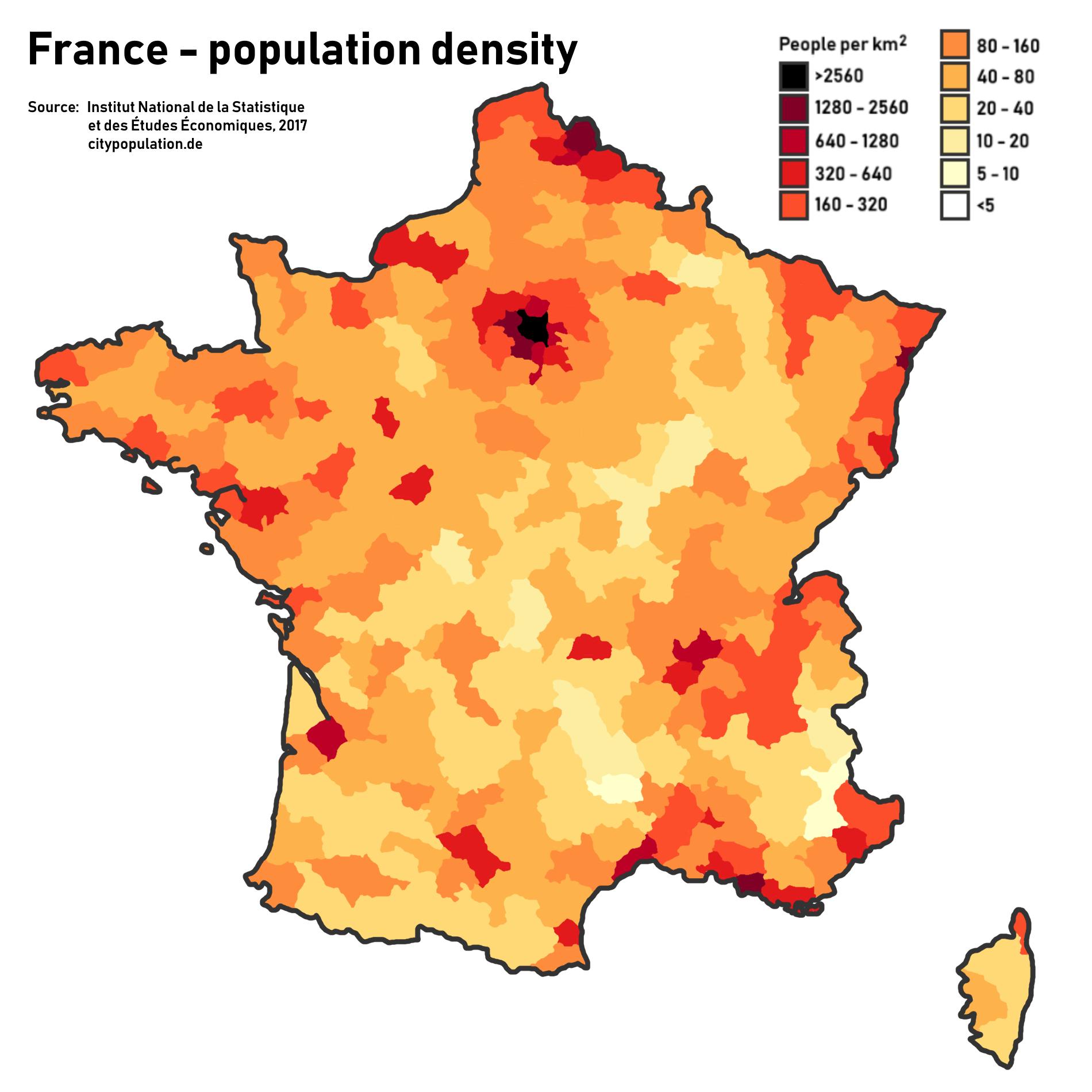
What is thematic map?
500
This is the reason why we cannot create a perfectly proportional map of the Earth.
What is the Earth is round?
500
This map of interstates in Montana would be considered this type of region.

What is a functional region?
500
The following images were taken using this type of technology.

What is a satellite?