The line that runs from Pole to Pole and measures zero in longitude is the Prime Meridian.
Longitude
A geographic spot on Earth’s
surface
Location
method by which shapes on a globe are transferred to a flat surface
Map Projections
the relationship between a map's distance and the actual distance on Earth,
Scale
List the state located at the following coordinates:
45° north latitude,
100° west longitude
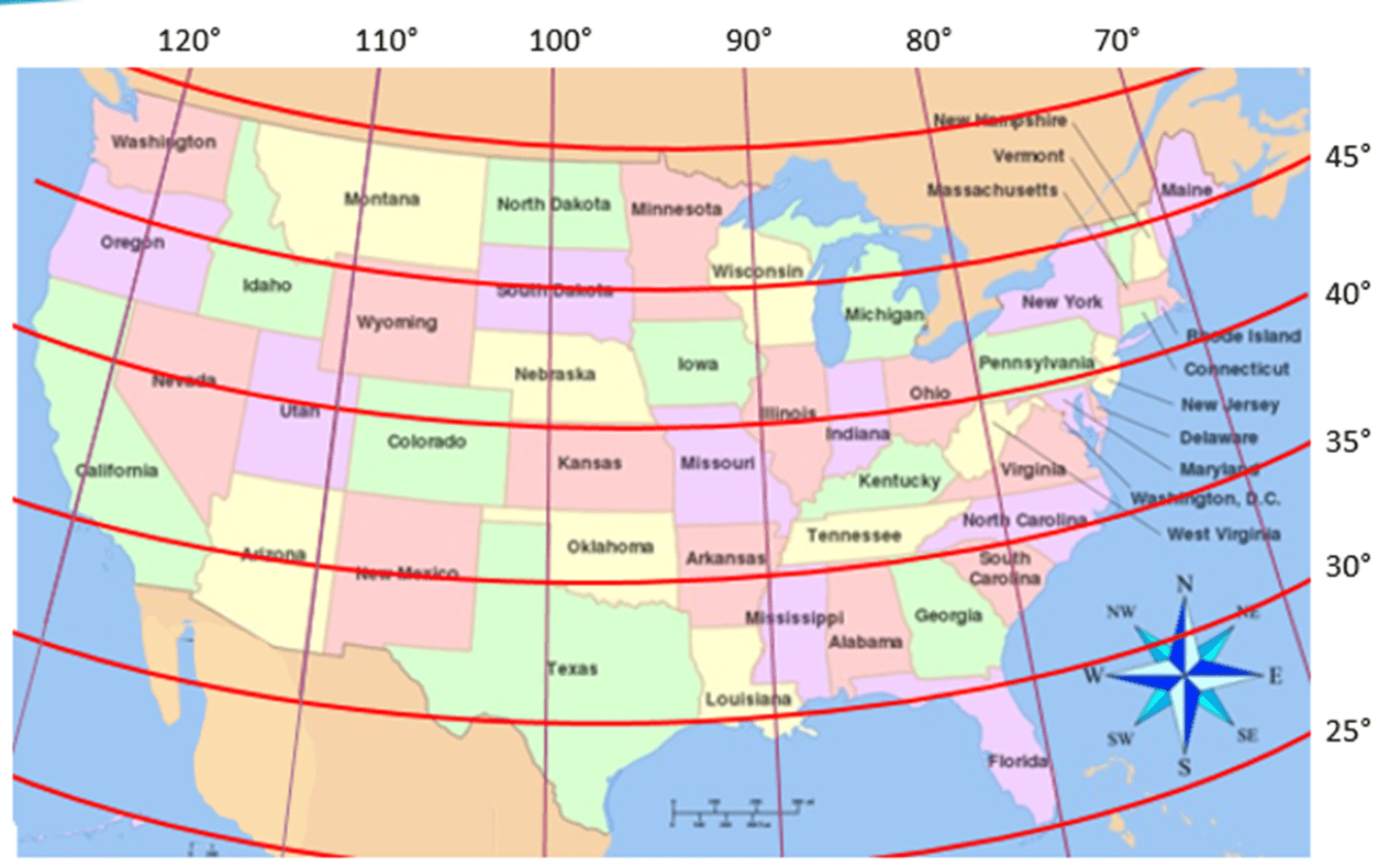
South Dakota
Florida has very hot and humid summers.
Place
imaginary lines drawn around the globe that run east to west
Latitude
The human connections to a location
Place
representation that is twisted, mistaken, or false
Distortion
Line on a map or globe that divides the earth into eastern and western hemispheres (halves).
Prime Meridian
Which state can be found at the intersection of
30° north latitude,
90° west longitude
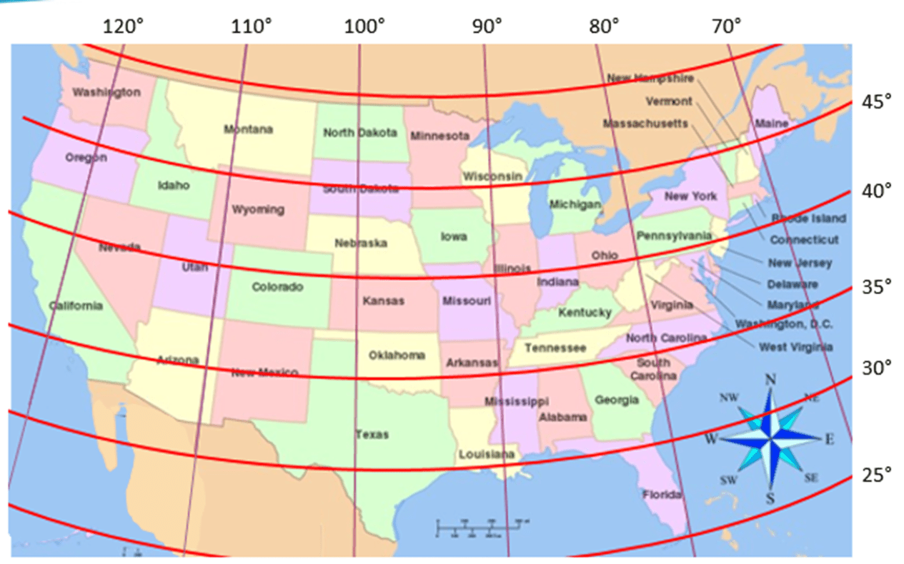
Louisiana
The states in the area known as the "Southwest" of the United States are often grouped together because they are very hot and dry desert-like areas.
Region
imaginary lines drawn around the globe that run from north to south.
Longitude
The way we impact Earth and it impacts us
Human-Environment Interactions
3 basic types of map projections
Planar, Conical, Cylindrical
Line on a map or globe halfway between the north and south poles.
Equator
What state can be found at the following coordinates:
40° north latitude,
110° west longitude
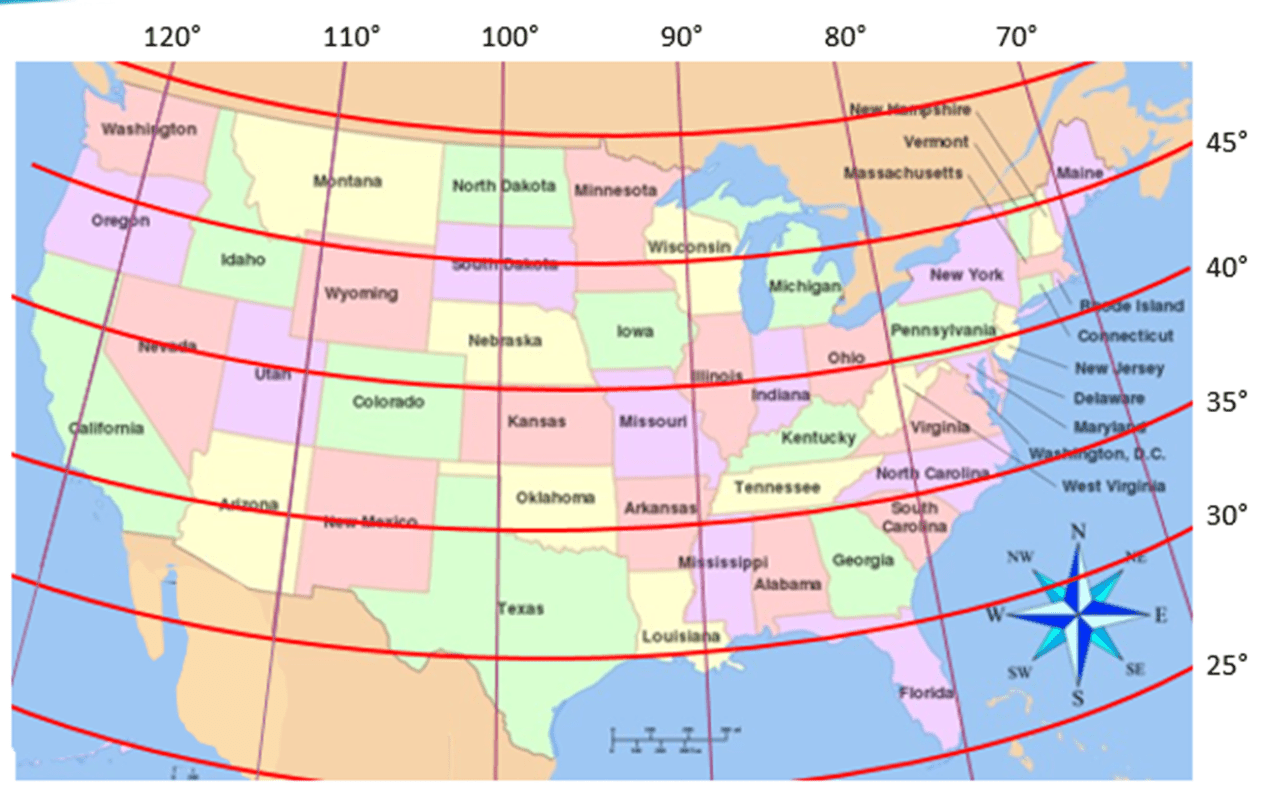
Utah
Canada is north of the United States
location
The imaginary line that circles the globe at the Equator is called zero. Numbers go up and down from there.
Latitude
an area of land that has common features. These can be natural (environment) or artificial (human created) features.
Region
Earth’s surface is projected onto a cone with the point of the cone over one of the poles, most accurate between the Equator and the poles
Conical Projection
List at least 3 map properties
size/area, shape, distance, direction, prime meridian, equator, hemisphere
What state can be found at
40 North latitude, 105 West longitude
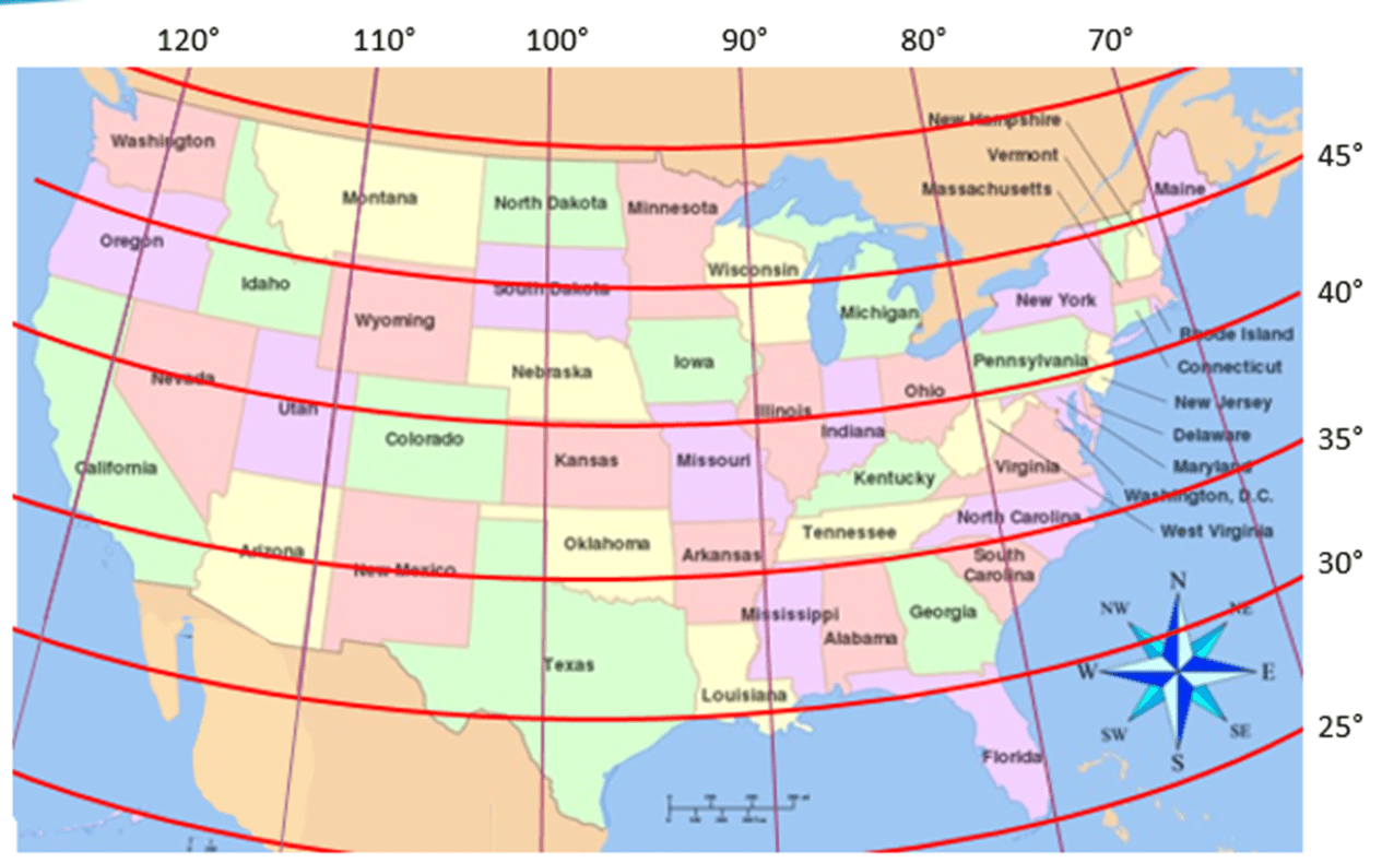
Colorado
The relationship between people and their environment.
Human-Environment Interaction
0 degrees longitude starts at an imaginary line running through Greenwich, England. What is the name of this imaginary line?
prime meridian
What do we use to find absolute location?
latitude and longitude
Earth’s surface is projected onto a cylinder (or tube) wrapped around the globe, most accurate near the Equator
Cylindrical (Mercator)
The map properties that are distorted to various degrees on a map (4)
scale, size, distance, projection
What state is at the following coordinates?
32° north latitude,
100° west longitude
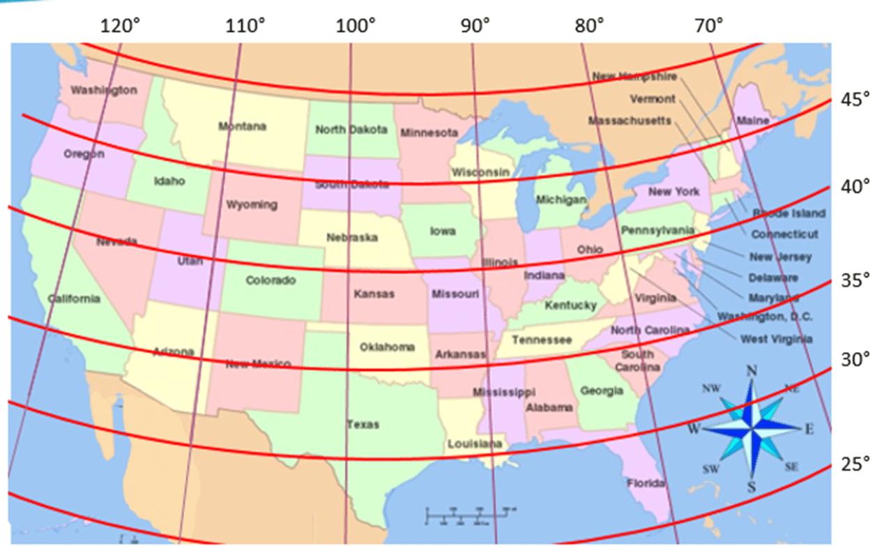
Texas

What is this symbol called?
Compass Rose
a set of numbers giving the precise location of a point
Coordinates
travel of people, goods, and ideas from one location to another
Movement
Earth’s surface is projected onto a flat surface (or plane), most accurate at the center point
Map Projection used to show North and South Pole.
Planar Projection
a half of the earth, usually as divided into northern and southern halves, or into western and eastern
Hemisphere
What state can be found at the following coordinates:
43 North longitude, 75 West latitude
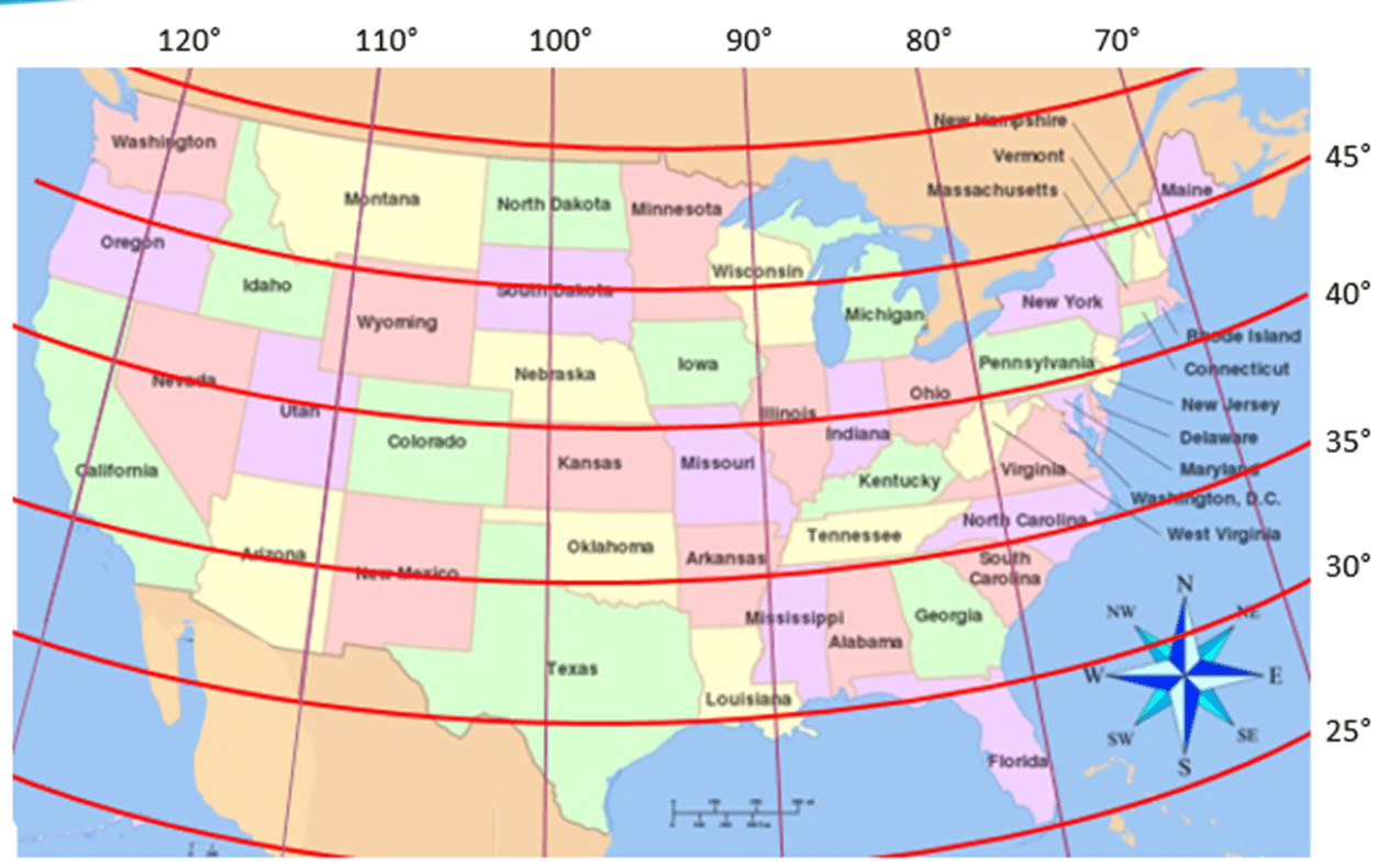
New York

What does the scale on a map show?
conversion of distance or size to the scale of the map