Clouds
Thunderstorms
Fronts
Wind
Randomness
100
Streamers of precipitation trailing beneath clouds that evaporate before reaching the ground
100
Stages to a thunderstorm
Cumulus, mature, and dissipating
100
This front typically moves at 20-35 miles per hour
Cold Front
100
This weather theory explains the cause of winds
Pressure Differences (high pressure flowing to low pressure)
100
A decrease in temperature lapse rate (less than ~ 20 per 1,000 ') will cause this effect on the stability of the air
Increase in stability
200
This cloud type forms when very stable, moist air is forced upwards on a mountain slope
Stratus

200
This stage of a thunderstorm is characterized predominately by downdrafts
Dissipating
200
These conditions are indicative of a cold air mass moving over a warm surface
Cumuliform clouds, turbulence, and good visibility
200
This force prevents air from flowing directly from a high-pressure area to a low-pressure area
Coriolis Force
200
Conditions necessary for icing to form on airframe surfaces
Visible moisture and temperatures below 00 C to -200 C
300
This characteristic of air determines the structure of a cloud as a result of being forced to ascend
Stability
300
Typically encountered in areas of temperature inversion and near thunderstorms
300
This type of front is created when two relatively equal air masses meet
Stationary Front
300
Areas of equal pressure shown on a Surface Prog Chart are identified with lines known as
Isobars
300
The greatest threats to an aircraft operating in the vicinity of thunderstorms
hail and turbulence
400
This cloud type would indicate convective turbulence
Towering cumulus

400
This feature is normally associated with the cumulus stage of a thunderstorm
Continuous updrafts
400
The boundary between a dry air mass and a moist air mass
Dry Line
400
The type of wind system associated with a low-pressure area in the Northern Hemisphere
400
Every physical process of weather is accompanied by or is the result of this phenomena
Heat Exchange
500
Standing lenticular altocumulus clouds are a good indication of what activity
Strong turbulence
500
The minimum distance that should be maintained between intense radar echoes before attempting to fly through thunderstorms
40 miles
500
The type of front is typically associated with a warm air mass trapped by colder air behind and cooler air ahead
Cold front occlusion
500
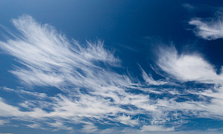
A jet stream and associated clear air turbulence is sometimes visually identified in flight by this type of cloud formation
Long streaks of cirrus clouds
500
The R44 POH provides guidance for high winds or turbulence in which Safety Notice