Weathering
Types of Weathering
Virginia
Erosion
Soil formation
Soil properties
100
The process that transports rocks, soil and sediments to a different location is called _________.

Erosion
100
Weathering of limestone by acid rain is an example of ____________________.

Chemical Weathering
100
Which VA Province is most known for its Karst Topography?
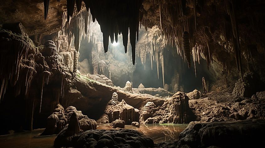
Valley and Ridge
100
The removal of weathered rock and soil from its original location is called ________________.
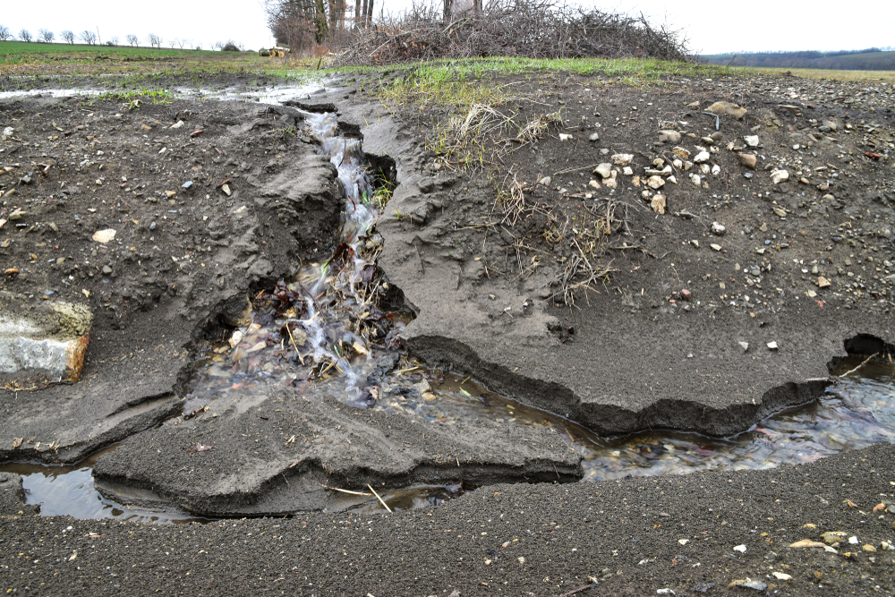
EROSION
100
What is one term used to describe water passing through soil?
Infiltration or Permeable/Permeability
100
Fertility of soil relates to:
A. how the soil was formed over time
B. the amount of nutrients that allow plants to growth
C. the amount of water found in the soil
D. the amount of bacterias found in the soil
B. the amount of nutrients that allow plants to growth
200
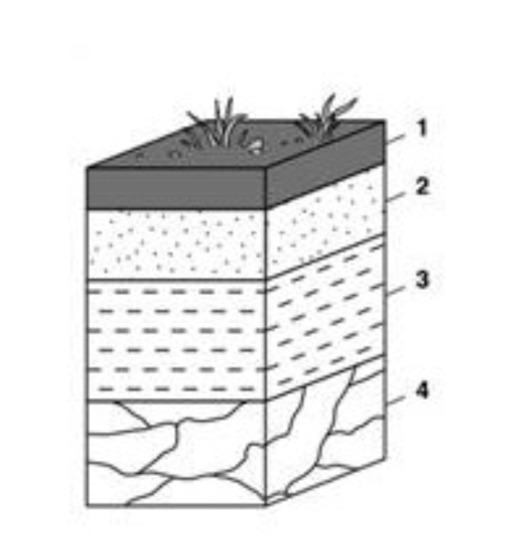
Which layer of the soil profile would be affected the most by weathering and erosion?

1
200
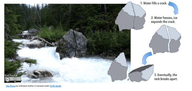
Ice expansion is an example of ___________________ weathering

Physical Weathering
200
___________ are the 3 provinces where we can find evidence of marine fossils in VA.
Valley and Ridge, Appalachian Plateau, Coastal Plain
200
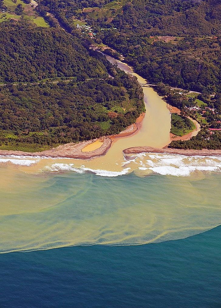
After the materials are transported, they are dropped in another location in a process known as ______________.
![]()
DEPOSITION
![]()
200
Which of the following best describes how most soil forms?
A- through the growth of trees
B- through the build up of snow
C- through the weathering of rock
D - through the cooling of lava
C- through the weathering of rock
200
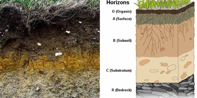
Which Horizon would be impacted the most by weathering and erosion?_______________

A Horizon or Topsoil
300
Settling of soil that often occurs when water flow slows down or stops, and heavy particles can no longer be supported by the river turbulence.
DEPOSITION
300
Which type of weathering is illustrated:

Sheeting
300
Describe how the marine fossils became part of the Appalachian Mountains in VA.
When two continental plates converged, a shallow sea was forced upwards and became part of the Appalachian Mountains.
300
Where is erosion the greatest?
Gentle Slope
Steep Slope
Flat Plains
Steep Slope
300
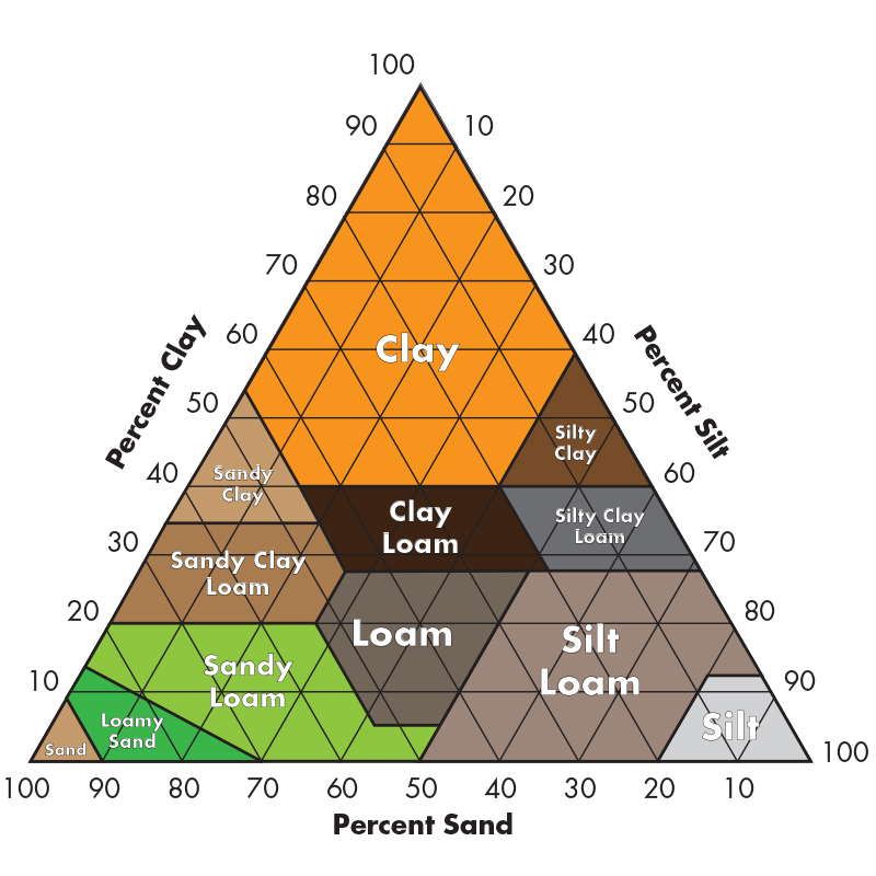 Soil that is 35% clay, 35% sand, and 30% silt is classified as ______________________
CLAY LOAM
Soil that is 35% clay, 35% sand, and 30% silt is classified as ______________________
300
The measure of how fast the water enters the soils is called ________________________
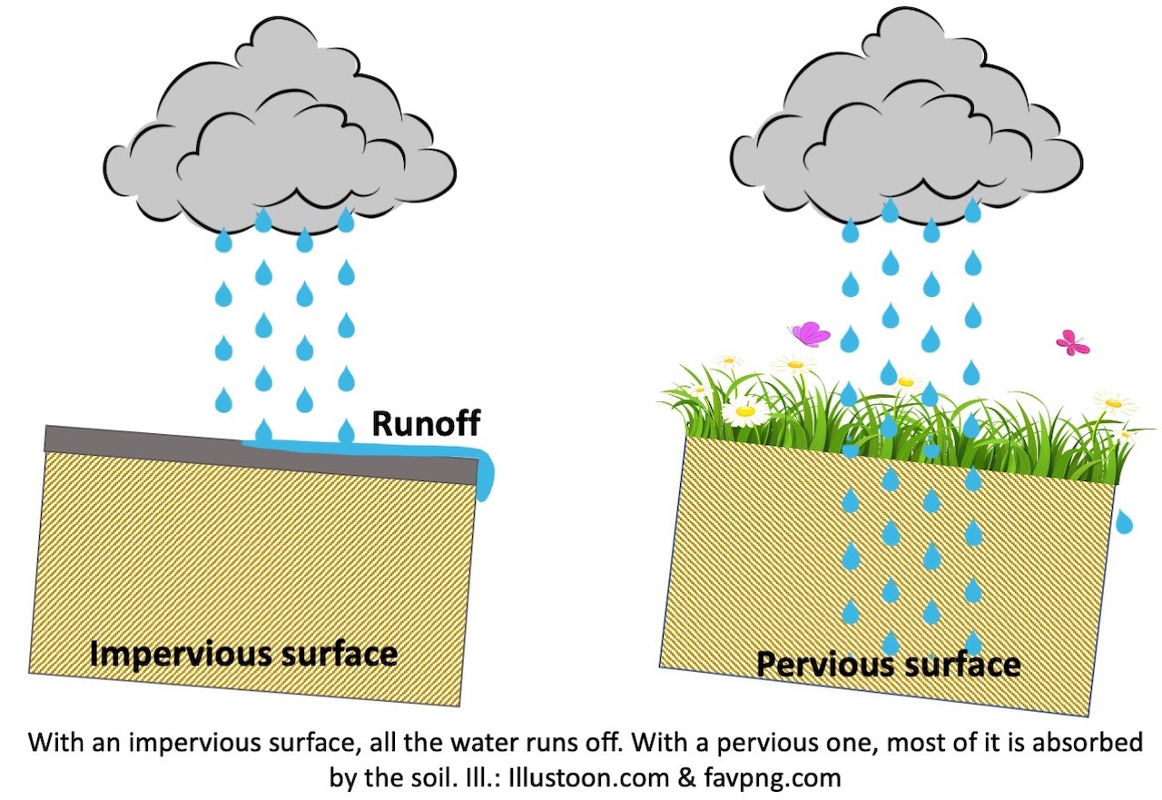
INFILTRATION/Permeability
400
The process of breaking down rocks is called ______

Weathering
400
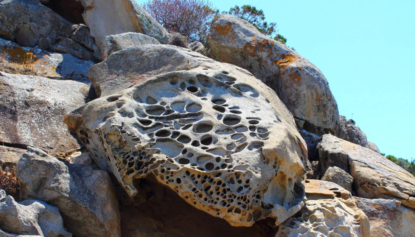
Type of weathering illustrated in the following image:

Biological Weathering
400
What metal oxidizes in the Piedmont soil to form Clay?

Fe or Iron
400
Erosion by _____________ often forms deep U shaped valleys like the one shown below.
GLACIERS
400
The layers of the soil are called ______________
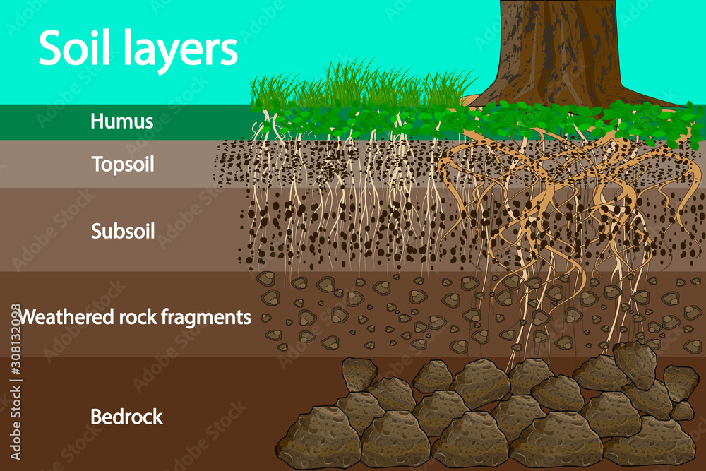
HORIZONS OR PROFILES
400
What is the most important factor involved in soil development?
a. climate of the area
b. slopes
c. the type of bedrock/parent rock
a. climate of the area
500
Which of the following aids in the weathering and erosion of rocks?
A. rain
B. water
C. wind
D. all are correct

D. all are correct
500
Chemical weathering involves a chemical transformation of rock into what?
Chemical transformation of rock into one or more new compounds.
500
Which Province has the largest coal deposits in VA?
Applachian Plateau
500
Precipitation that does not infiltrate into the soil is called _________.
Runoff
500
How would you describe both the porosity (High/Low) and permeability (High/Low) of the A Horizon?
High Porosity and High Permeability
500
Choose the soil property illustrated:
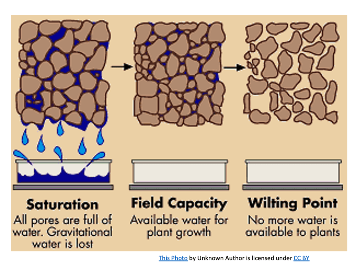
A. Soil consistency
B. Soil moisture/Permeability
C. Soil Temperature
D. Soil pH
B. Soil moisture/Permeability
600
Do
1)Does this soil appear to be a well developed, nutrient rich soil?
2) Does it contain a lot of humus?
3) Describe how you arrived at your answer for #2?
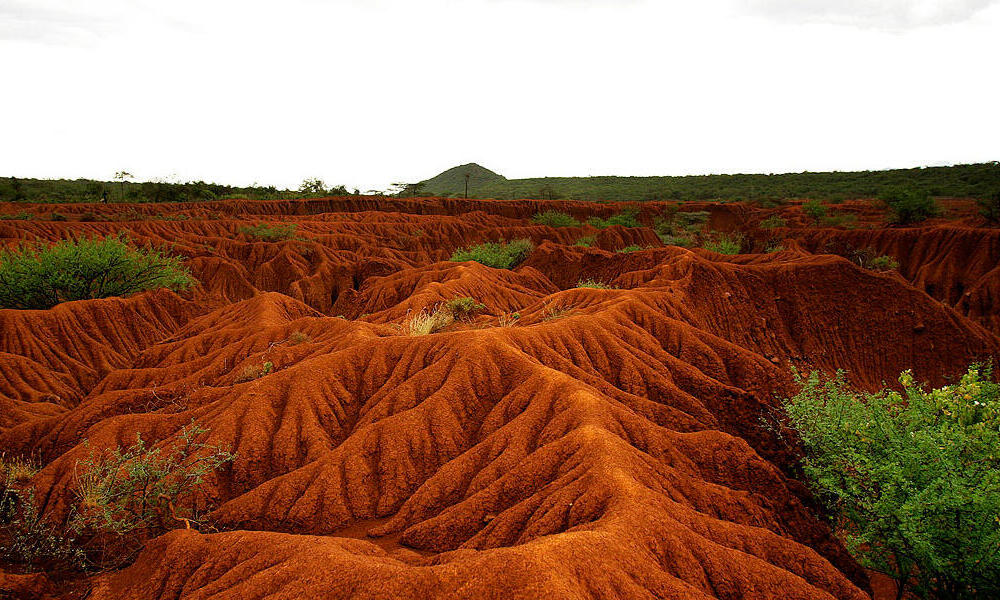
1) No
2) No
3) The soil is reddish orange and does not contain Humus (dark brown w/ nutrients)
600
Which type of weathering is illustrated:
Physical
600
What are the names of the 5 Provinces of Virginia? Write them in order going from VA Beach to the most western part of the state.
Coastal Plain
Piedmont
Blue Ridge
Valley & Ridge
Applachian Plateau
600
How does vegetation prevent or slow down the erosion rates?
The roots of different types of vegetation hold sediment in place and reduce erosion.
600
The solid layer of rock at the bottom of the soil profile is called ____________________

BEDROCK or Parent Rock
600
From the mountains to the beach, put the following sediment sizes in order of how they change over time moving down the mountain slopes to depositing at the beach:
Pebbles
Sand
Boulders
Boulders (Mountains)
Pebbles
Sand (Beach)