Projections
Classes of Geography
Landforms
More Landforms
100
True or False: The truest representation of the earth is a polar projection.
What is false?
100
True or False: Physical geography is the study of physical features of the earth.
True
100
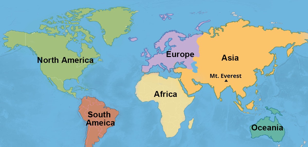
True or False: Mt. Everest, the highest mountain in the world, is located in Asia.
True
100
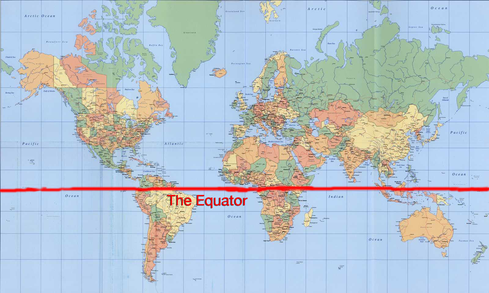
True or False: Most of the land masses in the world are in the Northern Hemisphere.
True.
200
What type of projection is this?
a. Interrupted-Area
b. Mercator
c. Polar
b.
200
The study of culture is called _____________ geography.
a. applied
b. cultural
c. urban
d. political
b. cultural
200
True or False: Mountains have the highest temperature of any landform.
False.
For every 300 feet in elevation, the temperature falls one degree.
200
Choose the location that best describes FORESTS.
a. plains
b. mountains
c. oceans
d. plateaus
b. mountains
300
True or False: All maps have distortions.
True.
300
The study of climates and their effect on people is called:
a. astronomy
b. geology
c. meteorology
d. climatology
d. climatology
300
Choose the best location for easy transportation.
a. plains
b. plateaus
c. mountains
d. oceans
a. plains
Transportation is easiest here because of mostly flat land.
300
Choose the best location for EASY TRANSPORTATION.
a. plains
b. plateaus
c. mountains
d. oceans
a. plains
Transportation is easy because of the relative flatness of the land...no major changes in elevation.
400
True or False: An interrupted-area projection shows the least distortion in land areas.
True.
400
The study of the earth's atmosphere and the factors that are important in weather analysis and forecasting is called:
a. astrology
b. astronomy
c. meteorology
d. geography
c. meteorology
400
Choose the best location for MINING.
a. mountains
b. plateaus
c. plains
d. oceans
a. mountains
One of the three most common occupations in the mountains besides grazing and logging. Mountains are "storehouses of minerals".
400
Choose the answer that best describes COOL and DRY.
a. plateaus
b. mountains
c. oceans
d. plains
a. plateaus
Plateaus are cool because of their higher elevation and they are dry because clouds lose their moisture through condensation before they blow over the plateaus.
500
The disadvantage of an interrupted-area projection is that it is hard to see the relationship between ____________________.
a. bodies of water
b. water and land
c. continents
d. none of the above
c. continents
500
The study of the earth's surface, climate, continents, countries, peoples, industries, and products is called:
a. geography
b. anthropology
c. geometry
d. geology
a. GEOGRAPHY!!
500
Choose the best location for INDUSTRIES (factories, manufacturing, etc.).
a. mountains
b. plains
c. oceans
d. plateaus
b. plains
Trade and manufacturing are developed more easily on the plains because of good transportation due to the flatness of the land.
500
Choose the best TWO locations for GRAZING.
plains
plateaus
oceans
mountains
plains and plateaus