Where it all began
Landforms 1
Landforms 2
Older Units REVIEW
Vocab
1
The Earth initially had only ONE large landmass called:
Pangea
1
A "natural feature of the Earth's surface" is called a __________.
Landform
1
A _______ is a natural stream of water that runs through the land.
Example: there is one named after the state of Illinois!
River
1
What continent is being shown on this map?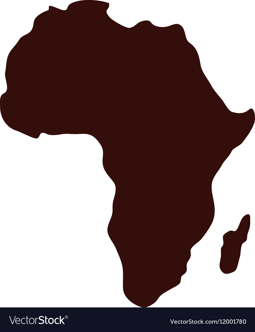
Africa
1
The Atlantic Ocean and Pacific Ocean are split into North and South by the ________________.
Equator
2
What is the hypothesis that today's continents were once part of a single large landmass that broke apart millions of years ago called? "____ ______."
Continental Drift
2
an area that is smaller than a continent and completely surrounded by water is called an "_____."

Island
2
A ____ is a sizable inland body of water.
Example: there is one named after the state of Michigan!
Lake
2
The world is split into the Eastern and Western Hemispheres by the _____________________.
Prime Meridian
2
What kind of landform is shown in the image?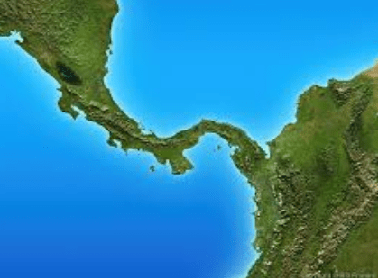
Isthmus
3
What is the name of the scientist associated with the theory of Continental Drift?
Alfred Wegener
3
Define "archipelago."
A group of Islands.
3
A ________ is a large body of water completely or partly surrounded by land.
Sea
3
What are the 3 types of regions?
*Formal region
*functional region
*Vernacular/perceptual region
3
What is the vocabulary word for this definition?
a specific location on Earth defined by its unique combination of physical characteristics (like landforms, climate, vegetation) and human characteristics (like culture, population density, built environment)
Place
4
Which continents separated from Pangea first?
The northern continents
4
The country of Italy and the state of Florida are examples of what kind of landform?
A Peninsula
4
A ______ is a small river or stream that flows into a larger river or stream. (a "branch" of a river.)
Tributary
4
What map projection is most commonly used by schools and Google Maps?
Mercator Map
4
What Ocean is directly WEST of North America?
Pacific Ocean
5
Other than the shapes of the continent's coastlines, what else did scientists match up to find where/how the landmasses fit together?
tectonic plates under the water
AND
the fossils of plants and dinosaurs matched up
5
Name one famous mountain from the United States and one famous mountain from somewhere else in the world.
TBD by teacher
5
Define "isthmus"
a narrow stretch of land connecting larger land areas.
5
List the 5 themes of Geography!
Movement
Regions
Location
Human-Environment Interaction
Place
5
Name an example of a Vernacular (or perceptual) region in the United States
Examples:
The Midwest
The South
The East/West Coast, etc.