Political Geography
Historical Events & the Modern Map
Political Power
Defining Political Boundaries
Boundary Conflict & Maritime Boundaries
Electoral Geography
Forms of Governance
100
This concept studies how power is organized across space.
Political geography
100
This concept refers to a state’s authority to govern itself.
Sovereignty
100
Control over land to influence people and resources.
Territoriality
100
Boundaries drawn before large-scale settlement occurs.
antecedent boundaries
100
The four steps of boundary creation include defining, delimiting, demarcating, and this step.
administering
100
The population count conducted every 10 years.
Census
100
A system where power is shared between national and regional governments.
federalism
200
A group of people sharing culture and history but lacking a state.
Nation
200
The right of people to govern themselves and form their own state.
Self determination
200
Political power refers to control over these three things.
people, land, and resources
200
Boundaries created after settlement due to political change or conflict.
subsequent boundaries
200
This international agreement governs territorial seas and EEZs.
United Nations Convention on the Law of the Sea (UNCLOS)
200
The process of reallocating House seats based on population change.
reapportionment
200
A system where power is centralized in one national government.
unitary state
300
A politically organized territory with sovereignty and boundaries?
State
300
This 1884 conference divided Africa without regard for ethnic groups.
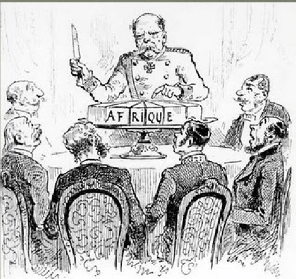
Berlin Conference
300
Economic and political influence without direct colonial control.
neocolonialism
300
Boundaries drawn by outside powers without regard to culture.
superimposed boundaries
300
The zone extending 200 nautical miles where a country controls resources.
Exclusive Economic Zone (EEZ)
300
Redrawing district boundaries within a state.
redistricting
300
The U.S. and Germany are examples of this form of government.
federal state
400
A state that aligns with a single nation.
nation-state
400
The treaty that ended WWI and redrew European and Middle Eastern borders.
Treaty of Versailles?
400
Regions of instability located between competing powers, like the Balkans.
shatterbelts
400
A boundary that no longer exists but still influences culture or politics.
relic boundary
400
When EEZs overlap, this principle is often used to resolve disputes.
median line principle
400
Packing and cracking are techniques used in this process.
gerrymandering
400
This is a major advantage of unitary systems.
efficiency in lawmaking
500
The Kurds are an example of this political group.
stateless nation
500
After the collapse of the Soviet Union in 1991, countries such as Ukraine, Estonia, and Kazakhstan became independent states. This change BEST illustrates which political process shaping the modern world map?
decolonization / independence movements
500
China funding and controlling infrastructure projects in African countries BEST illustrates this concept.
neocolonialism
500
The former division between East and West Germany BEST illustrates this type of boundary.
relic boundary
500
Disputes in the South China Sea MOST directly involve conflict over this maritime boundary.
Exclusive Economic Zone (EEZ)
500
Ohio’s oddly shaped congressional districts with high gerrymander scores BEST demonstrate this concept.
gerrymandering
500
Different marijuana and death penalty laws across U.S. states BEST illustrate this form of governance.
Fedealism